|
Home | Blog Index | Blog Archives | Christianity & Faith Essays | Storm Chasing Essays
Storm Chasing & Photography roundup for April 17 - May 2
It's time for another quick blog roundup of recent storm chases. This edition covers the last half of April 2019, with the first Midwest tornado of the year and lots of great slow-motion lightning captures.
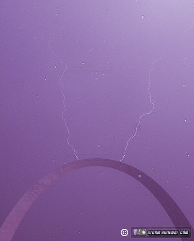
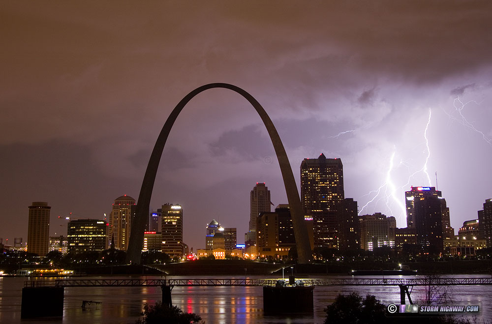
Another setback in the Arch lightning strike saga, but this night's shoot still manages to yield an interesting image. Event log >
  April 24: Thunderstorms in southeastern Illinois April 24: Thunderstorms in southeastern Illinois
I headed east for lightning along the Illinois-Indiana border, ending up at New Harmony, IN. No photos or video captured.
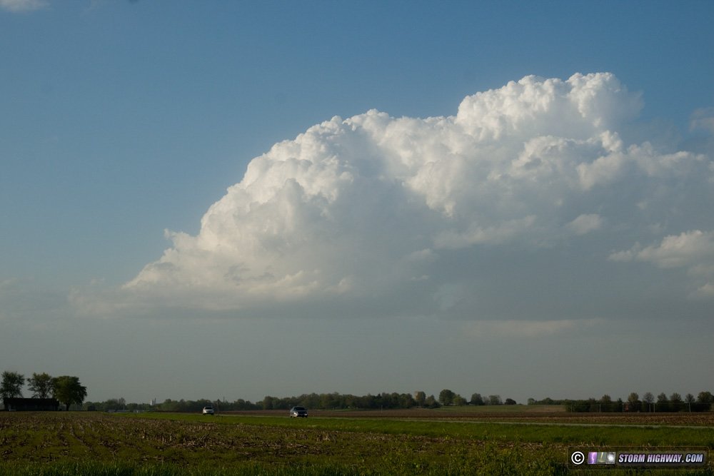
 April 27: Shallow convection near Highland, IL April 27: Shallow convection near Highland, IL
This setup had some potential, with a great wind field thanks to a passing upper level trough. A surface low just to the north of St. Louis was pulling some meager moisture northward, though it was barely enough to initiate convection let alone sustain any storms. Nonetheless, given the environmental shear, I went out thinking that there could be some high-based funnels with any stronger updrafts. I went up to Highland to look at a couple of developing showers. In the end, only tiny, shallow updrafts managed to develop, lasting only 15-20 minutes at a time and barely producing any precipitation.
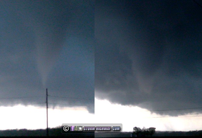
 April 30: Donnellson, Illinois tornado and lightning April 30: Donnellson, Illinois tornado and lightning
VIDEO: Illinois tornado and high-speed camera lightning, April 30
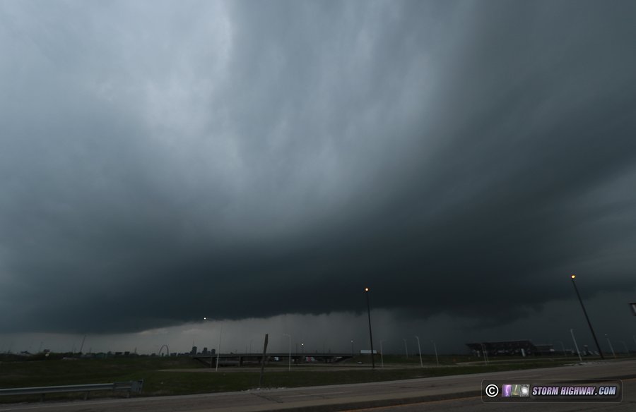
This day, a warm front would bring a chance for tornadoes to St. Louis and areas to the north and east. I was on the the long-lived supercell from near its messy start in St. Louis (first intercept in Sunset Hills, MO) to near Effingham, IL. The storm began developing a good "look" over downtown St. Louis, with a beefier-looking base and inflow banding (the Arch is visible at lower left here):
By Glen Carbon, the storm was fully supercellular with an intensifying mesocyclone crossing I-55 north of Edwardsville:
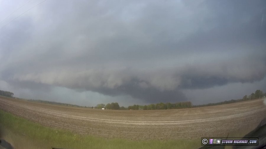
I stayed in the inflow notch for most of the way, and had a good visual on updraft/RFD features during that time. The storm suffered from severe undercutting for most of its life, but somehow managed to produce between Donnellson and Coffeen, just to the west of Coffeen Lake:
I left this storm soon afterward as its outflow raced far ahead of the updraft, sealing its fate. I continued east to Martinsville, IL for additional storms near the warm frontal zone, but didn't see any other serious attempts at organization. I stopped to shoot lightning with a storm along I-57 south of Effingham, which yielded three nice high-speed camera captures (video is below).
I headed back to St. Louis for more storms that were heading for the metro area, grabbing a couple more high speed lightning captures in Edwardsville. I then made my way into the city, staying out for most of the night awaiting several areas of lightning activity within a massive convective complex in central Missouri. In every case, the lightning dropped off to nothing as it approached the St. Louis metro, thanks to our environment being too convectively overturned to support it. I ended my storm chase day around 5AM.
Video of the tornado and lightning captures is below:
 May 2: Early morning lightning in the St. Louis metro May 2: Early morning lightning in the St. Louis metro
VIDEO: St. Louis metro lightning, May 2
Models agreed on warm advection thunderstorms developing and moving through the city sometime after 3AM. I headed out at 1AM to begin the chase (more like a "wait" this time). Storms both moved in from the west and developed anew right over the metro at around 4AM. Fighting an onslaught of mosquitoes, I set up on the east riverfront to shoot DSLR stills of the storms over downtown. There were a few nice bolts, but most were buried in rain with a shelf cloud blocking most of the action higher up. The video posted has a timelapse of these images.
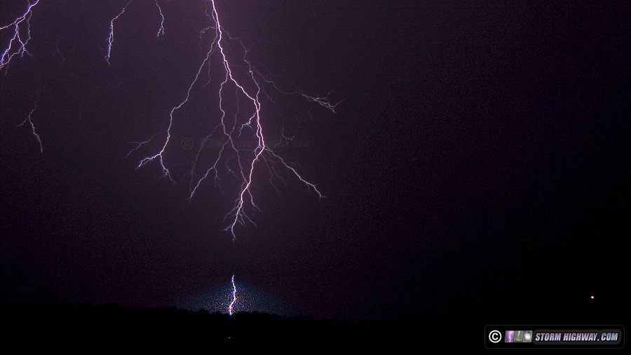
Once it was clear that downtown was done with storms, I moved east to intercept the last cell in the cluster moving toward O'Fallon. It continued to build along its eastern flank, and I ended up catching it at home in New Baden. The lightning here was high-quality, with tall, loud, powerful bolts piercing the predawn air. I shot high-speed video here, and each result on the camera's screen took my breath away. I don't think I will ever get tired of shooting high speed lightning, it is quickly becoming a chasing favorite. The slow motion footage captured not only stepped leaders, but two instances of upward ground leaders just before connection:
The video below shows all of the catches from this event:
That's it for now. Hopefully more to come as spring storm season continues, so stay tuned!
GO: Home | Storm Chase Logs | Photography | Extreme Weather Library | Stock Footage | Blog
Featured Weather Library Article:
|


