
|
||||||||||||||||||||||||||||||||||||
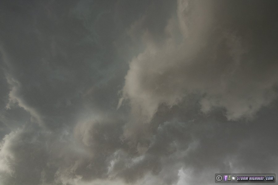
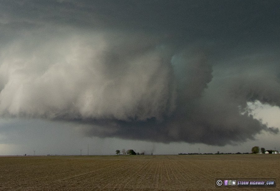
I ended my personal pandemic tornado drought this day with 4 in central Illinois. My previous tornado was June 15, 2019, and my last real opportunity that I am sure I would have scored on was the May 28, 2020 Illinois event. COVID travel restrictions prevented me from making that 3-hour drive to that target southeast of the Quad Cities. The Great Plains season last year was a no-show, so even though I was free to travel after Illinois finally lifted their non-essential travel ban on May 29, no further opportunities for tornadoes presented themselves (at least ones I am sure I would have succeeded at). I began this day undecided if I wanted to stay in the St. Louis metro for an isolated storm depicted by short-term models, or go up to the I-72 corridor for a strong storm shown there. Supercell parameters in both targets were similar. Instability (MLCAPE) and deep-layer shear were better in the STL metro, but low-level instability and surface vorticity were better in the northern target. I finally chose to head north halfway between the two targets to hedge my options, reluctant to leave the bubbling cumulus field west of St. Louis that was starting to generate radar echoes. But as that southern area continued to struggle while the northern storm near Quincy continued gaining strength, it was soon clear that the I-72 corridor would be the better play. I arrived at the storm at Concord, where I could see a persistent RFD cut slicing into a large rain-free base. I stayed close to this feature with the visible circulation just to my north, though the storm was moving east fast enough that it wasn't quite a leisurely process. Every time I stopped, the RFD quickly caught up to me within 30 seconds. During one such stop west of Ashland, a rope funnel appeared overhead under the RFD gust front shelf cloud:
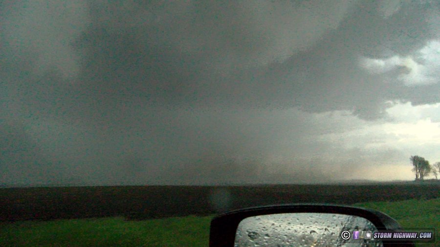
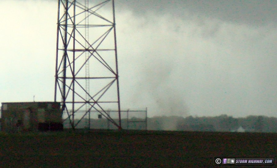
 I fell behind the RFD while making a northward jog west of Ashland, and caught up to it on the east side of town right as the storm produced a large dusty tornado about a mile to my northeast.
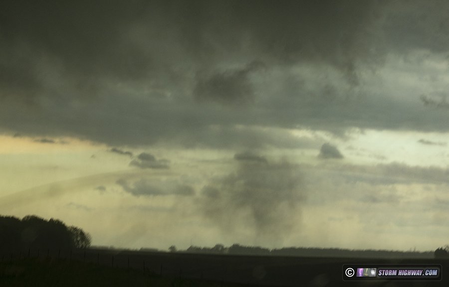
 After this tornado dissipated, I managed to stay ahead of the storm until Salisbury. At that location, there were no roads available to cross the Sangamon River - I would need to go either 5 miles north to the next bridge, or go south through the northern part of Springfield. The storm seemed to be continuing its trend of turning right, so I chose south via the Springfield route to make it to I-72. During this transit with numerous traffic lights and slow speed limits, the storm gained considerable ground on me. I finally was able to catch up again via I-72, witnessing another dusty tornado to my southeast near Dawson from the interstate.
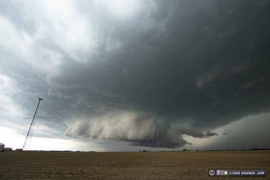
 I finally made it ahead of the storm and back into good position at Illiopolis. Here, dramatic structure and a rapidly rotating wall cloud approached from the west. It wasn't long before the third tornado of the day spun up under this feature, once again as a large dirt whirl spinning under the wall cloud.
 Cropped view of tornado:
 Just before I left to reposition east, another small vortex spun up in the field to my southwest. I scrambled to get the camera on it, barely grabbing this shot before it moved behind buildings and trees.
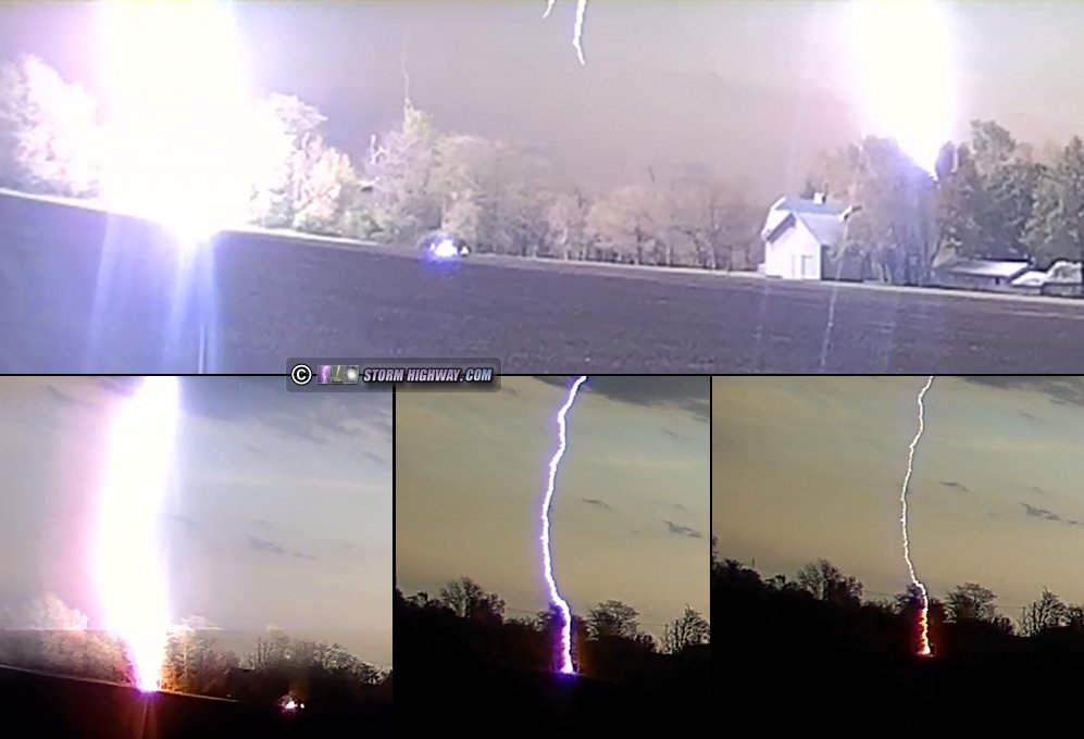
 Lightning had been rather lackluster up to this point in the day, so I had not had an opportunity to shoot any high speed footage. Suddenly north of Blackland, I found myself in the middle of a great cloud-to-ground lightning barrage. While I love close lightning, it is problematic for high speed video for 2 reasons: one, a close bolt won't have many leader steps at high framerates (you really want long lengths of lightning channel, meaning at a distance of at least 2 miles), and two, being close means it's harder to get a bolt in frame with them striking all around you. Therefore, I failed at catching any bolts on high speed at this point. My front dashcam did catch a bolt striking a tree a fifth of a mile away. The rolling shutter on my dashcams is very bad, meaning only slivers of the bolts get captured - but one upward leader and some secondary arcing at ground level is visible. This is a collage of several frames:
 I tried to get southeast to put some distance between the storm and me for high speed shots, but by then, the lightning barrage had faded. The supercell quickly transitioned to a bowing squall line south of Decatur, racing southeast with a nice shelf cloud, but offering nothing more of interest for me. I ducked out of its way at Sullivan and started the 2-hour drive back home.
GO: Home | Storm Chase Logs | Photography | Extreme Weather Library | Stock Footage | Blog
Featured Weather Library Article:
|
||||||||||||||||||||||||||||||||||||


Web Site Design and Internet Marketing by CIS Internet