|
Home | Blog Index | Blog Archives | Christianity & Faith Essays | Storm Chasing Essays
June 2022 Storms and Weather Roundup
June 2022 Event List
 June 10: Supercell at Highland, Illinois June 10: Supercell at Highland, Illinois
This was a marginal day for storms in and near the St. Louis metro area thanks to weak instability and weak low-level flow. But, strong deep-layer shear thanks to a potent northwest-flow upper jet moving overhead meant that supercell potential would exist with any storms that managed to maintain strength. A weak surface boundary existed from near Hannibal southeast through right near my apartment at New Baden, but stronger instability existed just to the west of St. Louis. I decided to stay at my office and watch how the day evolved. A storm fired on the boundary up along I-72 and immediately had a supercellular look on radar, though soon a strong outflow was visible surging south ahead of it. Jumping on this storm immediately was tempting, but I wanted to wait and see if stronger storms would develop upstream of St. Louis.
Eventually storms did fire northwest of the metro area, but they were not taking off as expected and were producing little to no lightning. I finally decided that the northeastern storm on the boundary would have the best potential, so I headed east and caught it along I-55 at Hamel, IL. The storm exhibited a decent RFD cut and wall cloud, but motion was weak.
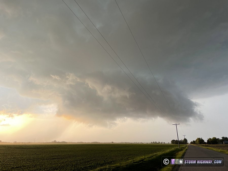
The storm cycled down briefly as I stayed with it, then a strong uptick in intesity happened at Marine. A strong RFD surge started kicking up dirt in the fields while the updraft maintained inflow just above the surface.
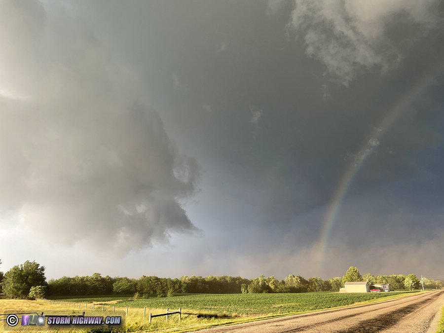
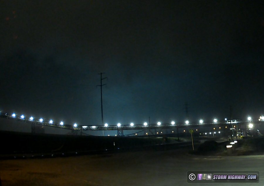
The appearance improved as the storm made a hard right turn at Highland, moving almost due south. A slowly-rotating wall cloud took shape as it passed over I-70 north of town.
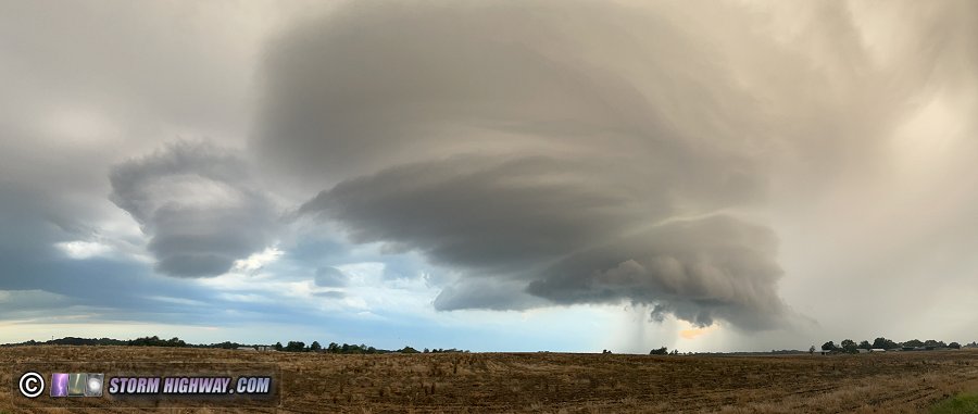
The updraft during this time had grown in size considerably, with the RFD trying to occlude small circulations on its western edge. None of these exhibited strong motion. Eventually, the storm's radar presentation started to diminish, and seeing no imminent tornado threat, I decided to move east of the storm a little to see what the structure looked like. Southeast of Highland, I stopped and looked west to see a surprisingly-impressive updraft with several lenticular lobes. This first image is a panoramic image taken with my phone:
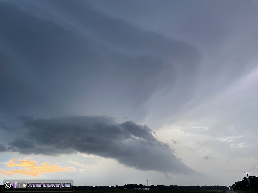
The storm lost its definition just after this, and the updraft was gone 15 minutes later. Despite its short-lived nature, this storm exceeded my expectations for the day.
 June 17: St. Louis daybreak severe storms June 17: St. Louis daybreak severe storms
The first solid lightning opportunity in quite some time was shown by models to affect the St. Louis metro area early in the morning. I was awake by 2AM to prepare for this event, and at 4AM made my way up to Moscow Mills to start shooting high speed video of the squall line advancing southeast toward the metro area. When I arrived, the storms were in a weakening phase with outflow racing far ahead.
Mesoanalysis showed increasing instability ahead of these weakening storms, and sure enough, new lightning-active cells began firing along the outflow as it moved into the metro area. I expected these to continue to develop areawide, so I returned to downtown St. Louis. I made it just before the renewed storm complex's gust front moved over the city. Numerous power flashes occurred north of downtown as the strongest winds focused in that area.
Visible lightning activity was lackluster, so I abandoned the downtown play and headed west to Brentwood for possible upward lightning in the trailing stratiform region.
The storms' stratiform region was disrupted by the brief weakening phase earlier, with a large gap in between the cores to the south and east and a larger lightning-active stratiform area to the north. New cores were developing just to the west, with one producing a burst of cloud-to-ground bolts that was good enough to capture one nice multiple-CG flash event.
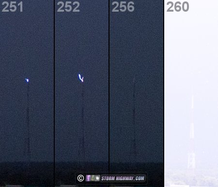
The stratiform region rapidly filled in the gap within 10 minutes, and a brief series of strong positive cloud-to-ground bolts signaled renewed upward lightning potential. A close positive CG event occurred in conjunction with a short upward leader to the closest tower. This image shows a series of frames from the 1,500 FPS high speed video showing the upward leaders and the subsequent bright flash from the positive CG return stroke:
Video of this event from 3 of my cameras is published on my Youtube channel:
 June 25: St. Louis metro lightning June 25: St. Louis metro lightning
I spent a couple of hours following multiple rounds of storms from Hazelwood east to back home. The lightning was decent, but uncooperative for my cameras. No photos or videos captured.
GO: Home | Storm Chase Logs | Photography | Extreme Weather Library | Stock Footage | Blog
Featured Weather Library Article:
|


