|
Home | Blog Index | Blog Archives | Christianity & Faith Essays | Storm Chasing Essays
Updates on St. Louis Metrolink/bike trail extension to MidAmerica Airport
UPDATE July 2026: The trail is complete and is now open!
Work is finally under way on the much-anticipated extension of the St. Louis Metrolink light rail line from its current terminus at Scott AFB to MidAmerica Airport. The plans for the extension have been publicly posted by St. Clair County. This is a running blog post that will be periodically updated (click to jump to newest photos).
In May of 2020, I published this blog post about bike trail connections around Scott AFB and the surrounding region, citing a Silver Creek crossing as a critical component to opening up safe bike commuting and recreation routes. I was pleased to see that official plans for a bike trail across the creek were already in progress as part of the Metrolink extension project.
Even if you're not a cyclist in the area, if you live nearby or regularly use Wherry Road, Rieder Road, Seibert Road and/or Old Route 158, this project will be of interest to you. It may affect your commuting or travel, especially to and from the base. I put together the current overview of the Metrolink extension and its peripheral details based on the publicly-released project drawings. Keep in mind that it's possible that some details of the project could change as construction continues. |
Click for Larger Map
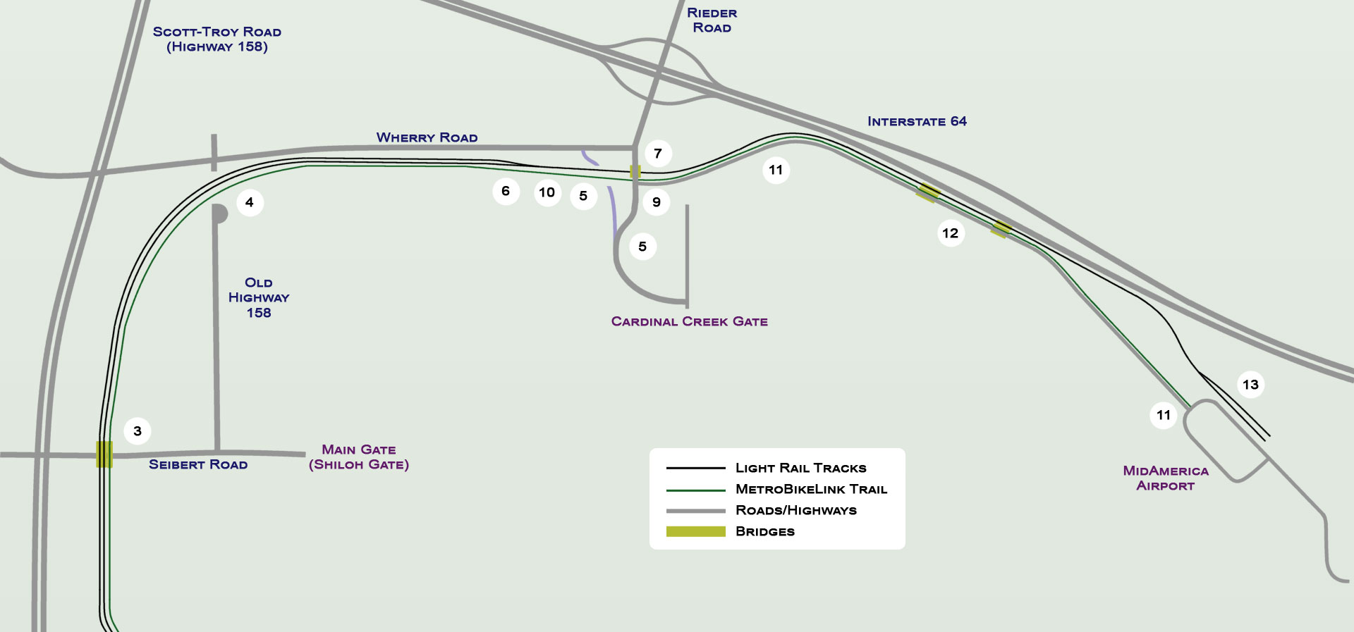
Some interesting items of note. Some of these are labeled on the above map.
- There will be no new at-grade crossings of public roads on the extension.
- The MetroBikeLink bike trail will parallel the light rail line extension on the south/east side of the tracks.
- The double-track Metrolink line and bike trail will rise up and cross over Seibert Road on a new bridge. Seibert Road is the 4-lane road to the Scott AFB main gate (also called the Shiloh Gate).
- Old Highway 158 will be permanently severed where the double-track line crosses its current alignment just south of Wherry Road, with a cul-de-sac installed on the stub end of the road to the south of the tracks. Many Scott AFB commuters currently use this road to reach the base, this will require an alteration of their commutes to Highway 158 / Scott-Troy Road.
- The current access road to the Cardinal Creek Gate of Scott AFB (currently designated as north-south segment of Wherry Road) will be permanently severed by a large cut for the rail line just south of the east-west section of Wherry Road. Access to the base gate will be moved to a new extension of Rieder Road southward until a point it merges with the old access road.
- The Metrolink line will go from double track to single track just west of Rieder Road.
- Rieder Road will pass over the Metrolink line on a new bridge.
- The Metrolink line near Rieder Road will run through a 27-foot deep cut with retaining walls on either side as it approaches and passes under the new Rieder Road bridge.
- A new 2-lane road will intersect with Rieder Road just south of the new bridge with a 3-way stop sign, and continue roughly parallel to the Metrolink tracks across Silver Creek to the airport.
- The bike trail will gradually diverge from the light rail tracks west of Rieder Road, rising up along the south side of the new cut until it meets Rieder Road at grade at the intersection with the new 2-lane road to the airport.
- East of Rieder Road, the bike trail will closely parallel the north side of the new 2-lane road to the airport.
- The single-track Metrolink line and combined access road/bike trail will each cross two new bridges over the main Silver Creek and Little Silver Creek channels.
- East of Silver Creek, the Metrolink line will go from single track to double track just west of a new station on the north side of the airport parking lot. The station platform will have two tracks.
- The Metrolink light rail portion of the project is slated for completion in late 2024. While they are included in the Metrolink extension drawings, the new 2-lane road across Silver Creek and the new segments of bike trail are separately-bid construction projects. As such, there is not yet an estimated completion date for either the road or the trail.
For a bike commuter to Scott AFB, O'Fallon, Shiloh or Belleville from the east (including Mascoutah, Lebanon, New Baden or Trenton), the cycling route would be from the main entrance to MidAmerica Airport on Highway 4 through the airport's streets/parking lot to reach the new trail. Mascoutah riders would need to use Highway 4 to reach the airport entrance. Riders coming from the north side of I-64 (Lebanon, Trenton and New Baden) would need to ride a short distance on Highway 4 across I-64 to reach the airport entrance. There have been talks to build a trail southward from the airport to Mascoutah that would preclude riding on Highway 4, but there are not yet any official public plans for such a segment. That being said, trail development in the St. Louis region has been proceeding at an above-average rate, so we could be seeing even more progress in this realm sooner than we think.
The MetroBikeLink trail is actually one of two crossings of Silver Creek in the works for this area. The other, the Trolley Trail between Lebanon and O'Fallon, will cross Silver Creek just north of Highway 50 on an abandoned interurban trolley roadbed. The Trolley Trail project has recently received significant funding from the State of Illinois for engineering work to begin.
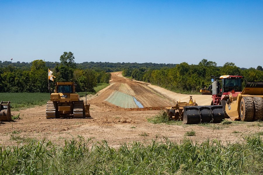
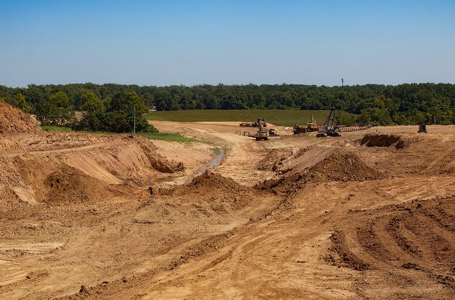
September 1, 2023 Photos
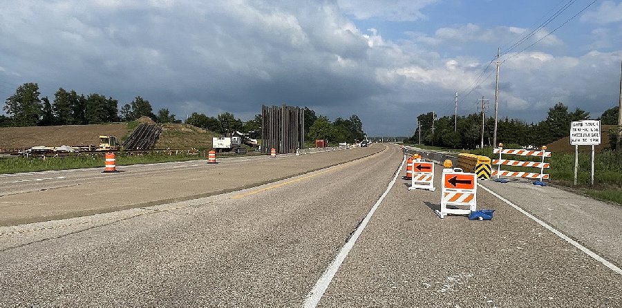
Progress on the approach fill and pilings for the parallel rail/bike trail bridges over Seibert Road (the road to the Scott Air Force Base main gate), looking east from west of the right-of-way.
Looking west from near Rieder Road atop what will eventually be a cut under the road. The bike trail grade diverges from the light rail grade here (on the left) and will rise to meet Rieder Road at grade, while the light rail line (on the right) will continue through the cut and under Rieder Road.
Looking east from near Rieder Road showing the earthmoving progress on the cut under Rieder. When complete, 4-lane Rieder Road will extend left-to-right across this image, with a bridge over the light rail tracks.
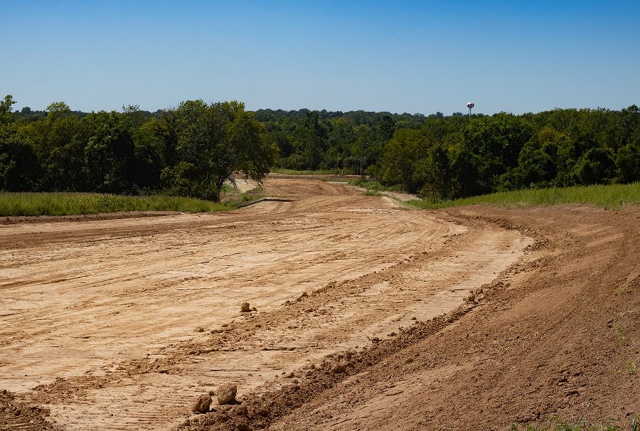
Right-of-way grading continues in the Silver Creek floodplain next to Interstate 64, looking east. The right-of-way here will accomodate the single-track light rail line, the bike trail and a two-lane public road (in that order from left to right). Four new bridges will cross the dual channels of the creek (two each for the light rail tracks and the road/bike trail combination).
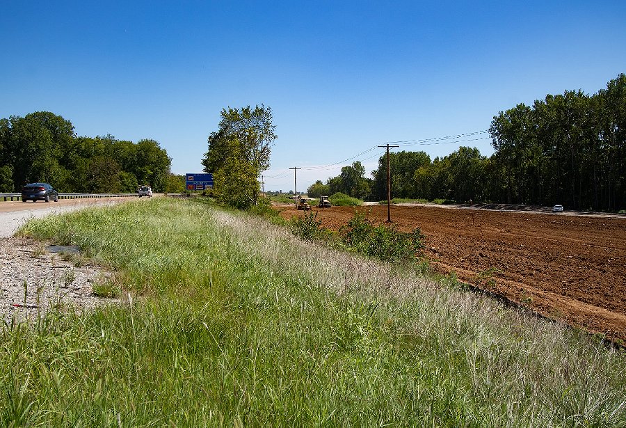
Looking west across Old Highway 158 from the crest of the hill on Wherry Road. The right-of-way with here will accomodate the double-tracked light rail line on the right and the bike trail on the left. Old 158 is still open for the time being, but will eventually be permanently closed.
April 9, 2023 Photos
Tree and brush clearing as well as utility/power line modifications along the right-of-way have been in progress for a few weeks.
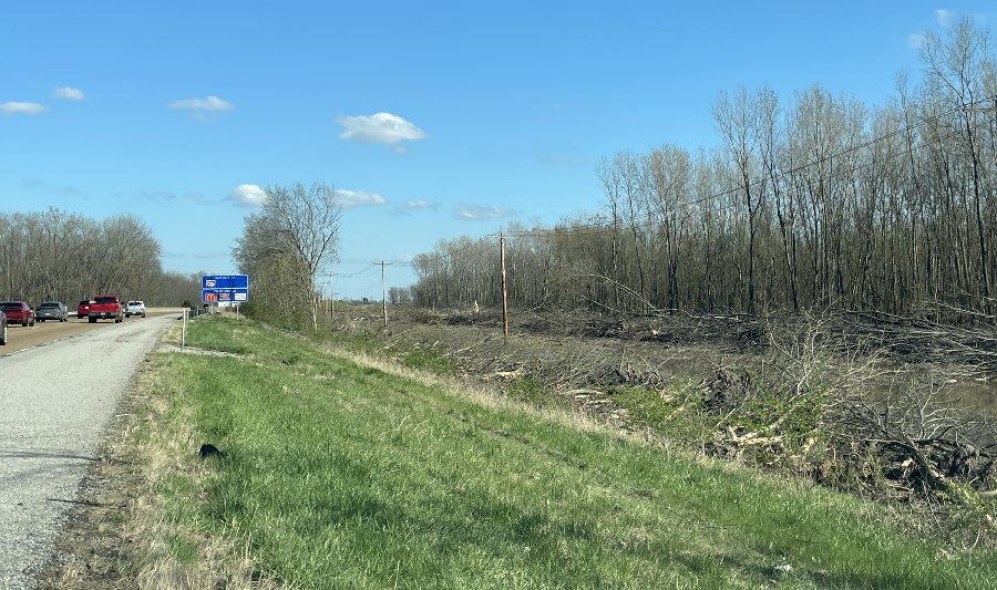
Tree clearing along I-64 in early April 2023 for the new light rail extension, bike trail and road.
GO: Home | Storm Chase Logs | Photography | Extreme Weather Library | Stock Footage | Blog
Featured Weather Library Article:
|
|


