|
Home | Blog Index | Blog Archives | Christianity & Faith Essays | Storm Chasing Essays
Spring storm season update for May 25
We're in the climatological peak of severe weather season in the Midwest and Plains, but you wouldn't know it from my daily schedule the past 2 weeks. It's been life-as-usual here, with very little of significance in the realm of storms to pursue either at home or in the Great Plains. The season's medium-to-long range outlook for the upper level jet pattern is getting perilously close to looking like a no-Plains-trip year for me, with nothing looking worthy of a chase for as far out as models can reasonably be trusted.
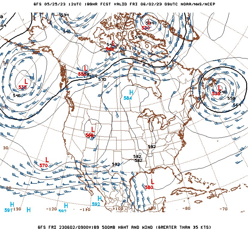
Abysmal GFS 500mb winds forecast for June 2: southern stream jet *south* of the Plains, with offshore flow over the Gulf supressing northward moisture transport
No, the season is not over yet - but in reality, June just doesn't reliably produce major events in the Plains, and it's more likely than not that the peak Plains tornado season will be over in the next 2 weeks. Since 2001, I've done a Plains trip in June only once every 3 years or so. Sure, you don't turn your back on a big system coming into the Plains in June, but you also can't count on one happening most years. And yes, those 2-percent tornado days on the dryline continue on the Texas Caprock, but those tend to not be worth the expense of a multi-day trip (in my opinion). Finding a gem in that type of pattern just takes grinding out a large number of those marginal chase days, which I do sufficiently throughout the year with similar-quality days in my backyard (no travel necessary).
Here at home, mid-May hasn't been much better. Upper-level flow and decent instability have been absent across the Midwest, with Tuesday (the 23rd) the first time the St. Louis region has seen even convection in 9 days. The parameters didn't warrant going out for more than an hour 10 miles from home as some towering cumulus bubbled up north of I-64 near Lebanon, IL, eventually growing into a 25-minute heavy rain shower with no lightning or hail to be seen.
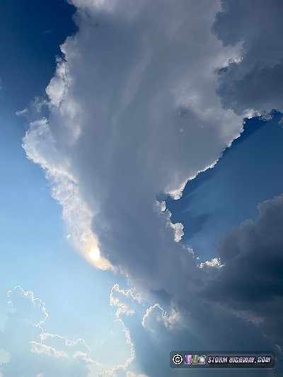
Not even a rainbow appeared as the direct sunlight shone on the precip toward the end of the cell's life cycle, then after dark, I missed a brief lightning-active storm that fired just to our southwest after I'd returned to work. It was symbolic of a Midwestern peak season that has so far been eluded by impressive and/or cooperative storm phenomena.
Barring a big turnaround in the long-range outlook, it's looking likely that we'll soon be going into summer weather mode here. With the typical northwest flow and mesoscale boundary events to start watching for, things will start to get more active - eventually.
GO: Home | Storm Chase Logs | Photography | Extreme Weather Library | Stock Footage | Blog
Featured Weather Library Article:
|


