|
Home | Blog Index | Blog Archives | Christianity & Faith Essays | Storm Chasing Essays
Storm chasing season forecast update 7 for April 21
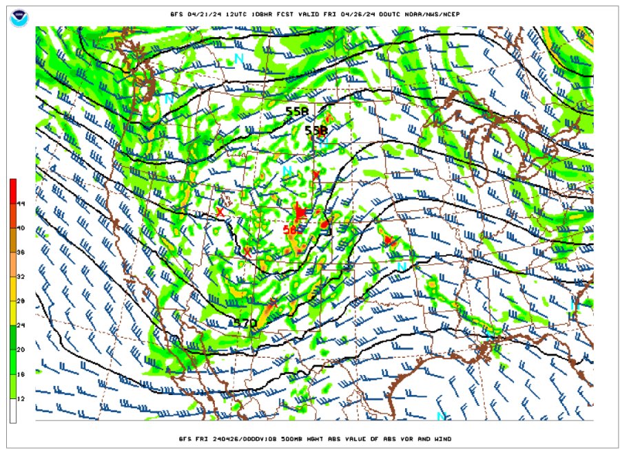
April has been a very active month for severe weather in the Plains and Midwest, and it appears that may continue through the end of the month. After our current few days of downtime, medium-range models have been in agreement on another significant upper-level trough moving into the Plains late this week, with the first of several days with supercell/tornado potential shown for Thursday.

GFS 500mb forecast for Thursday evening, April 25
As with past events, we'll be again possibly dealing with moisture quality issues with this system. The reason for that is these troughs have been moving through the USA from west to east quickly. Since troughs are almost always followed by strong cold fronts as they exit, deep moisture gets swept down to - or completely through - the Gulf of Mexico, "resetting" the low level environment that the next system must then rebuild. If the next trough is also moving quickly, there is often not enough time for it to bring sufficient moisture northward for the good wind profiles that the main jet streak's arrival over the Plains brings (the trough's "ejection" as it's called).
All things considered, the synoptic (that is, the large scale) pattern indicated by models supports the possibility of the second Great Plains trip of the season happening this week. I'm elevating the trip probabilities to reflect that. Like the last one, this system may also bring a tornado event to the Midwest in the days following as it moves east. Stay tuned!
The following table charts the probabilities for a Plains storm chase expedition taking place for the date ranges shown:
| 2024 Plains Chase Expeditions - Probabilities as of April 21 |
| April 21-23 | 0% | |
| April 24-28 | 55% | |
| April 29-30 | 10% | |
|
| View 1,607 storm chases: |
| by year: |
|
| by type: |
|
|
|
GO: Home | Storm Chase Logs | Photography | Extreme Weather Library | Stock Footage | Blog
Featured Weather Library Article:
|