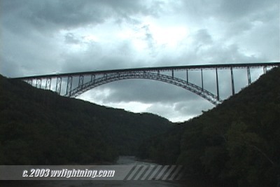
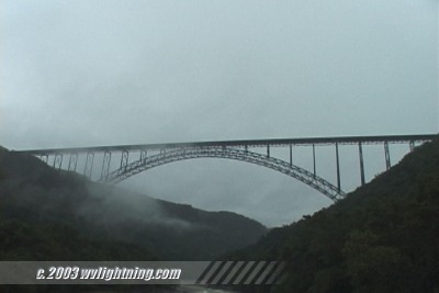
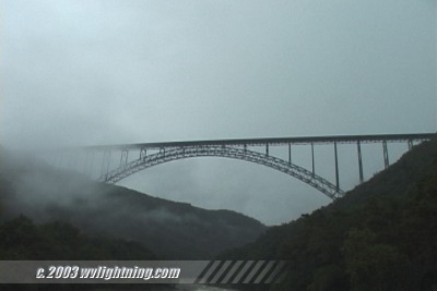
 Ominous Skies: Fayetteville, West Virginia - July 10, 2003 - 7:00PM Ominous Skies: Fayetteville, West Virginia - July 10, 2003 - 7:00PM
EXPEDITION VIDEO: RealVideo, 847KB - Dark clouds roll in over the New River Gorge Bridge in Fayetteville.
A NWS damage survey team confirmed several remarkable significant severe weather events in West Virginia from a line of storms that pushed through the state on Thursday July 10.
An F2 tornado was confirmed near Parkersburg in Lubeck, WV (Wood County) where 30 homes and businesses were damaged and 4 homes destroyed. Damage from 80mph to 100mph straight-line winds were also chased in parts of Jackson County (Between Parkersburg and Charleston).
Some data info: I wish I had taken better notes from this day but here is what I do have. Just before the line of intense cells, associated with a frontal boundary to the west, crossed the state line at about 5:00PM EDT, 100mb MLCAPE in the region was only around 1000 to 1500 j/kg and decreasing sharply west to east, but 850mb - 500mb shear was somewhat good, and improving west to east. SPC showed a supercell composite of 4, a significant tornado parameter of 2, 3km EHI of 3 in the damage area just before the cells produced the aforementioned severe events. In prior days, the tornado threat appeared much more pronounced than this, with a supercell composite of 9, sig. tornado of 4 over southeast Ohio on one instance with nothing developing.
The severe events occured about 100 miles west of the highest elevations of the Appalachians, in the foothills close to the Ohio River. I was in Fayette County, in mountainous terrain about 100 miles southeast of the damage areas, and chased no severe events as the rapidly weakening line moved over my location.
With a strong, fast-moving line of severe thunderstorms approaching from the west, it appeared that much of West Virginia would see a significant storm event. While the line, moving as fast as 60mph in places, caused wind damage in the Kanawha Valley, it quickly weakened as it approached the mountain counties to the east. As the remnants of the storms approached Fayette County, an ominous display of threatening skies rolled in over the New River Gorge, but no severe weather was seen in this area. After a period of rain and a few lightning flashes, the storms continued to weaken as they moved east into Virginia.
Video grabs from July 10, 2003:

Digital Video: Sony DCR-TRV900 3CCD MiniDV, 720x480 NTSC
|


