 Thunderstorms light up WV: Lightning, heavy rain last from early afternoon through the night: May 19, 2005 Thunderstorms light up WV: Lightning, heavy rain last from early afternoon through the night: May 19, 2005
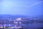
ABOVE: Lightning over I-64 in Charleston overnight.
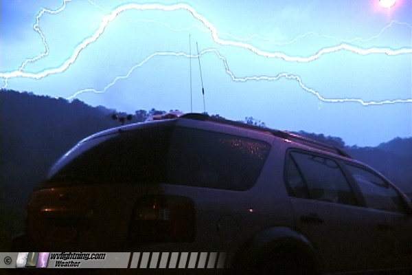
EXPEDITION VIDEO: Lightning near Milton
HUNTINGTON, WV - Several strong thunderstorm cells moved across the Huntington and Charleston metro areas on Thursday afternoon, lasting into the overnight hours. Heavy rain and frequent lightning were the primary threats, though hail and damaging winds have been reported across the region. The following is a log of the day's chase. Photos can be enlarged by clicking on each thumbnail image.
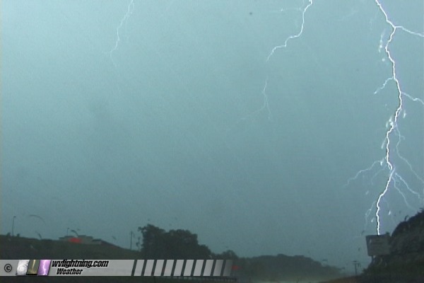
Started the day's trip at 2PM when a rapidly intensifying cluster of convection fired southeast of Cincinnati and began moving toward the Huntington-Ashland area. A tornado warning was issued for Scioto County in Ohio based on a doppler-indicated couplet, but I was still in Cabell County, too far away to intercept. I targeted Ashland as the best location for lightning. Traffic on 52 at South Point was congested as usual so I had trouble making it in time. Furthermore, there was no shoulder/berm bewteen Ashland and Ironton, so I had no place to pull over and film the impressive lightning show. Ended up stopping near South Point to set up and catch a few strikes.
Video capture - click to enlarge
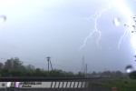 
From there, it was back through Huntington to 29th Street, where I grabbed a few b-roll shots of traffic in the pouring rain, as the lightning activity had subsided. A new cell was forming and heading up from the southwest, so I jumped east a mile or two to wait for the lightning. Got set up at Merrick Creek
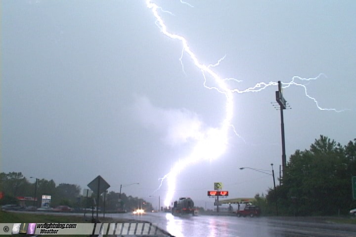
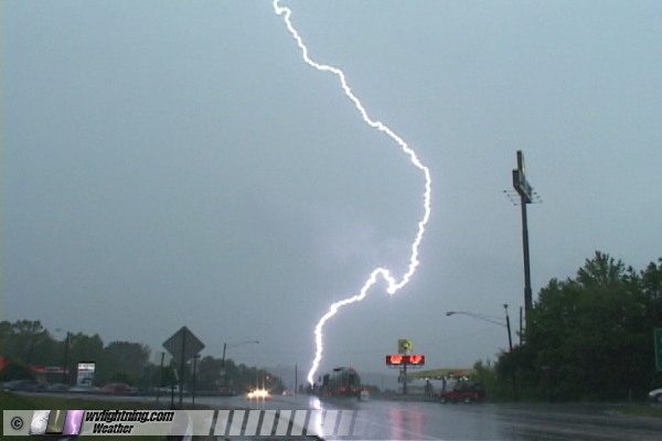
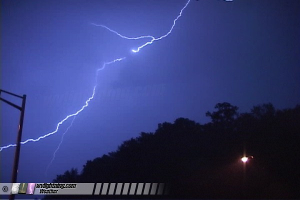
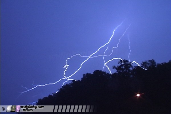
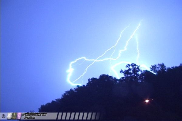
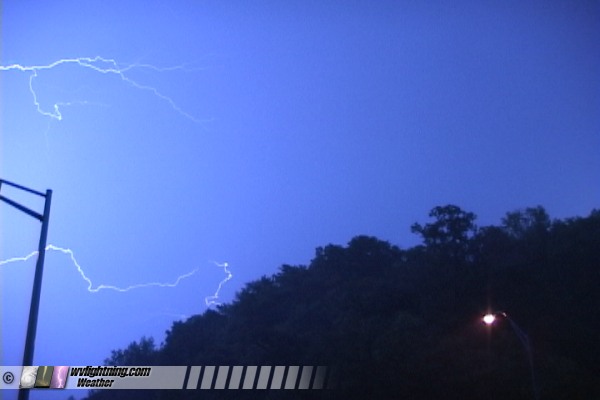
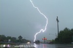
with both cameras rolling, but no good bolts cooperated. Finally stopped at Milton to review/capture video. While I sat in the car editing video, I left a camera set up facing south in case a stray bolt from the departing storm decided to make an appearance. And, one did! A fairly close strike occurred less than a mile away, visibly hitting in front of the treeline in the distance (video of this strike appeared on The Weather Channel during the day on Friday):
Video captures - click to enlarge
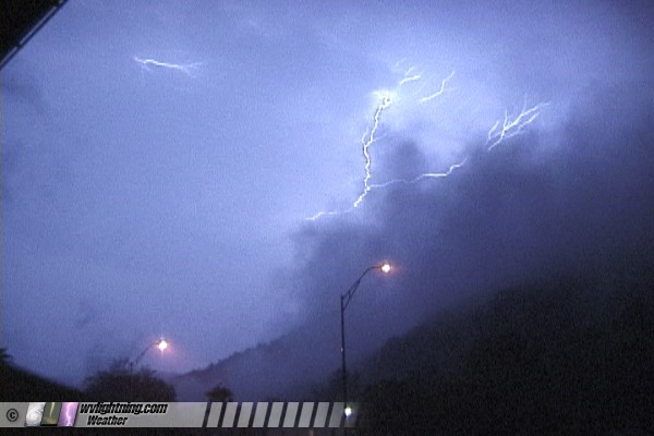
After feeding the Huntington video, I became concerned about the large area of heavy rain on radar moving through the coalfields. So, I ventured down to Hamlin to look for signs of impending flooding. Finding none, I headed back to Charleston, arriving in time to see new convection firing around an apparent mesolow (MCV) spinning in the coalfields. An active cell in Boone County was flickering nicely and heading for the Turnpike, so I drove to Paint Creek to wait for it, adjusting back to Sharon where I set up the cameras once again:

I used one camera to attempt a 'promo' shot of lightning with the chase vehicle. One bolt cooperated perfectly, orienting itself horizontally above the car and filling the sky:
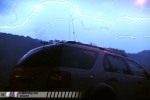 Animation:

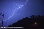
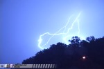
After this tiny but active cell moved off into the mountains, I headed back to Charleston where a large electrified stratiform precip shield was producing huge anvil crawler disharges every 3 to 5 minutes. With light winds and steady rain, I was able to Porta-brace both cameras and leave them running outside on the Fort Hill overlook to catch the show over the city:
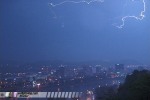 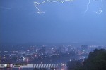
This nice display lasted until after 2AM, with many sonic-booming cloud-to-ground/anvil crawler strikes. The two cameras got some decent video of this lightning over downtown Charleston and the distinctive I-64 bridge. I stopped downtown to feed video, then called it a night at 3AM.
GO: Home | Storm Chase Logs | Photography | Extreme Weather Library | Stock Footage | Blog
Featured Weather Library Article:
|