
|
||||||||||||||||||||||||||||||||||||
MULLEN, NE - I observed a significant wedge tornado after dark in the Sandhills of Cherry County, Nebraska with one of the more prolific tornado-producing supercells of the decade. This is a log of the day's chase. I had been indecisive about chasing this setup thanks to near-unanimous model portrayals of capping preventing storms from developing along the dryline from western Nebraska to the Texas panhandle. The environment along the dryline was excellent for supercells and tornadoes, and if a storm fired and sustained, there was no question it would be good. With more certainty of storms, I would have done my usual of departing St. Louis on Saturday evening and stopping for the night in Salina. Instead, I went to bed early at home and set my alarm for 4am so I could look at the full 06z model suites to make a final last-minute decision. The 06z models were not very different from their preceding runs, but there were enough blips of convection shown here and there on the dryline to be concerning. Models often have trouble with these scenarios, and it is fairly common for some of the models (like the HRRR) to not show any storms until a few hours before they form. In this situation, you can't wait for that to happen because like many chasers, I had an all-day drive to the target (9 hours in my case). So, it's a situation that's a coin flip on whether storms will form. If you make the long trip and no storms develop, it's a long and tiring "blue sky bust" as it's called. If you stay home and storms do form, you'll be in great distress about missing them. This requires what I call a "checked swing" chase trip. If you are still indecisive at your last possible go/no go decision time, you *have* to start the trip anyway. Delaying departure past that point is a no-go call, as you won't make it in time if you wait any longer. As more data comes in, you can hopefully see things clearly enough to make a final call. At that point in a "checked swing" chase, you either continue on (executing the swing), or turn around and go home (checked swing). So, I departed on what I expected to be a checked swing chase at 5am. Every time I stopped to look at new data, nothing was changing from earlier expectations, so I continued westward. By the time I passed Junction City, Kansas, this "checked swing" chase was already practically a full swing. I might as well continue on, meaning it was all up to the weather now on whether it would be a strike or a hit. As I arrived in WaKeeney, Kansas, cumulus was bubbling up on the dryline in two areas: one just to the west near Goodland and another down near the Oklahoma border. Both would be viable targets if a storm formed in either area. Complicating things was that the areas north and south of these were emerging as respectable - even preferred - target areas. Models had been consistent on supercells firing in the Nebraska panhandle at the northern edge of the instability axis in an area with increasingly volatile environment after sunset. The other was that models were showing stronger indications of storms initiating (albiet briefly) in the Texas panhandle where similar volatile supercell/tornado wind profiles existed, but with much greater (explosive) instability. I at first, wrote both of those areas off as I could not make either one before dark. The southwest Kansas cumulus field slowly died off, while an updraft finally formed north of Goodland and reached anvil level near the Nebraska border. That was the cue to go north for the intercept across the state line near McCook. By now, the Nebraska panhandle storm had formed (as models indicated) near Bridgeport and appeared to be getting established. My storm's updraft, however, vanished - leaving an "orphan anvil" drifting away to the northeast. Some towering cumulus continued in that area, but slowly diminished. My original target area was done at 5pm.
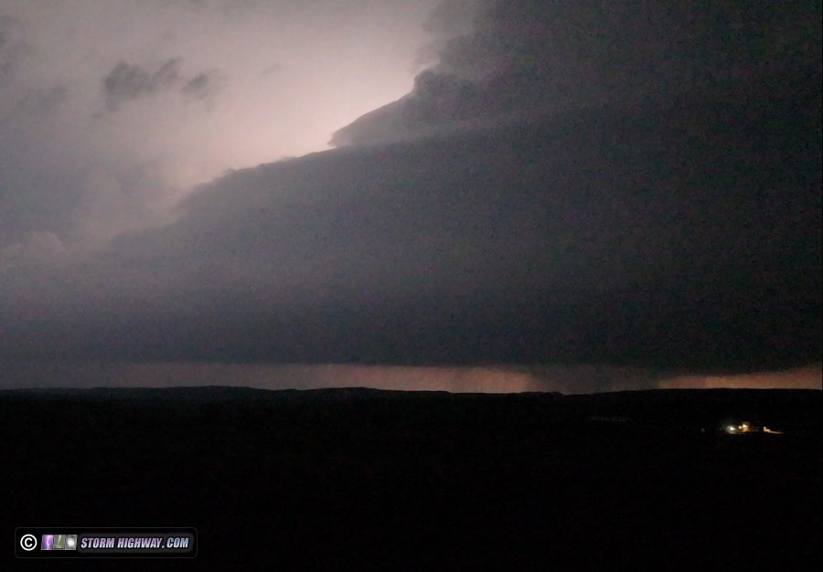
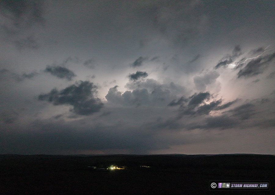
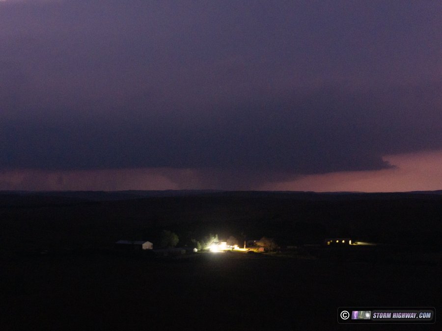
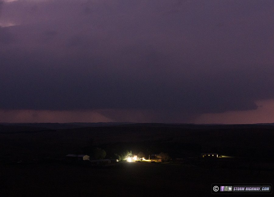
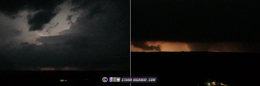
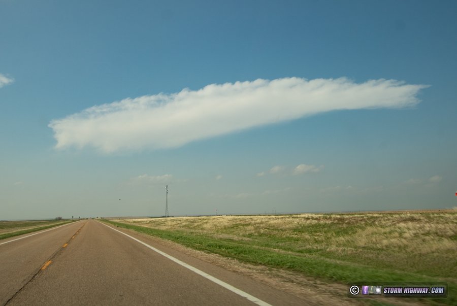 Orphan anvil near Oberlin, Kansas Orphan anvil near Oberlin, KansasI plotted the course to intercept the Sandhills storm, and although it was 3 hours away, I would make it just before dark. Models agreed that this storm would last well into the night, so I thought it would be worth the trek for some lightning and storm structure shots (with a chance of a tornado in the mix). As I approached I-80, the storm began wrapping up and producing its first tornadoes. I was still 2 hours away, and the rest of the drive was agonizing knowing what was unfolding. The distances in the Sandhills are deceiving - what appears to be a 25-30 minute drive at first glance is actually more than an hour. Complicating the intercept is the fact that the Sandhills region has very few east-west roads. The supercell, just barely creeping northward, was already crossing Highway 3, the last paved east-west road at Hyannis and heading into no-man's land. Highway 61, to its west, would likely have poor views of tornadoes, but the next north option (Highway 97) was almost 30 miles away from the storm, meaning views of it would be too distant until well after dark. By the time I'd get to Hyannis, the storm would be too far north of Highway 3 for any good views. It appeared the classic Sandhills road situation was going to thwart any chance of me seeing anything. I decided to continue to Hyannis anyway. Another storm had developed to the south of the original and was heading for a merger just north of the town, so I hoped to at least have some view of that. When I arrived in the town, the original storm's circulation had finally faded, so that option was out. The new storm, however, appeared to be taking over - but it was already well north of Highway 3 and again, moving into no-man's land with the only option to go back to Mullen and head north on Highway 97 - again, a very long haul that would take another 70-80 minutes and end up with an intercept well after dark. After I turned around, reports of a tornado with the new storm came in. I stopped and sent the drone up along Highway 3 to take a look, but couldn't see anything. At that point, there was nothing else to do but go to Mullen and then north on Highway 97 into Cherry County for a nighttime intercept. I was finally in position on the storm just after 9:20pm. Again, this being the Sandhills, views of storms are poor from ground level, making the drone a vital tool to get a good look. Structure was dramatic with constant lightning revealing the two separate supercell updrafts:
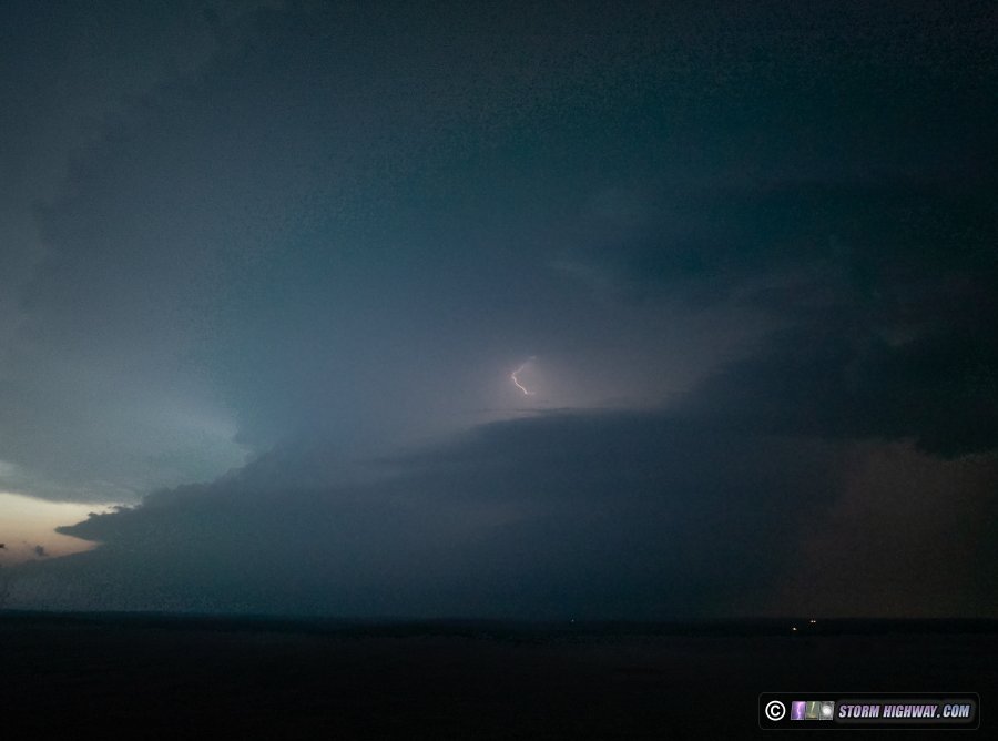
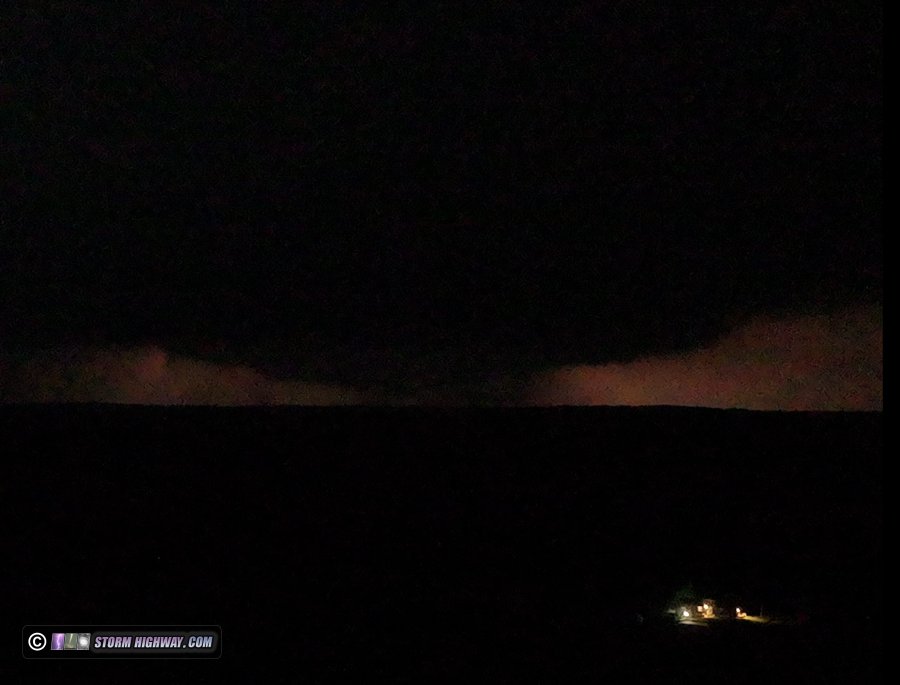
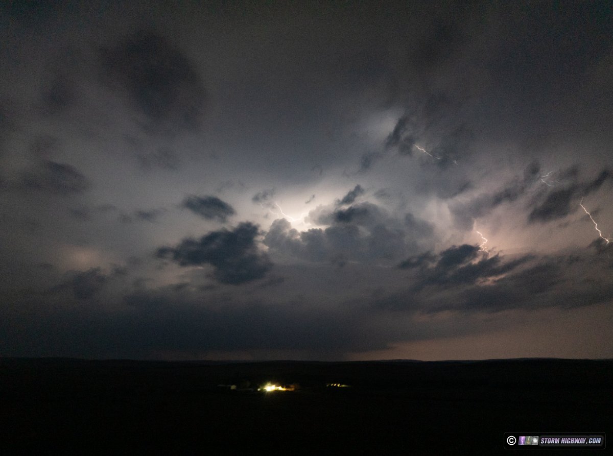
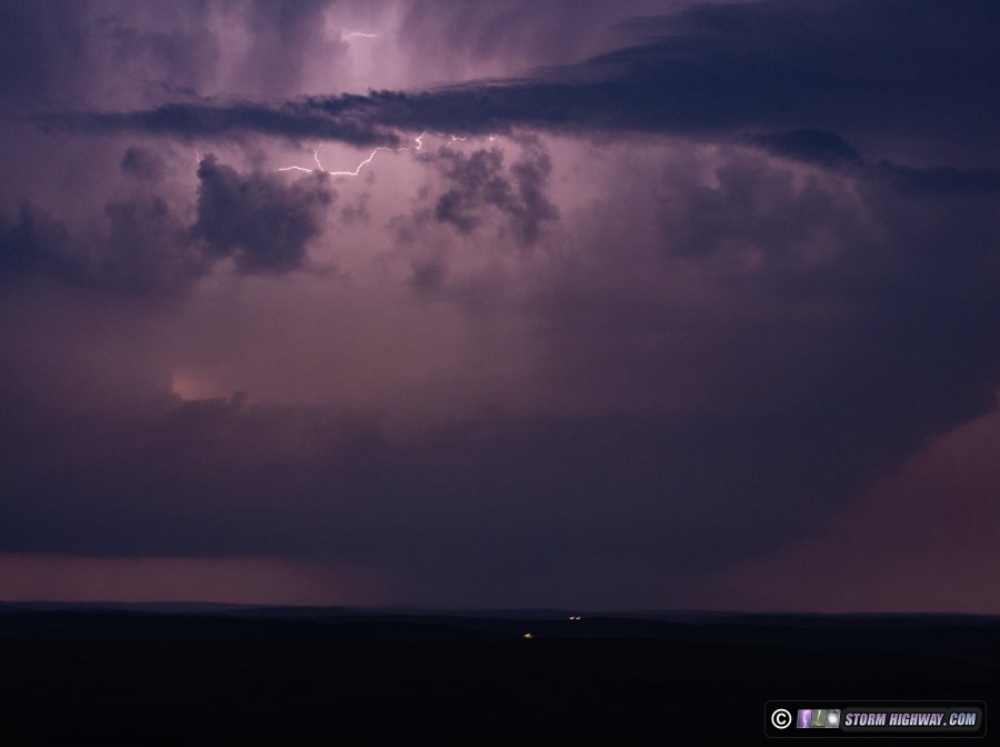 I kept the drone up for about an hour, continuously monitoring the evolution of two separate mesocyclones that had at times very strong velocity couplets associated with almost certain tornadoes. However, these all were rain-wrapped from my vantage point to the east. Finally, I could make out a persistent cone funnel at around 9:30pm to the west:
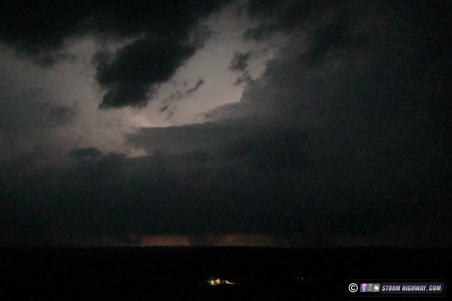
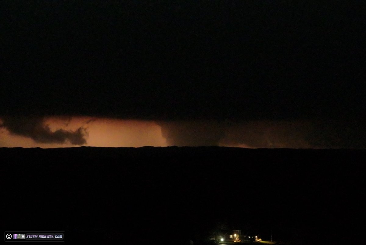
 The funnel either dissipated or wrapped in rain: I lost visual on it after about 1 minute. Even with the clear view afforded from the drone, it wasn't easy to discern what was happening during this interval. Everything was split-second visible only in certain lightning flashes that backlit the meso. There was also a lot of distracting scud along the RFD gust fronts that produced look-alikes, but thankfully these were displaced some distance to the south of where the tornadic portion of the storms were located. Most of the screenshots on this page were pulled after I arrived home and could finally watch the video frame-by-frame on a large screen. As the storms began moving to where I was looking at them from the southeast, I finally had a clear view of a very large tornado developing and strengthening. A large-from-the-start funnel rapidly condensed under a broad lowering, a situation that indicated the potential for a very large wedge tornado to just condense across this entire area.
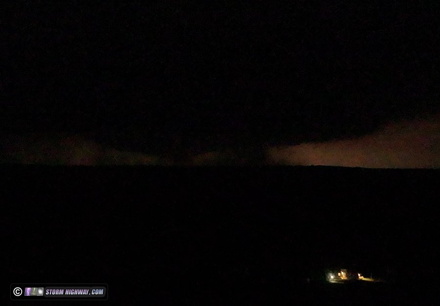
 The right side of the tornado became wrapped in rain for a period:
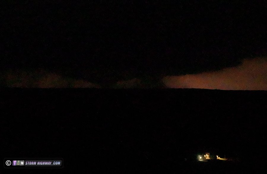
 Finally the rain moved east/north of the tornado and allowed for a couple of clear views. This one zoomed out showing the storm's structure:
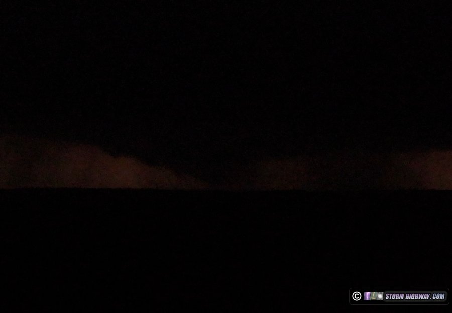
 The best view provided by a bright backlighting lightning flash:
 I had already gone through 3 drone batteries and much of a 4th (I was only getting 15-20 minutes on each one thanks to the drone having to fight the strong inflow to stay stable). The storm was now getting away from me, and facing the prospect of the long haul south to Kansas or Oklahoma, I decided to call the chase. In retrospect I should have stayed on the storm, as it continued producing numerous visible tornadoes (including multiples). I just figured my drone flight time would have been too limited by the battery life issue to keep chasing the storm for much longer. I made it to my overnight spot in Brady after midnight.
GO: Home | Storm Chase Logs | Photography | Extreme Weather Library | Stock Footage | Blog
Featured Weather Library Article:
|
||||||||||||||||||||||||||||||||||||


 ABOVE: Supercell with wedge tornado near Mullen, Nebraska


Web Site Design and Internet Marketing by CIS Internet