
|
||||||||||||||
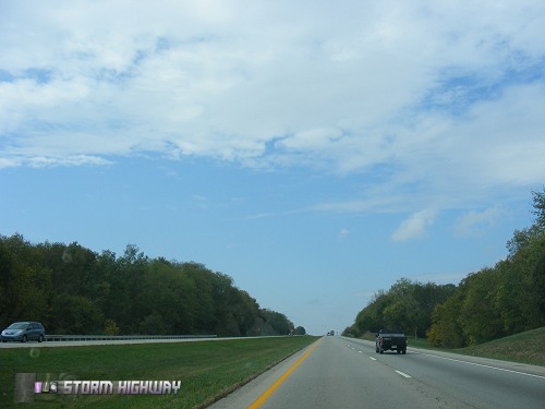
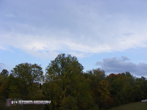
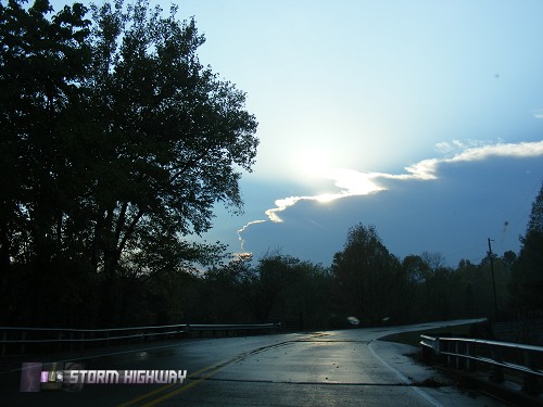
OWENSBORO, KY - Severe weather and tornado outbreaks are common in the fall, and this year was no exception. Thursday's outlook for tornadoes looked high from Mississippi to Michigan, with widespread clearing skies in the threat area promising good destabilization. I left Charleston at 10:30AM and headed west on Interstate 64 for a preliminary target of Evansville, Indiana. Initiation today was forecast to be late in the afternoon, so I expected to have plenty of time to make the 5-hour drive. Overcast skies and rain showers were the norm until near Mt. Sterling, Kentucky, where I finally encountered clear skies (below left). Fall colors were starting to come out across the Bluegrass countryside (below center and right).
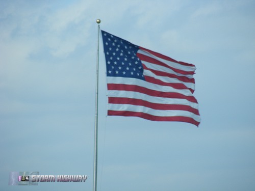
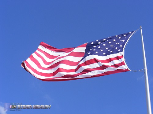
 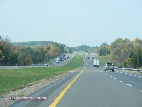  A small area of overcast covered the Louisville metro, while flying flags revealed the strong southerly flow ahead of the main system.
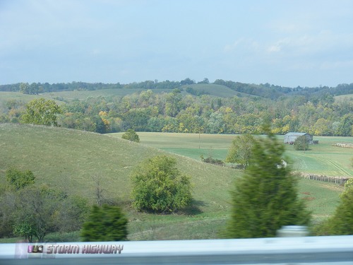
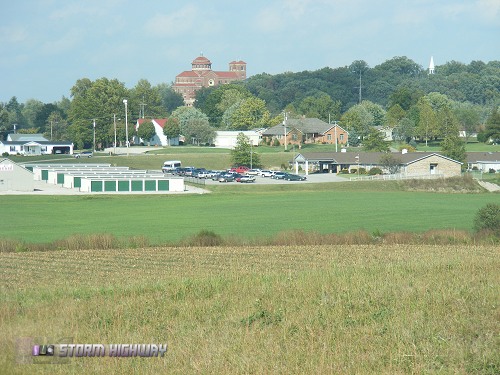
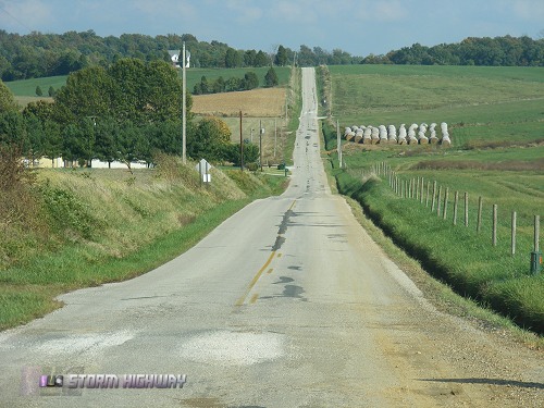
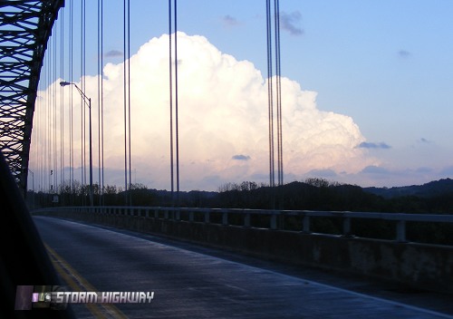
   I had re-activated my WxWorx data stream for the day, and was checking it every 30 minutes or so for signs of initiation. By 2PM or so EDT, I noticed the first echo of a rain shower south of the Paducah, Kentucky area moving northeast. The cell was not intensifying and was not an immediate candidate for an intercept, but its trajectory was going to take it across I-64 near Tell City, Indiana. I had already stopped for gas in Ferdinand, which was west of the cell's projected interstate crossing. I decided to hang tight in Ferdinand for a while instead of continuing to Evansville, in case I needed to adjust back east. Ferdinand is a cool small midwestern town, with a strange-looking monastery on top of a hill (below left and center). The terrain in this part of Indiana is on the western boundary of a hilly area within Hoosier National Forest, with flatter land to the west. Rolling hills are the norm here (below right).
   Strong southerly winds backed slightly to the southeast (below left) and by 4PM EDT, initiation was finally underway. The small rain shower I had been watching to the south suddenly exploded into a large supercell with rotation markers on WxWorx. A small cell was also developing to the northwest of Ferdinand (below center and right).
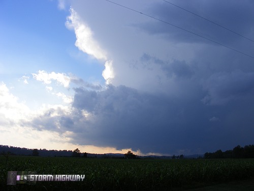
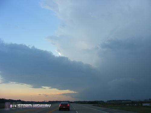
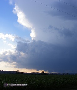
 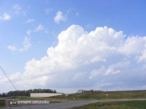  I drove back east to the Tell City exit, then dropped south. Mammatus were visible above the fall colors (below left) and I was on an easy intercept course for the storm's circulation (below center). My first view of the storm along the Ohio river was stunning - a classic-looking supercell (below right).
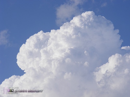
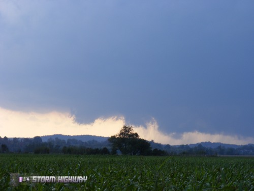
   I quickly stopped and got cameras zoomed in on the lowerings under the base - which upon closer inspection were not rotating, but rather being undercut and pushed along by outflow (below left and right).
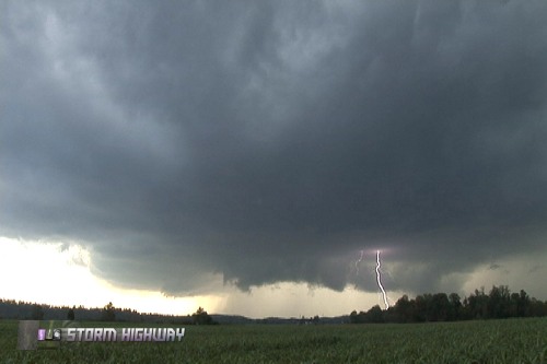
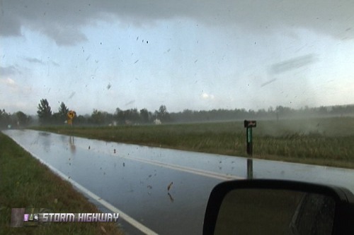
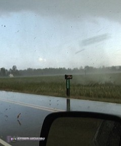
  The storm continued to look outflow-dominant and undercut as it rapidly approached me (below left and left-center), finally taking on a donut-shape with a heavy precip core descending in the center (below right-center). The time-lapse video of this is impressive. Finally, the precip and gusty outflow reached me, spinning up a small gustnado next to the car along with kicking up all sorts of debris (below right).
    Due to the curving 2-lane roads and the very fast storm speeds, I abandoned this storm after it passed me, focusing my sights on the next supercell in the line to the southwest of Owensboro. The storm was visible and blocking out the sun to the southwest (below left). As I crossed the Ohio River near Tell City, I looked back to get a nice sunlit view of my first storm (below center). As I approached Owensboro, the storm structure was impressive (below right).
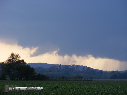
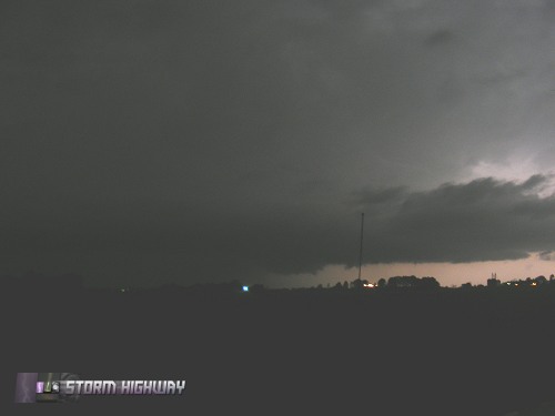
   I arrived in downtown Owensboro as the second storm began impacting the city. Despite strong rotation indicated on radar passing directly over town, I could not confirm anything visually before strong outflow overtook me. I drove back east for a few miles inside the rain before getting this view of a non-rotating wall cloud to my south:
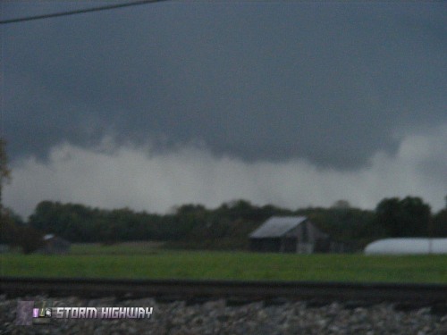 This storm was also racing away, so I abandoned it for yet another storm moving up from the southwest. A bell-shaped structure was visible as I approached:
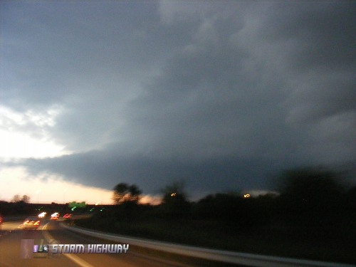 I once again stopped directly in the path of where the radar-indicated rotation was approaching, but again could not see any evidence of cloud base rotation. It was getting dark, and this was my last daylight observation of any storm features.
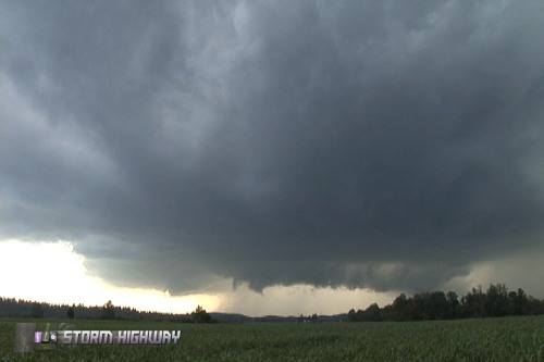
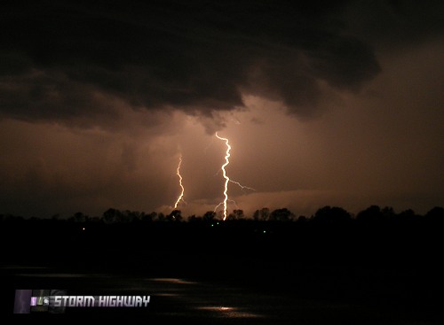
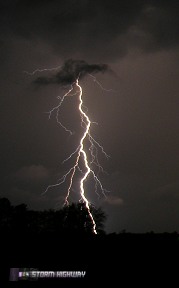
 I dropped south about 5 miles from Owensboro to get some lightning shots of the third storm, with flashes illuminating the cumulonumbus tower (below left). More supercells were moving in from the southwest, producing vivid cloud-to-ground lightning (below center and right).
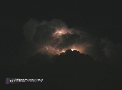   The fourth supercell of the day was also threatening Owensboro yet again. My lightning-illuminated view of it from the southeast revealed a similar structure to the previous three storms:
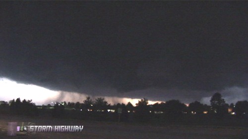
 I drove back into Owensboro in front of the storm, where power was mostly out among blaring tornado sirens. Like all of the previous storms, outflow and heavy rain overtook me in town several minutes before the radar-indicated circulation arrived at my position. I continued heading north in the downtown area when I was stopped by a slow-moving eastbound CSX freight train. As the train passed, numerous power flashes exploded behind it in downtown Owensboro (below right and left).
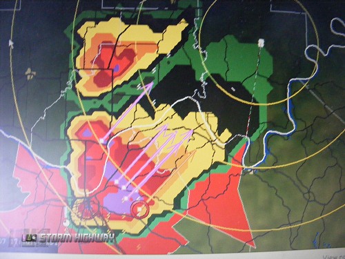
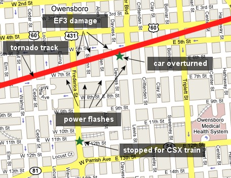
  A confirmed tornado track was surveyed at this location, with extensive damage in downtown Owensboro. The train most likely stopped me from driving into the path of a rain-wrapped tornado. Here is a map showing the surveyed tornado track and my position at the railroad crossing:
 At less than 500 yards or three city blocks, that is the closest I have been to a tornado in 15 years of storm chasing. The fifth supercell of the evening was approaching from the southwest and on course to cross the William H. Natcher Parkway at Hartford, south of Owensboro. I drove south once again to watch the storm pass, but like all the others could not see anything in the lightning flashes but a long shelf cloud reminiscent of the previous storms. The sixth supercell approached the interchange of the Western Kentucky Parkway near Cromwell, but once again I could not visually identify anything of interest. I finally started home at this point (about 11PM), not confident that I was going to be able to see anything with the remaining storms to the southwest. I stopped to work on my video in Lexington, at which point the fast-moving line finally overtook me around 2AM. After finishing the video work, I left Lexington around 3AM. I broke ahead of the line again in Huntington, WV and arrived home in Charleston at 5:30AM. The line arrived there shortly after daybreak, with heavy rain and lightning - bringing the chase and outbreak event to a close. Thanks to the Lord for allowing me to capture some nice video along with keeping me safe on the many miles. It is always nice to have a 'real' event close enough to home that I can make it out and back within the same day.
|
||||||||||||||


Web Site Design and Internet Marketing by CIS Internet