|
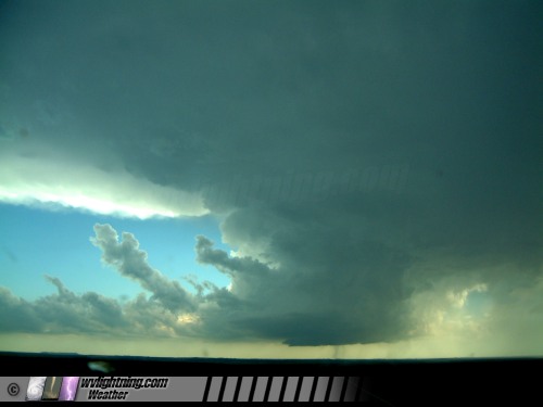
A classic supercell thunderstorm towers above the landscape near the town of Kadoka in western South Dakota on June 7, 2005. On the far left, the 'flanking line' feeds into the updraft in the center. The round rain-free base indicates strong rotation in the updraft. The 'vault' area, to the right of the updraft, is notorious for large hail. Most of the rain is falling out of the picture to the right, testifying to the strong upper-level winds carrying the precipitation away from the updraft. This allows the updraft to remain in a steady, balanced state. A broad wall cloud is attached to the rain-free base. This storm had just produced a tornado just minutes before. Image from 4.7MP digital camera.
[ View more photos and a detailed summary from this chase ]
|