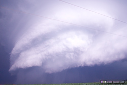
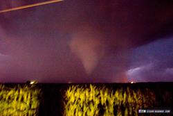
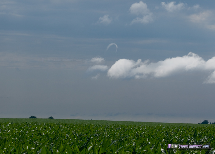
PONTIAC, IL - A potent shortwave embedded in northwest flow spread strong midlevel winds over a very moist warm sector and warm front draped across Illinois on Wednesday, June 22, setting the stage for a potential severe weather outbreak. For the most part, the forecast verified, with multiple tornadoes logged across northern Illinois - two of EF2 intensity. I witnessed two tornadoes during this event: a very brief and low-contrast view of a narrow cone at Troy Grove, and a close-range, highly visible, fully-condensed cone after dark at Pontiac. GPS LOG: Click to view the GPS track for this chase I arrived in my general target area of Rochelle, IL by 4PM. A horseshoe funnel indicated the available vorticity in the low levels:
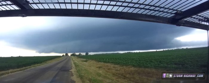
 I began my storm intercept mode near the town of Polo, IL as convection began to ramp up in intensity along the Mississippi River. I was on the first storm that emerged from this at Dixon, IL. CG lightning was uncharateristically frequent and intense in the storm's forward flank region, a theme I'd see all afternoon. When I got visual of the base south of Dixon, the storm had dramatic structure, but appeared elevated, somewhat elongated and at risk of growing upscale rapidly.
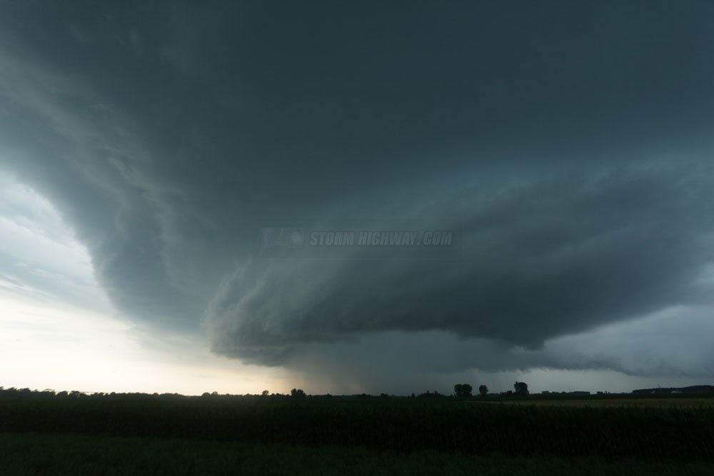
 So, I left this storm and jumped on the second one that developed just to the west, reaching it at Deer Grove. This one had better structure, and more importantly had surface inflow channeling into a persistent wall cloud:
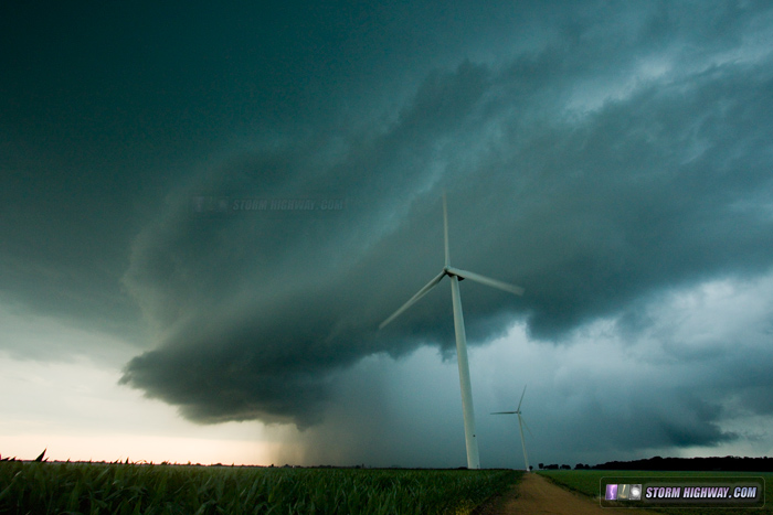 I followed this southeast for a while, but it appeared the storm wasn't really getting its surface inflow established and again, looked as if it might grow upscale. Outflow was really pushing hard south and east of the meso and threatening to blow out the low level circulation. I wanted to be in Chicago for lightning if upscale growth happened, so I headed down to I-80 and moved ahead of the storm to keep that option in play. It was at this time that the storm's inflow started visibly intensifying - as structure, inflow tail length/definition, and radar velocity improved. I moved back north to re-intercept the storm at Troy Grove. As I arrived, inflow was screaming from the east along with a rare-in-intensity barrage of cloud-to-ground lightning in the forward flank and inflow regions of the storm.
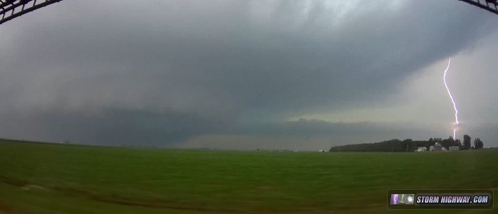 I was in the vicinity of the reported tornadoes here, but at first wasn't sure I was seeing them with my eyes as I could only make short stops to stay ahead. After watching several other chaser videos and seeing the official NWS damage surveys, I now know the power flashes I saw in Troy Grove were caused by a tornado, and a low-contrast funnel I saw west of Troy Grove was a narrow tornado (possibly a satellite of the main circulation):
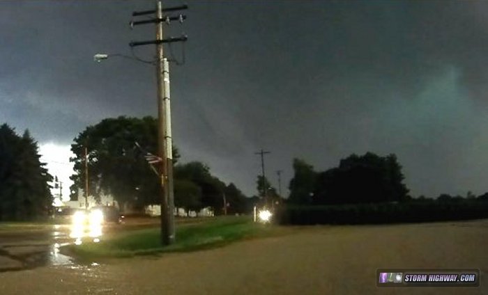 There was also a very tight area of anticyclonic rotation here that may have produced a ground circulation near I-39:
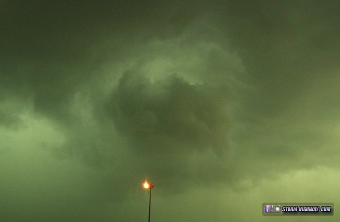 The storm was heavily HP, but inflow was intense. The inflow tail was pulling scud tags right up off of the ground east of I-39. Eventually, I got a glimpse of a funnel/possible tornado way back in the notch at Waltham:
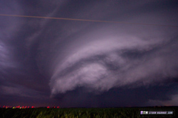
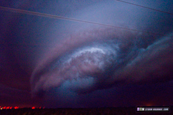
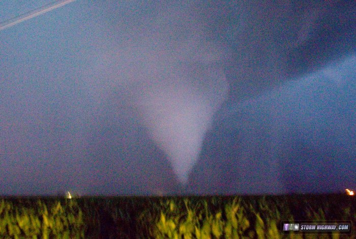
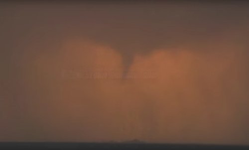 Northerly winds ramped up beyond severe limits at this point, correlating with a tornado confirmed just north of Ottawa. It was too dark and the rain too heavy for me to see anything, though. These winds took town trees and power lines on the road I was on. I had to drive around several large tree limbs in the road. A few power poles were snapped, but thankfully the power lines were not over the road. At this point, darkness had fallen, so I began heading south for home - hoping to stay ahead of the MCS. This was in question, due to the debris in the road and downed power lines. I only felt comfortable going 35mph tops - any faster and I'd risk hitting debris and damaging my car/windows/tires. Finally, I made it out of the wind damage swath south of Ottawa and could resume normal speeds. At Pontiac, I noticed the southwest flank of the MCS was beginning to organize, so I headed west a few miles to investigate. The storm cycled a couple times, then really ramped up as it approached me 5 miles northwest of Pontiac. I shot relatively constant handheld still images here at 1600 ISO at the full-wide end of the 10-22mm lens, the frequent lightning providing enough illumination to clearly see what was happening and to capture imagery. First, dramatic structure was visible: Click any image below to view a large version.
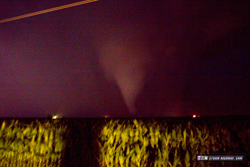
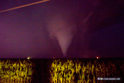
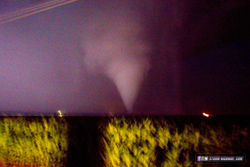
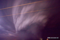
A cone funnel emerged:
 ...then grew larger:
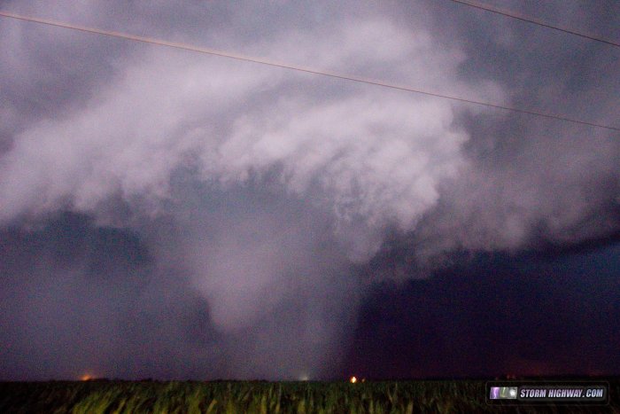 ...then quickly condensed fully to the ground less than a mile to my west as the distinct 'waterfall' sound began:
This was a very surreal scene - an audible tornado in the darkness that would occasionally be revealed as a ghostly white cone each time a lightning bolt flashed. This GIF is from my passenger side dashcam, and even shows a lightning bug flashing at the same time a lightning bolt illuminates the tornado:
 All along, I had been ready to jump back in my car and bail north if needed, but at this point I could see the tornado moving quickly right to left (meaning I was not in the path). A debris cloud was briefly visible:
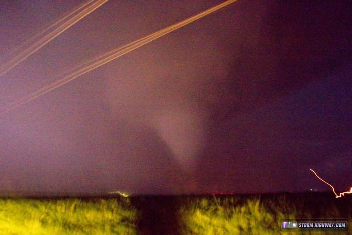 After a short fully-condensed stage, the tornado transitioned to a truncated cone/bowl with debris that continued for the remainder of its life. The waterfall sound suddenly got louder as a farmstead was impacted about 1/2 mile away:
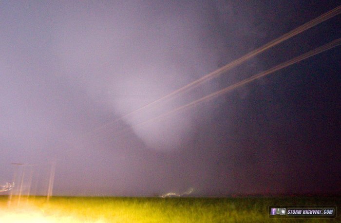 The tornado then crossed the road less than a mile to my south. Again, even though the condensation was not extending to the ground, a damaging circulation was still present:
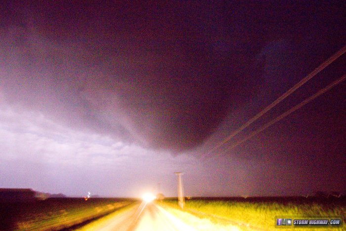 I posted one of the images of the tornado on Twitter (alerting the National Weather Service in Chicago via a tag) as quickly as I could. I then drove over to check on the residents of two farmsteads that had been impacted, snapping this photo to my east as I drove (notice the lights of Pontiac had not yet gone out):
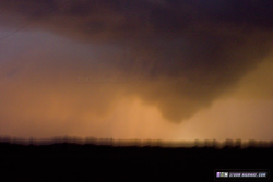 I was the first to arrive on the scene at both farmsteads that had been hit. Thankfully, everyone was OK. Meanwhile, the tornado continued on into Pontiac. Due to stopping at the impacted farms, I missed seeing the power flashes that occured as the tornado struck the west and south sides of town. My dashcams, however did capture these:
 Another circulation began organizing to the west of the original, right over Pontiac. This area passed over town without incident. I chose to not follow the storms east due to the late hour and needing to be back home for work the next day. This map shows the National Weather Service damage survey track of the Pontiac EF2 tornado. My location at the time of the above photos is marked with the red dot:
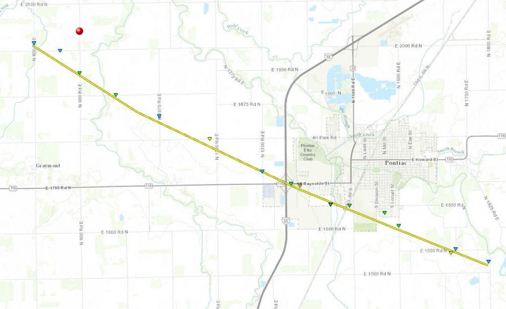 You can see this and more detailed damage surveys and tracks at the NWS Chicago's page on the June 22 tornadoes. Other chaser accounts from this event:
|
|||||||||
Web Site Design and Internet Marketing by CIS Internet


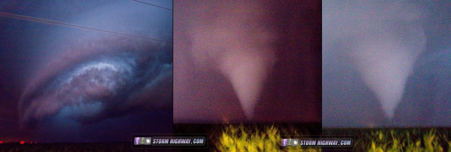 ABOVE: Tornado near Pontiac, IL on June 22, 2016

