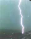
Lightning Season 1997
* Storms in West Virginia
Summer storm season winding down- The quiet storms are here
It's beginning to get awful quiet here in the mountains- at least that
big expanse we call the sky is. The weather's been hot and muggy,
cool and rainy, and
sometimes mild and sunny (perfect for an drive down a remote West Virginia
road, an activity that does a good job of clearing your thoughts and
refreshing your spirit).
However, lately there have only been a handful of small
night-time thunderstorms- yes,
those steady-rain-for-hours ones with a few faint intracloud discharges
hidden way up in the clouds. You know, those soft-blue sky-painting
flashes that produce that sleepy, soothing rumble that
just makes you want to lie down on the old glider on Grandma's back porch
and let the constant sound of the rainwater dripping out of the broken
downspout on the corner of the house put you to sleep.
Although there isn't much to be photographed during these storms, and not
much in the way of scientific or thrill-seeking observations, these
storms are just as enjoyable as the big, severe ones that keep your
adrenaline flowing. They are a full-length nature album with
visual effects and surround sound, one of the most relaxing things to
listen to on a warm night. These quiet storms are the first to roll in
in the spring and the last to move through in the fall...like birds
migrating north and south for the season. They're sort of an
introduction and closing act for summer weather- worthy to be watched!
True, these storms won't produce cloud-to-ground lightning so close that
it makes your hair stand on end and your fillings glow. But, they
are a
different breed- another product of the Lord's vivid, diverse, and mighty
creative power. So next time one drifts through your town, grab a lawn
chair and a glass of ginger ale, and head for the back porch......because
the snow's only a few cold fronts away.
(8-18-97)
Local thunderstorm frequency above average in 1997
1997 has been a great summer for lightning photography here in West
Virginia. The Lord has sent many strong storms through here, as well as
other parts of the country.  Storm activity during May and June was
unusually slow, compared to past years when most severe weather occured
during these months. However, July was a particularly active month,
with many days of thunderstorm activity.
So far, August has brought a fairly moderate frequency of storms.
High temperatures coupled with many moisture-laden air masses have been
the motors for thunderstorm formation. Thunderstorms have formed during
many days when fronts were not a factor in the local weather patterns.
'Lightning Storm Chasing & Photography' Aids
A valuable storm-watching tool is NEXRAD or Doppler radar, which allows
you to see every storm's location by colored blobs on a map. The Weather
Channel shows the radar often, and you can also see it right here on the
'net. The radar image I use is the
INTELLICAST national radar: It's a high resolution image updated every
hour, allowing you to track storms yourself. Although the image isn't
very current, it allows you to see the storm, rain, and snow activity as
it was about 1 hour ago, and if you check back every hour, you can see a
storm's general direction of motion and make a pretty reliable prediction
whether or not it's headed your way, and if so, when it will arrive.
Here's the link to the INTELLICAST hourly national radar image:
* INTELLICAST National Radar Map- you can 'zoom in' by clicking
the map at the point where you live.
A nice feature of the Intellicast
site is a pre-assembled radar animation. It allows you to see the general
direction of weather systems' motion:
* INTELLICAST National Radar Map Animation
Keep an eye on the skies and be safe!
-Dan
* Lightning Season 1998
* Lightning Season 1999
* Back Home
| View 1,609 storm chases: |
| by year: |
|
| by type: |
|
|
|
GO: Home | Storm Chase Logs | Photography | Extreme Weather Library | Stock Footage | Blog
Featured Weather Library Article:
|