April 17, 2000
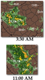
 At 3:30 AM Monday morning, the flashes and booms woke me suddenly. I was out in the truck and on the road in 2 minutes, heading east on I-64 to attempt to intercept a small storm to the south that was quickly moving northeast. At 3:30 AM Monday morning, the flashes and booms woke me suddenly. I was out in the truck and on the road in 2 minutes, heading east on I-64 to attempt to intercept a small storm to the south that was quickly moving northeast.
I caught up with the center of electrical action in the heavy rain just west of Campell's Creek and exited the Interstate. But I couldn't get set up underneath the highway overpass quickly enough before the frequent, bright cloud-to-ground strikes moved over the mountain north of me and out of view. *Sigh*... lost that one.
But as I drove back toward town, I could see flashes to the west from two more active cells. I knew that these storms would be rapidly passing to the northwest about 5 miles away from downtown. I decided to just head for Fort Hill and try and catch what I could.
The travelling motion of anvil crawlers from the first storm to the northeast were visible as they flickered behind the low clouds. If they had been fully visible (not behind the clouds), they would have been easy and dramatic captures on film.
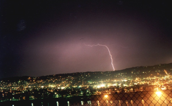
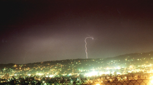
I parked on Fort Hill and set up the camera in the truck facing north. The storm was dissipating quickly, but I still caught two CG bolts at a distance of about 6 miles with the west side of the city as a foreground.
The next morning, a second line of stronger storms moved through the Kanawha Valley, with the more active lightning shows occuring several miles north of town.
Below: Lightning at 4:00 AM over Charleston's west side, viewed from Fort Hill. 
< Back
| View 1,609 storm chases: |
| by year: |
|
| by type: |
|
|
|
GO: Home | Storm Chase Logs | Photography | Extreme Weather Library | Stock Footage | Blog
Featured Weather Library Article:
|