
Sunday, April 8, 2001
At 7:15 PM, I first heard that a severe storm watchbox was in effect in the northern part of the state along with southern Ohio and eastern Kentucky. Strong storms were expected to develop into the night as far south as Roane County, only 30 miles north of Charleston, so at 7:30 I packed up and headed north.
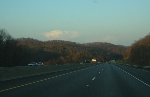
As soon as I climbed the first mountain on I-79, I could see several thunderstorms that had already formed about what seemed like about 40 miles to the north. Two distinct cells are visible in photo below, looking north at 7:40 p.m. on I-79 near Big Chimney.
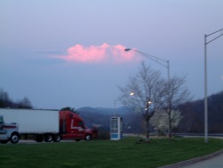 Things looked promising until I passed Big Otter, when the rate of lightning-created static on the AM radio was slowing fast. The photo at right is of the larger cell, slowly dying but still putting out a visible flash every 30 seconds or so, viewed from the Frametown rest area. Frametown is about 55 miles north of Charleston, and as you can see I don't seem any closer to the storm than I did when I left town. The storms were beginning to lose their well-defined shape, becoming wispy-edged Things looked promising until I passed Big Otter, when the rate of lightning-created static on the AM radio was slowing fast. The photo at right is of the larger cell, slowly dying but still putting out a visible flash every 30 seconds or so, viewed from the Frametown rest area. Frametown is about 55 miles north of Charleston, and as you can see I don't seem any closer to the storm than I did when I left town. The storms were beginning to lose their well-defined shape, becoming wispy-edged
The sky was now crystal-clear overhead and to the south, so it was obvious that what little activity did develop was winding down. I turned around at Sutton, 70 miles from home, and headed back south.
Maybe next time......
< Back
GO: Home | Storm Chase Logs | Photography | Extreme Weather Library | Stock Footage | Blog
Featured Weather Library Article:
|


