Supercell and tornadoes in southwest Kansas: Storm produced three tornadoes on the ground simultaneously
April 23, 2007
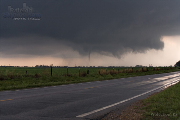
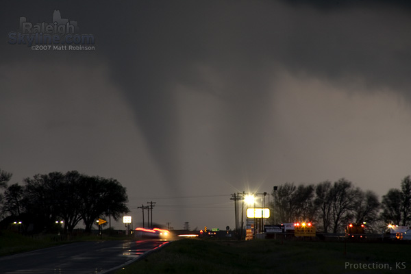
ABOVE: Tornadoes near Protection, Kansas on Monday, April 23.
HD EXPEDITION VIDEO: Tornadoes in Protection, Kansas Watch Video
Click any thumbnail on this page to view a larger version. All images are from video unless otherwise noted.
PROTECTION, KS - My brother Matt and I witnessed four (possibly five) tornadoes in southwest Kansas on Monday, April 23 near the town of Protection. We left Oklahoma City at 9:00 AM on Monday morning, heading west on I-40 with a target of Canadian, Texas, roughly 4 hours away. We arrived in Canadian early in the afternoon, where we camped out at the public library for a little more than an hour to monitor data via the library's free wifi hotspot. A few storm chasers were also partaking of the free internet access including Brian Sterz, Rich Theis and Ryan Theis.
Finally, we noted that convection was beginning to initiate to our south and to our east. A lone storm down on I-40 was tempting, but Matt and I decided to hang tight in Canadian so that we would remain in striking distance of the eastern cells if they ended up being the better play. We waited for about 25 minutes just south of Canadian, watching our southern and eastern cells closely. Eventually, the southern storm began to look worse on radar, as well as not producing any lightning. The eastern cluster of storms looked stronger and more persistent, so we made the final decision to head northeast.
By this point, we were quite a distance behind the northern storms. At first we thought we wouldn't be able to catch up. But as we drove north, our GPS position on WxWorx was closing the gap encouragingly fast. The storms were also moving nearly due north at only 30MPH, according to the WxWorx tracks. We finally caught up to the southern storm's updraft base at Follett, Texas and easily remained with the slow-moving storm for the rest of the day.
The storm at times displayed a nice RFD slot and inflow banding, but for the longest time looked pretty meager both in person and on radar. Lightning activity dropped to near nothing. Surface inflow and motion at the base was nearly nonexistent. We knew the upper dynamics would be arriving near dusk, so we stuck it out. That paid off!
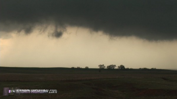
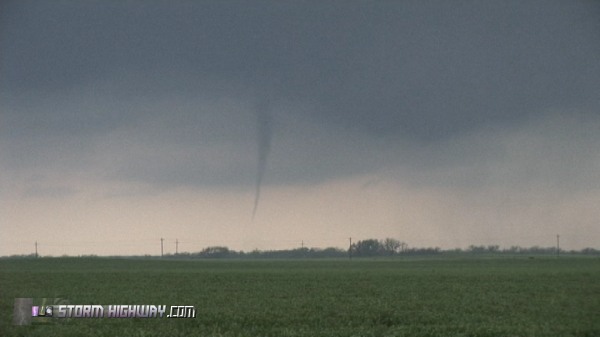
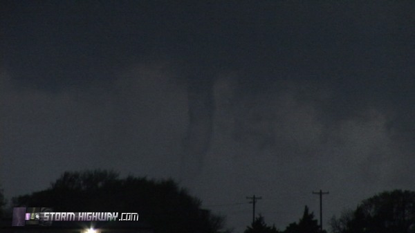
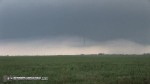
As we headed north in the vicinity of the Kansas-Oklahoma border, the storm suddenly intensified, and I mean suddenly. Inflow ramped up considerably and structure improved dramatically. Strong rising motion at the base was quickly accompanied by rapid rotation. Small, sinuous rope funnels began appearing under the base.
A wall cloud lowered fast, with a rapidly rotating funnel appearing to the right for a few seconds.
"OK," we're thinking, "we've finally got ourselves a storm". The wall cloud was really spinning as it crossed the road ahead, looking like it would produce any second.

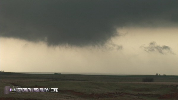
Now we had a problem. We had no road options eastbound to stay with the storm until 6 miles north. Our only option to keep up was to drive north then east around the meso, hopefully beating the core across the road to the east. We'd lose the meso for 15 minutes doing this, but it was the only choice we had. We needed to do it fast to avoid the biggest hail, so with radar at our disposal, we held our breaths and dove in.
The DOW appeared in the rain ahead of us as we punched north, two cars ahead of us to be exact. The hail increased in size to the point that I was fearful of losing the windshield. Prayers for protection from the hail were answered quite dramatically, as the next sign we saw along the road was for the town of Protection. Lighter skies ahead signaled that we were almost through the core, and soon the base came into view again. The DOW promptly pulled over, and we continued east for some distance further to ensure escape from the hail.
We pulled over on the east side of Protection, and set up with a clear view of the base.
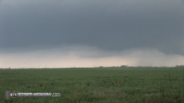
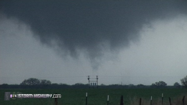
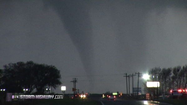
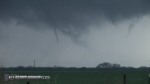
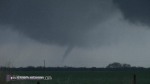
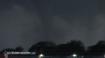
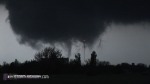
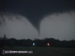
As sirens sounded, the first tornado descended quickly.
Digital image by Matt Robinson
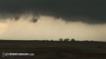
For most of its life, this tornado was not fully condensed to ground - however, a debris cloud was visible on the ground.
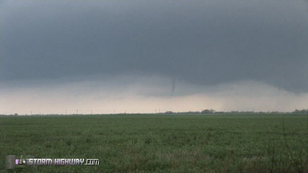
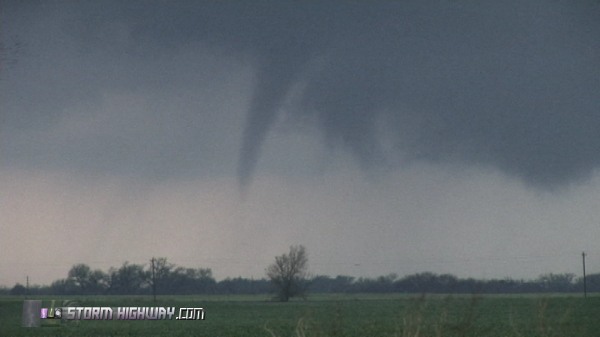
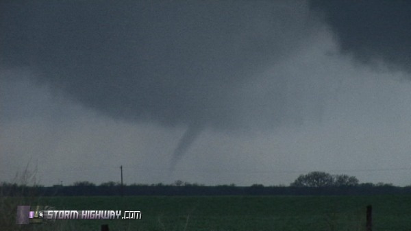
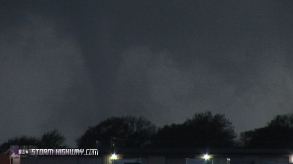
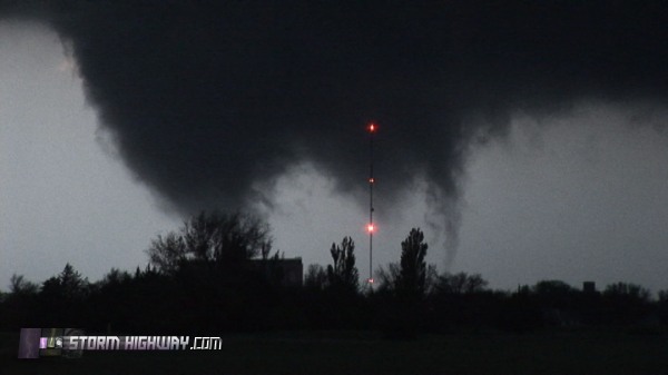
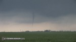
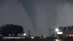
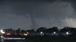
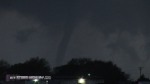
As the tornado approached the road, it began roping out. The funnel disappeared, but the ground circulation was still visible for quite some time. As this was happening, a second, much broader circulation with rapid rotation reached the ground, tornado number two!
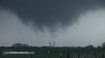  
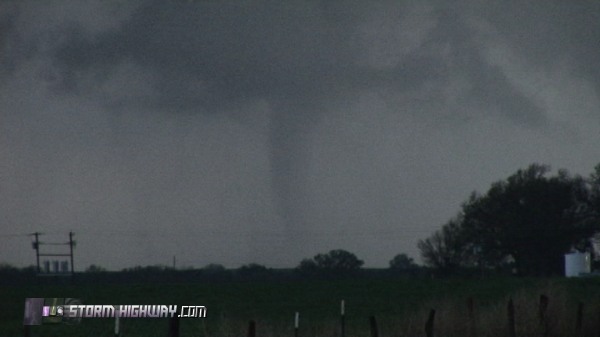
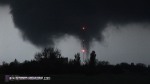
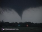
Still at the same time, while I'm focusing on tornado #2, Matt points out that a third circulation to the south has produced a fully-condensed tornado!
 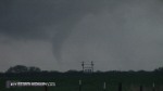 
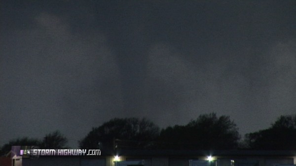
That makes 3 on the ground at the same time for us! Circulation #1 is still producing the dissipating original tornado, circulation #2 is touching the ground, and the third tornado has condensed. The new tornado to the south became the show of the day as it remained fully condensed for the next 5-8 minutes and crossed the road.
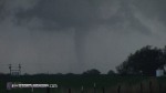
Digital image by Matt Robinson
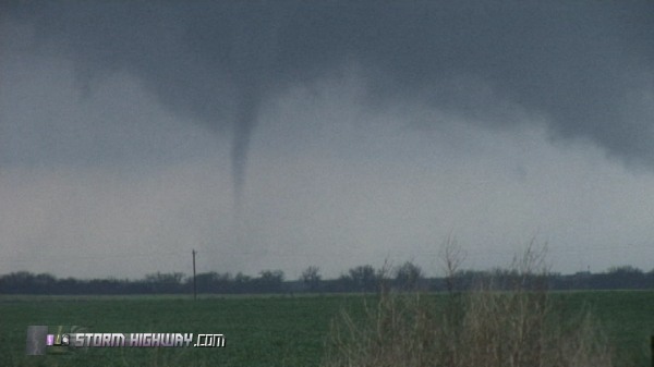
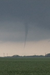
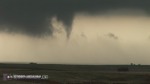
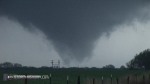
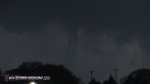
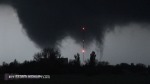
At times, a large debris cloud enshrouded the funnel of tornado #3.
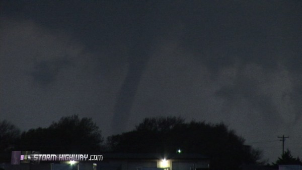
The funnel transitioned to a waterspout-like transparent tube appearance. I have not seen many images of supercellular tornadoes doing this.
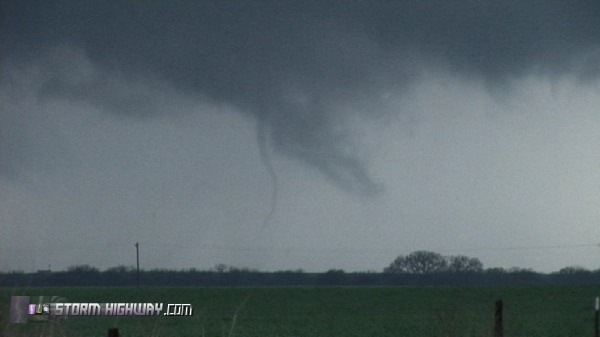
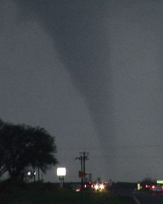
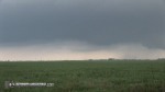
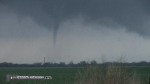
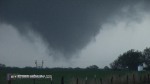
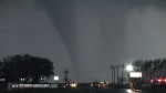
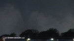
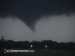
At this time, a new wall cloud was rotating vigorously to our northwest with dramatic contrast.
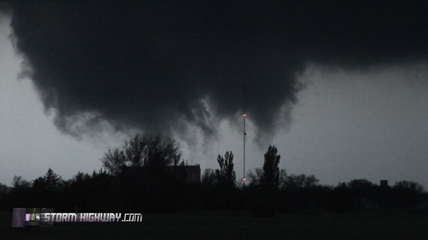
Trees partially obscured our view, but after reviewing video, it appears that yet another tornado was in progress at this time.
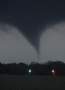
The wall cloud lifts slightly, but after a few minutes, produces a smooth cone tornado that lasts only a few seconds.

Digital image by Matt Robinson
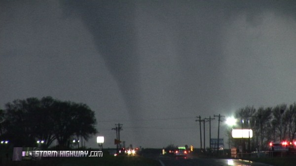
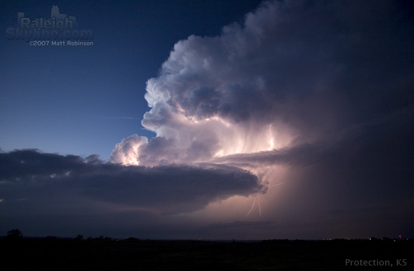
Darkness is limiting both or view and our video/photo documentation now. So, we headed east for some distant views of the storm - which turned out to be spectacular. Blue, starry twilight sky, white cumulonimbus pulsing with lightning, supercell structure below.
Digital image by Matt Robinson
We ended the day at a Sonic in Pratt, where we met up with Brian, Rich, Ryan, Terry Schenk, and Jeff and Kathryn Piotrowski. All of us had bagged the tornadoes today, and we shared our enthusiastic accounts.
This was our first Great Plains trip of 2007 - what a way to start the season! A lot of my prayers were answered and I've got to give credit to the Lord for both our success and safety. The rest of the week promised several days in a row of severe weather setups, so after a night's sleep in Pratt, we were ready for Tuesday's chase.
NEXT EVENT: Challenging day in central Kansas >
|