| Home | Blog Index | Blog Archives | Christianity & Faith Essays | Storm Chasing Essays
April 2 chase outing #1; Monday update
A very narrow corridor of weak instability developed through eastern Missouri on Friday evening. A line of showers started to intensify as it encountered this zone, so I drove to Wentzville (northwest edge of the STL metro) for the slim possibility of lightning and a shelf cloud. While a few cells pulsed here and there (mainly to the north of I-70), it wasn't doing as much as I'd hoped (which wasn't much to begin with). A large area of outflow slowly pushed east into the St. Louis area, with a sharp temperature drop behind it (so cold that I had to roll the window up and turn on the heat after I crossed it westbound near Lake Saint Louis). No new activity was developing along the outflow as it shoved through the warmer air to the east, so I turned around and arrived back home at 7:30.
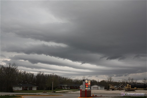
This developing shower just behind the outflow boundary produced these southwest-pointing 'fingers'. This was near Moscow Mills (north of Wentzville) at around 6:00PM. I'd never seen this type of cloud feature before, another unique image to add to the collection. It's little things like this that make some of the 'bust' chases seem worthwhile.
click to enlarge
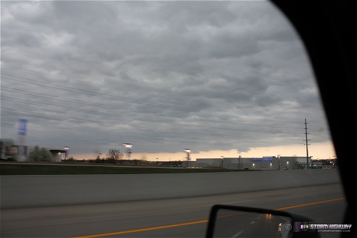
A shot of the outflow edge, looking northeast from Chesterfield along I-64 on the way home. I finally crossed the outflow boundary eastbound at I-270, with a very noticable spike in temperature that required rolling the window back down to stay comfortable.
click to enlarge
Some sporadic lightning is still slowly moving this way from the AR/MO border, but it's doubtful that any will make it this far north tonight like I expected earlier.
Monday chase update
Not much more to say with this forecast, other than the 00z WRF/NAM has stayed consistent with Monday's best play very likely being the warm front in northern Missouri. Even if it wasn't the better target, I already had a strong 'local bias' in picking the warm front (for the uninitiated, 'local bias' means a storm chaser favoring an area due to its geographic convenience rather than its meteorological merits). A shorter, cheaper drive and less chaser crowds for an early-season setup like this seems much more appealing. I tend to have less 'local bias' in May and June, so I won't feel too bad about giving in to it a few times in April.
|


