|
Home | Blog Index | Blog Archives | Christianity & Faith Essays | Storm Chasing Essays
More Charleston snow photos, big warmup ahead
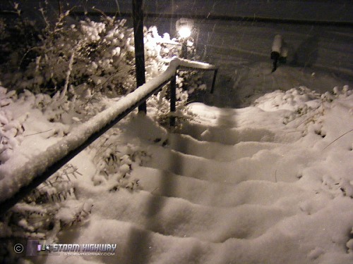
I added a few more photos from today to the January 1-3, 2008 snowstorm event log. The upslope snow continued strong through mid-morning Thursday, bringing an exact repeat of covered roads as yesterday. My front yard and steps had a good four to four and a half inches total at sunrise (photo above). By midday, the sun was out, and by afternoon the skies were clear. The 4 to 5 inch low-density snowpack across Charleston sublimated quickly in the sunlight, and now only shaded areas have the bulk of their accumulations remaining. Unfortunatly this meant that the classic 'blue sky/white ground' shots were nowhere to be seen by the time I was able to get out this afternoon. Everything will be gone in a few days as temps rocket into the 60s during the weekend, wrapping up this New Year's cold air and snow episode for West Virginia.
GO: Home | Storm Chase Logs | Photography | Extreme Weather Library | Stock Footage | Blog
Featured Weather Library Article:
|


