| Home | Blog Index | Blog Archives | Christianity & Faith Essays | Storm Chasing Essays
Charleston shelf cloud / severe storms
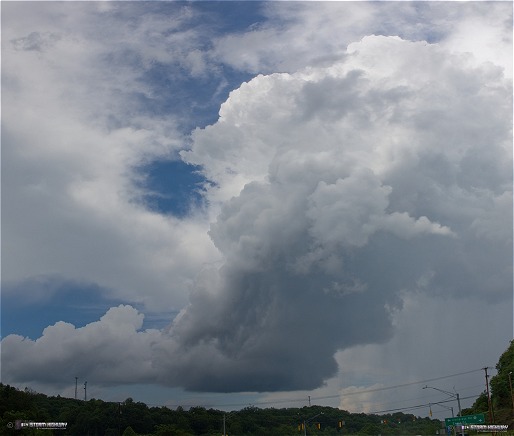
Once again, an excellent storm chase day in home territory proves the better option than traveling to the Plains during a 'down pattern'. I captured a ton of nice imagery today, here are just a few highlights. This tiny but well-structured updraft showed up on a north-moving outflow boundary from earlier convection. This cell moved almost due north from Alum Creek and passed just west of Charleston. This first image is a panorama stitch from near Childress Road and Rt. 119.
click to enlarge
click to enlarge
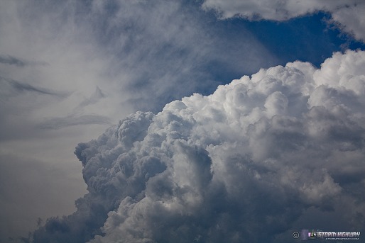
I followed this little cell north into Charleston, where it eventually dried up. As the same boundary moved north, another cell fired to the west and rapidly exploded. Here is a zoom of the convection as viewed from Fort Hill:
click to enlarge
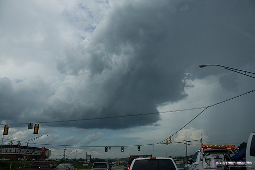
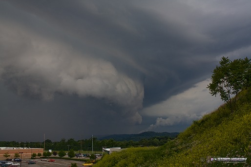
This new storm was moving into an area of unfavorable roads, so I let it go. A strong but narrow line of storms was still to the west, moving east toward town. Satellite showed sharp clearing behind the line, so I expected a nice rainbow over downtown once the back edge of the storms moved through. So, I wanted to be at Fort Hill for that opportunity. However, I also expected a shelf cloud ahead of the line, which meant that I would need a west-facing view (Fort Hill is to the north-northeast). Due to rush hour traffic, I didn't think I'd have time to go across town to the Sunset Drive overlook and make it back to Fort Hill in time for the rainbow shot. So, I decided to catch the shelf cloud at Southridge, where I had a quick drive on 119 back to Fort Hill.
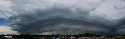
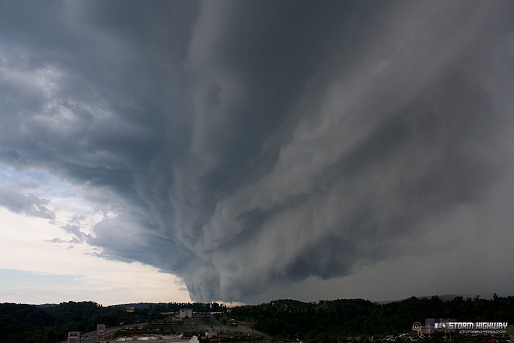
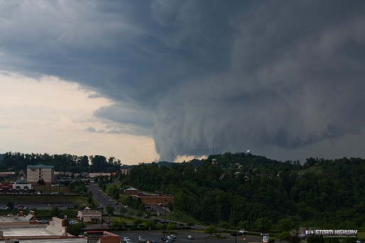
The storms to the west rapidly intensified just prior to arriving in Charleston, resulting in a monster shelf cloud that far exceeded what I expected to see! I climbed up the hill in front of the Trace Fork shopping center for this view, then barely made it back down to my truck before getting munched by the line. This first image is a 7-frame panorama stitch, one of about 6 I shot here.
click to enlarge
click to enlarge
click to enlarge
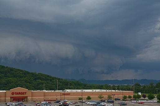
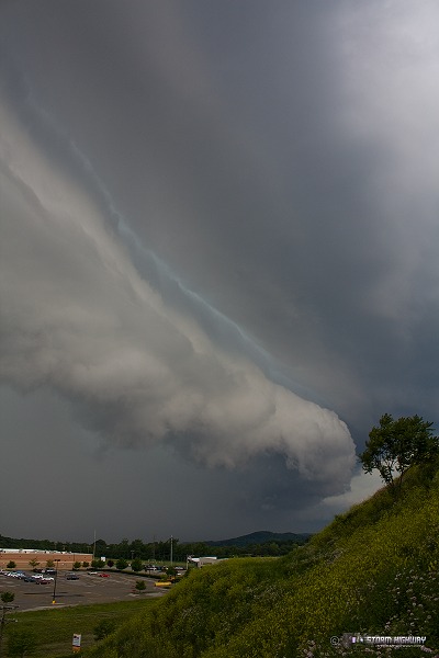
The KRLX NEXRAD radar dome is visible here:
click to enlarge
click to enlarge
click to enlarge
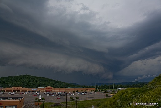
Last shot before scrambling back down the hill:
click to enlarge
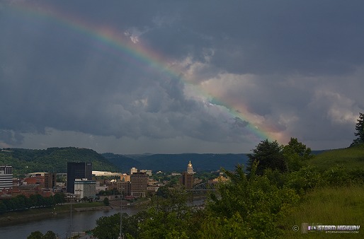
I drove back to Fort Hill for the rainbow - which did appear, but unfortunately only partially due to the rain moving out too fast. This rainbow was supernumerary, that is, containing extra color bands on the inside. The last time I saw a supernumerary rainbow was back on September 22, 2007 in Raleigh.
click to enlarge
That is a pretty freaking awesome shelf cloud.
- Posted by Dann Cianca from Denver, Colorado | |
|


