|
Home | Blog Index | Blog Archives | Christianity & Faith Essays | Storm Chasing Essays
Lake Michigan moisture plume
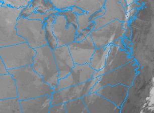
A classic Lake Michigan plume of moisture has set up across Ohio in our post-frontal northwesterly flow overnight. The infrared satellite image shows the associated cloud cover streaming toward West Virginia:

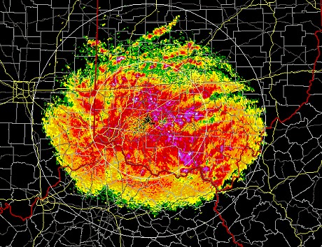
Surface winds are light and temperatures hovering above freezing here, so I don't think this will get much in the way of upslope enhancement to amount to much for Charleston. A band of precip associated with the plume is crossing into West Virginia at this hour:

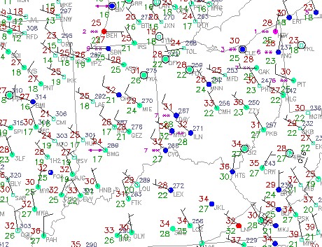
Upstream obs in western Ohio are reporting snow, but the band is sneaking around the WV stations so that it is hard to tell what is falling now from the Ohio River eastward. It's snowing in Dayton at 31 degrees F, but Huntington is still at 35F - meaning things could be rain, snow or a mix of both.

If snow is falling in this band between Huntington and Hurricane, it's possible that it could drop the temps a few degrees to reach the subfreezing mark. Snowfall is like dropping little ice cubes through the air - the flakes will usually cool the ambient surface temperatures several degrees. So, this is not one that morning drivers can ignore just yet.
| View 1,609 storm chases: |
| by year: |
|
| by type: |
|
|
|
GO: Home | Storm Chase Logs | Photography | Extreme Weather Library | Stock Footage | Blog
Featured Weather Library Article:
|