| Home | Blog Index | Blog Archives | Christianity & Faith Essays | Storm Chasing Essays
September Illinois lightning
HD EXPEDITION VIDEO: IL Lightning on 9/2
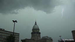
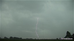
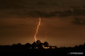
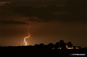
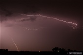
I started today's chase by heading up to Springfield - half to chase moving over the city, and half to get a jump on the possible drive to Chicago for storms later on. I set up for a capitol/lightning shot (below left, no real success there), then went over to the tall TV towers east of town along I-72. No upward flashes occured to the large towers, but a downward CG hit a smaller tower in the distance (below right).
click to enlarge
The storms moving through Springfield did not develop trailing stratiform precip regions, despite having several hours to mature - and so there was no upward lightning at the towers east of town. For this reason, I chose not to complete the Chicago trip, as the environment up there would likely support similar storm evolution (not to mention storms appeared generally weaker farther north). Heading back south, I had to punch through 20 miles of blinding rain and intense lightning on I-55 south of Springfield. I saw several close strikes along the highway, including one with a fire-orange glow at the ground where it met a corn field about 200 yards off the road. There was no practical or safe way to record or capture these scenes while driving in the low visibilities, so I didn't try.
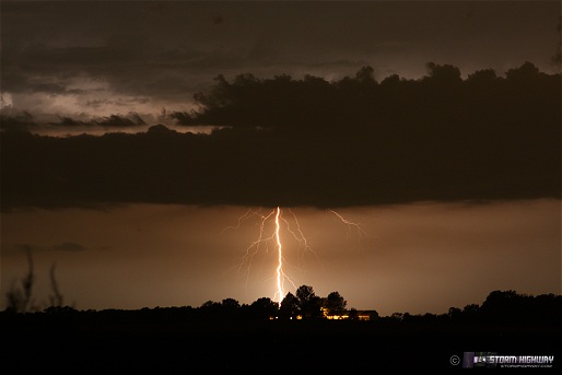
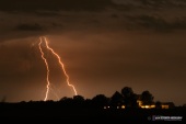
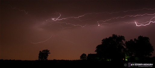
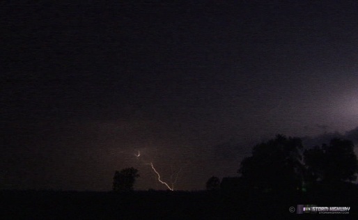
As I neared home after dark, storms near St. Louis were generally weakening, but some areas of stratiform precip developed and stayed electrified enough for some nighttime lightning photography. After arriving home, I went back out around New Baden at various locations to set up the cameras. Quite a bit of intracloud flashes here - not full "anvil crawlers", but bursts of relatively small but intricate localized discharges. All this time, a stronger cell to the distant southeast provided some cloud-to-ground bolts, colored orange due to the 30-40 miles of atmosphere they were viewed through.
click to enlarge
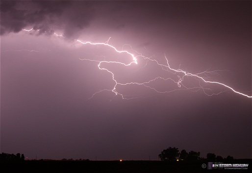
  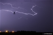
The video shows one of the intracloud discharge sequences triggering upward flashes off of towers far in the distance in Missouri, south of St. Louis. Here is a frame grab from the video:
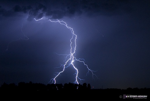
September 1 storm - New Baden, IL
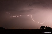
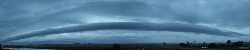
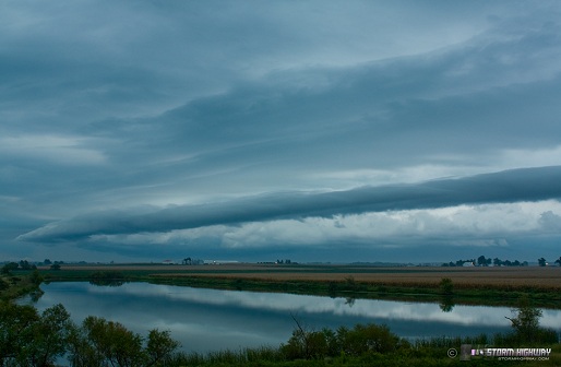
Cloud cover most of the day on Wednesday limited instability generally north of the Ohio River. The result was a northward-moving complex of storms dissipating as it approached I-64 east of St. Louis. This arcus/shelf cloud marked the outflow boundary as it passed over New Baden. As the sun went down, a few flashes of lightning were visible in the storm remnants near Mount Vernon - but nothing else photogenic showed itself.
click to enlarge
|


