| Home | Blog Index | Blog Archives | Christianity & Faith Essays | Storm Chasing Essays
Lunar halo, aurora bust, Thursday severe weather
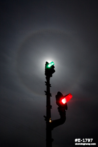
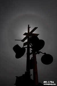
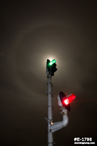
With most of the lower Midwest socked in with a fairly thick layer of cirrostratus last night, there was no hope of being able to see the aurora borealis display that occured thanks to a strong geomagnetic storm. However, the lunar halo created by a bright moon behind the cloud deck was enough to go outside for a few photos. Lunar halo photos look better when you block the overpowering moon with an object, allowing the dimmer halo to shine. In this case, I chose some railroad signals at the Billharz Road crossing east of New Baden for the task. Click on each image for a larger version:
Thursday severe weather prospects
I've been watching with interest a possible severe weather setup showed by models to occur in the Midwest on Thursday. A strong jet max associated with a deepening upper trough will move through the region. The main limiting factor will be weak moisture return and resultant lack of instability. The pattern currently evolving across the Midwest in the coming days will not leave much time, if any, for moisture to recover ahead of Thursday's upper support. If 55°F+ surface dewpoints do manage to make it north of an I-64/I-70 line on Thursday, conditions will be in place for severe weather and possibly a few tornadoes. The main risk area as currently depicted seems to be focused more in Missouri, but it's still too early to nail down even vague details. The next two days should bring a better idea of what to expect.
|


