| Home | Blog Index | Blog Archives | Christianity & Faith Essays | Storm Chasing Essays
Days 1-3: A three day (mostly) stormless tour of Kansas
I'm back in St. Louis this morning after the first Great Plains trip of the 2013 season. It turns out my original concerns about this system were warranted. This trip was one of my worst busts ever, in terms of the ratio of mileage to imagery and video captured. The lesser-than-forecast low level moisture, coupled with a few ill-timed cloud decks, meant that the storms could not break the cap in the places necessary to produce good supercells and tornadoes. The only places storms managed to form were in areas with very meager moisture, with little hope for producing much of anything remarkable. For the most part, I didn't jump on those storms like many did, instead opting to hold out in the better areas in the hopes that a storm would beat the odds at the last minute.
These 'blue sky busts' or 'cap busts' are a part of storm chasing. I've found that if you get too haughty in discriminating against potential cap bust setups, you'll sometimes miss good storms and tornadoes. Setups like this are a gamble - sometimes you win, sometimes you lose. If you stay home on those days when you could have easily afforded to go out, you'll miss the 'wins'.
Since this whole trip was one giant bust, I'm consolidating the three chase logs into one post.
Sunday, April 7
Sunday was actually the better of the three days, in that I actually switched on my cameras if only for a brief time. I departed St. Louis after work at 7AM, arriving at the triple point target in the Oklahoma/Kansas border area near Medicine Lodge at 5PM. A couple hours before my arrival, it was evident the day was shot. A large, dense cloud deck overspread the target area early in the day, preventing surface heating from generating enough instability to break the strong cap.
Storms began firing up near I-70 in upper 40°F dewpoints. It is extremely unlikely that a storm will produce a supercell tornado with such meager low level moisture, so I chose to hold out in the original target area. At sunset, I finally conceded that the day was done, and headed up to Hoisington to get a hotel room. On the way there, I had a good view of the supercell tracking near Great Bend. I stopped a few times to look and grab a shot or two.
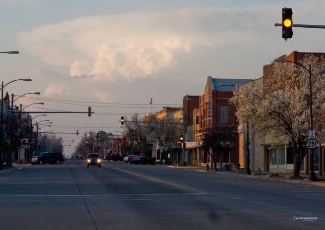
From downtown Pratt (click for larger version):
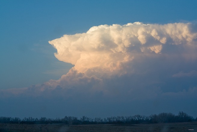
From near St. John (click for larger version):
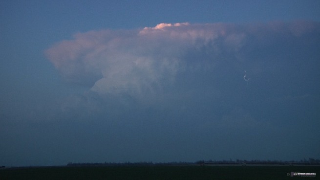
From north of St. John (the only lightning I saw this entire trip!) (click for larger version):
Monday, April 8
Monday was the anticipated best day of the three, but again failed to generate storms in the best areas. After leaving Hoisington, I chose to position in Ness City, Kansas, about halfway between two possible targets in northwestern Oklahoma and southwestern Kansas - both areas that held promise if storms could form. After it again became evident that the cap would hold in both of these areas, I finally started heading toward a supercell that had formed (again in meager low level moisture) near Burlington, Colorado. I eventually broke off the pursuit of this storm at Goodland after its mushy appearance, dwindling radar presentation and moving even farther from the better moisture. This storm would intensify later after dark, but not producing anything of note. A brief dusty landspout was reported while it was still in Colorado. I ended up stopping for the night in McPherson, Kansas in preparation for the next day. I did not touch any of my cameras this day.
Tuesday, April 9
The 00z models on Monday night had Tuesday's setup looking pretty good, with backed surface winds in 60°F dewpoints underneath an 80 knot+ 500mb jet streak in Kansas and Oklahoma. However, morning revealed yet another widespread cloud deck and a crashing cold front that would plow through the target area much too early for surface-based supercells to get established. After a couple of hours of watching the day unfold, I called the chase off and began heading home at around 2:30PM, arriving back in St. Louis at 9PM. Like on Monday, I took no photos or videos this day.
NEXT PLAINS CHASE: Rozel, Kansas tornadoes on May 18 >
|


