| Home | Blog Index | Blog Archives | Christianity & Faith Essays | Storm Chasing Essays
Storm chasing forecast update for April 15 - 24
I really don't have any good news to talk about on the storm chasing prospects front, but figured it was time for another update. Long-range models still show no indication of a chase-worthy pattern taking shape over the Midwest and Plains for the next 2 weeks. The only feature of note is this compact wave shown traversing the country toward the end of this week:
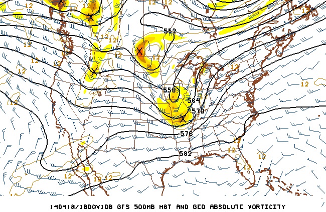
Normally, something like that would pique my interest. But alas, thanks to the potent cold front that is currently crashing southward across the USA this morning (with snow behind it in places), Gulf of Mexico moisture is going to be cut off well in advance of that nice-looking upper feature. That means no good low-level moisture/instability will be available for the otherwise great wind profiles afforded by the wave.
Looking farther into the future, there are still no signs of that deep western trough that storm chasers look for. Again, it's still very early in the season, so we all just need to be patient. Some years don't see things getting active until late May. I added a third date range to the table below that is more climatology-influenced than model forecast-based. We can't realistically make a specific forecast that far out, but in general, I start to expect unfavorable patterns like this one to eventually break down after an extended period. I won't go higher than 25% though, not until that date range starts to show up within the 10-day period in which we have some model data to work with.
The following table charts the probability of a Great Plains storm chase expedition happening for several indicated date ranges in the near future:
| 2014 Plains Storm Expeditions - Probabilities as of April 14 |
| April 15-19 | 0% | |
| April 20-24 | 5% | |
| April 25-30 | 25% | |
|
It's getting pretty difficult to be patient for the storms. Considering that there's only been one small outbreak in late february and that's it, this lack of tornadoes halfway through april is getting pretty ridiculous. It's probably going to be a month before anything really happens. It snowed a little yesterday too! In 2011 and 2012 there were tornado outbreaks. A tale of 2 types of aprils.
- Posted by Tim | | |
|


