| Home | Blog Index | Blog Archives | Christianity & Faith Essays | Storm Chasing Essays
Storm chasing forecast update for May 3-15
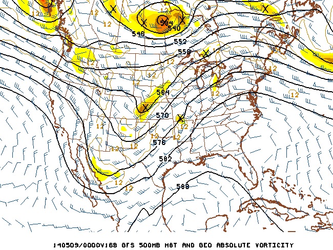
Now that this most recent system has moved on, it's time to start looking ahead again for the next round of opportunities. Taking a quick look at all available model data, I don't see a terribly bad situation for the Plains, but not a great one, either. A nice upper trough is shown moving through the center of the country next week, though with mostly a positive tilt and not much of a core of strong flow:
Notwithstanding, a pattern like that in May usually means "pay attention". In general, any instability and upper support over 30 to 40 knots is worthy, particularly in May! Tim Marshall's famous saying "When it's May, you chase!" are words of wisdom. And for those on their annual fixed storm chasing vacations next week, these definitely won't be "down days".
That being said, the GFS model is showing a strong cap for what would be this trough's "main event" on Wednesday, with storms firing late (or not at all). Wednesday (and even Tuesday) will have to be watched, however - if moisture return is better than what is shown now, it may be a worthy event to make a run out west for. Right now, however, I'm not very excited about Tuesday-Wednesday in the Plains, so for the time being, I'm going low on the chase chances.
Further complicating matters is that Tuesday, Wednesday and Thursday are all shown as being Midwest storm chase days with this system, with precip shown overcoming capping in areas with good instability and upper support. That will really limit my own personal consideration for a Plains trip. If the Plains setups remain marginal, a 'local play' will all but ensure that I'll stay in the Midwest for this system. Again, I always like the cost savings of a close-to-home tornado chance (single tank of gas or less, no hotel) as opposed to a Plains trip for equal or slightly greater chances (many tanks of gas and one or more hotel stays).
Looking past next week, there is no consistent pattern showing itself. The GFS's most recent run looks bleak for storm chasing beyond the 9th, showing an eastern trough/omega block pattern. Remember, though, that's into the 'guesscasting' realm that we can't pay much attention to (unless it becomes a consistent signal). Again, it's only early May, we've got a long way to go before this season is over. There will be several more pattern changes.
The following table charts the probability of a Great Plains storm chase expedition happening for several indicated date ranges in the near future:
| 2014 Plains Storm Expeditions - Probabilities as of May 2 |
| May 3-5 | 0% | |
| May 6-8 | 25% | |
| May 9-15 | 10% | |
|
|


