VIDEO 1:
Nebraska tornado, funnels, storm structure - May 15
VIDEO 2:
Dashcam time-lapse of May 15 chase
With Friday the 15th's setup looking like western Nebraska, I hit the road fairly early in the evening on Thursday with the intention of checking out a 'sleeper' setup for supercells in central Missouri on the way. Although a brief tornado did occur on Thursday's setup, it was nowhere near where I was doing my "on the way to the Plains" chase near Jefferson City. I arrived at my hotel in Nebraska City at 1AM and set my alarm for 6AM. I departed just before 6:30AM Friday morning, expecting a very long haul to the western borderlands of the state (possibly into Wyoming).
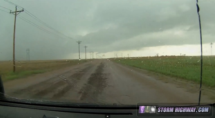
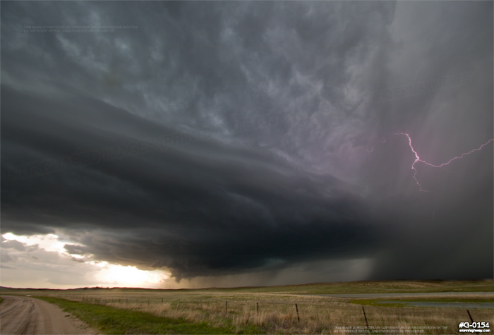
I arrived in Sidney, NE in plenty of time, able to have a relaxed-pace lunch as storms began going up to the south and heading my way. After hanging with the first updraft to get organized at and north of Sidney, I headed east on gravel roads north of town to intercept a new storm getting organized to the south of the first. My road was gravel, but the farther I traveled, the worse it got. Apparently there was only an inch or so of gravel aggregate on top of pure mud, with the mix not compacted down enough to make for a stable road surface. Essentially, it was your standard Plains rutted, muddy road that storm chasers always get stuck on, only with some gravel to make it barely passable. Two miles in, the traction conditions began to mimic that of snow. A brief harrowing fishtail alerted me of that fact, and I had to slow to 25mph tops from that point on. That gravel indeed was the only reason I did not get stuck several times, so it wasn't as bad as it could have been.
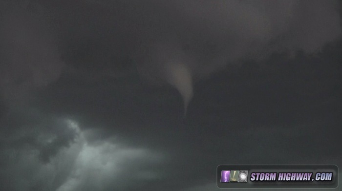
The updraft to my south rapidly organized and dropped a funnel more than halfway to the ground. I'm convinced this was probably a tornado, with a ground debris/spray that would only be visible to someone very close. Since no one else confirmed that, I won't "count" it:
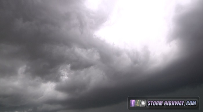
The storm's mesocyclone was heading directly north at me, so I stayed put and hoped it could cycle again before arriving at my location.
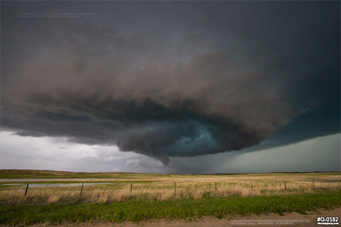
An RFD clear slot cut into the base, with the center of the nearly-occluded circulation heading right for me.
I moved about 1/2 mile east to get out of the way, but nothing ever came of this. The RFD was simply overpowering the circulation's inflow before it could really tighten and reach the surface. That said, it was an amazing scene to look straight up into the RFD clear slot and see the fantastic displays of motion - downward with the RFD, upward with the updraft, and horizontal/vertical circulations in between. It's one of the rare times I had such a close-up view of the inner workings of what normally can lead to tornadogenesis.
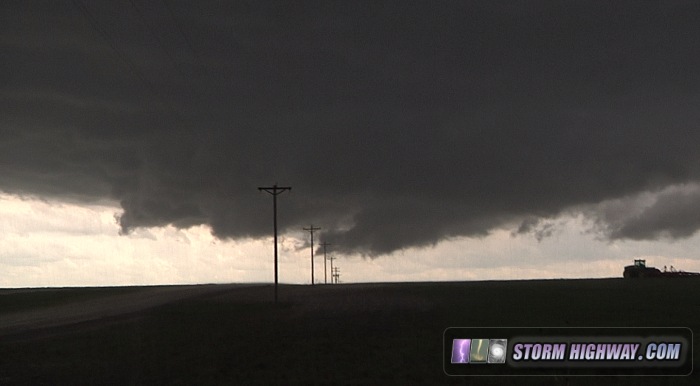
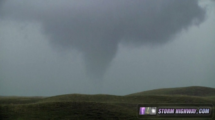
After another careful pass over the questionable mud/gravel to return to the highway, I caught back up with a tightening circulation just south of the river at Bridgeport. This quickly produced a well-defined funnel nearly overhead that persisted for about 2 minutes.
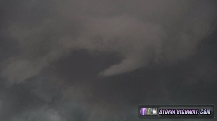
I followed the storm to Alliance, where I stopped on a gravel road and watched yet another big RFD surge carve into the base:
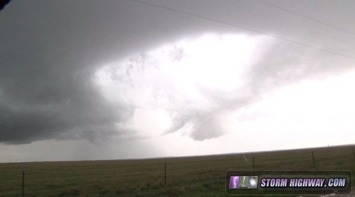
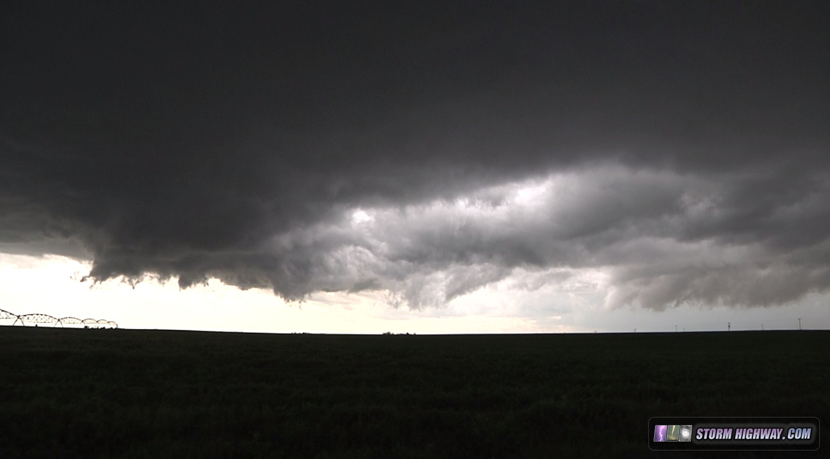
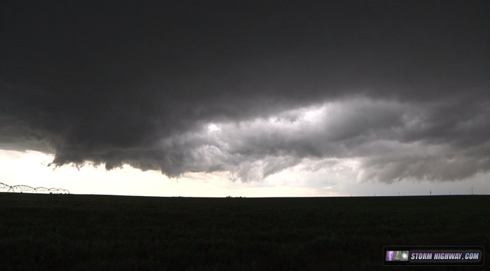
The circulations seemed to have their best shot upon complete RFD occlusion, when rotation really tightened up and tried lowering. Yet, I had never seen anything make it to the ground so far. At Alliance, I gassed up and headed east to intercept a new storm moving up from the south. This one had a great, unobstructed inflow trajectory to the east, and sure, enough, it ended up putting on the best show of the day. My first view of the storm's base at Lakeside had me thinking tornado-in-progress, but after a short time it was evident I was looking at well-placed rain curtains rather than a dusty debris cloud:
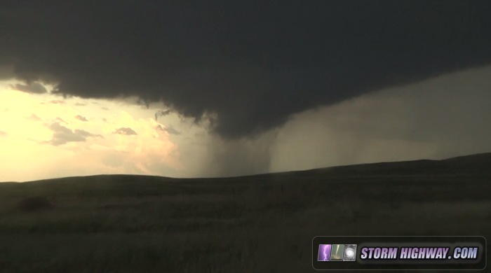
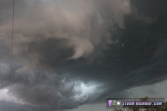
The storm rapidly organized as it approached Lakeside, with inflow and structure really picking up. A rotating wall cloud lowered and filled in a few times, with periodic funnels and areas of tight rotation. However, nothing made it to the ground during this time, though it was close. The RFD cut in hard here, slicing a spiral cinnamon-roll pattern into the base.

Still images from the (new) DSLR:
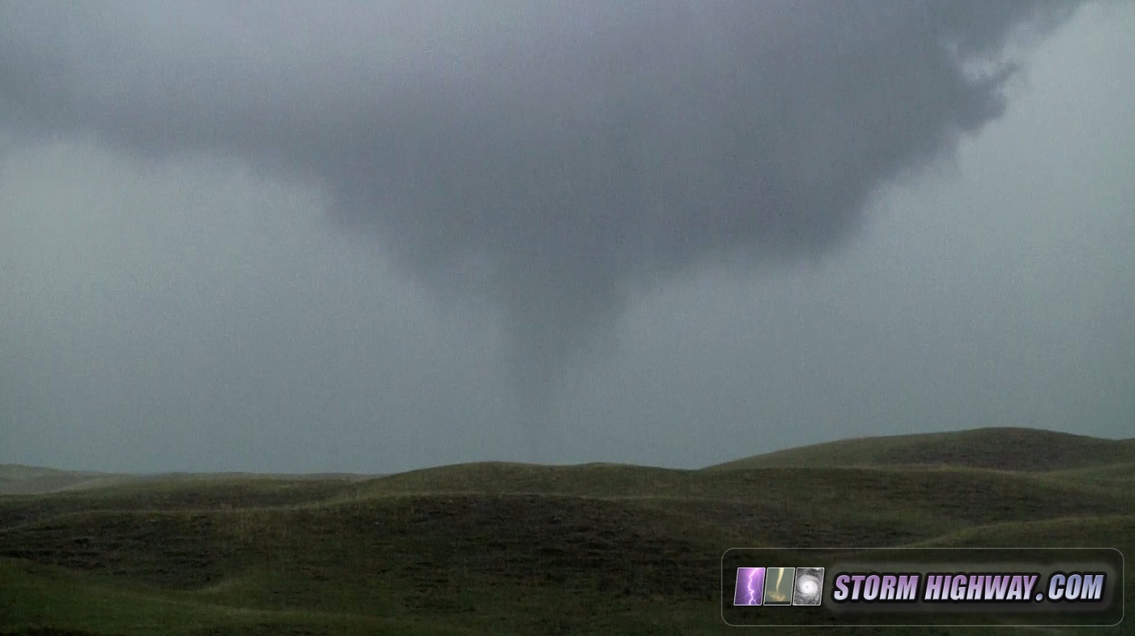
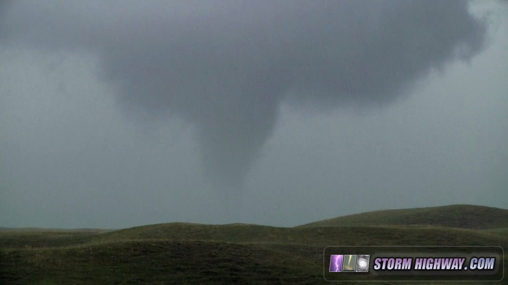
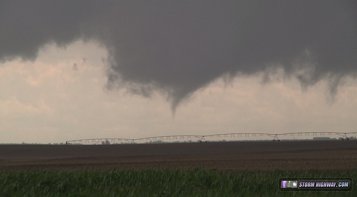
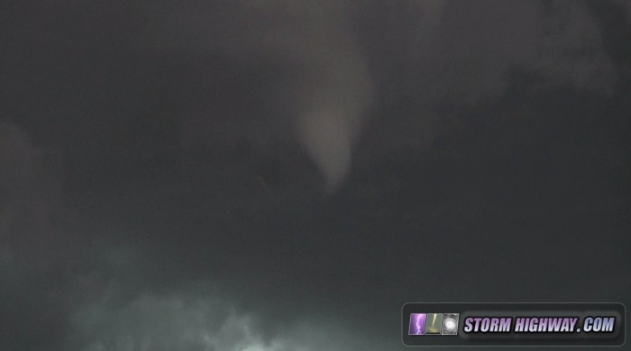
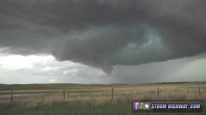
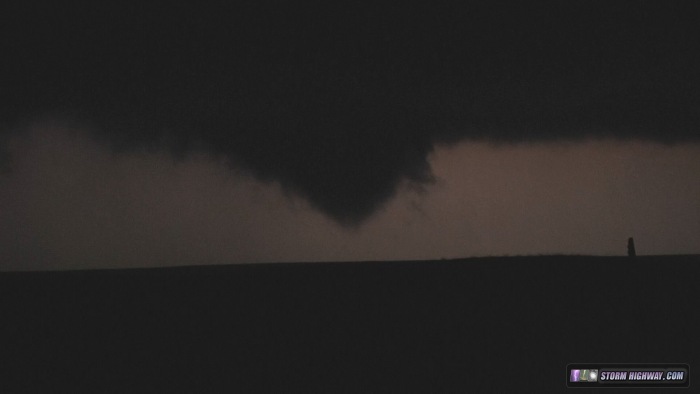
I followed this storm northward on Highway 250 from Lakeside. The RFD continually occluded off multiple simultaneous circulations, which paraded off to the west. The main updraft base stayed east of the road. At one point I could see three distinct areas of circulations all lined up from due north to due west. Many times, these tightened, producing funnels and possible brief non-condensed tornadoes. Finally, one resulted in a briefly-condensed tornado about a mile west of the road:

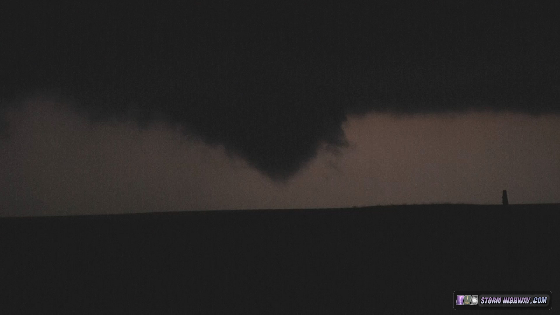
This process continued on as darkness fell. I stopped my chase at Rushville, about 20 miles south of the South Dakota border. Lightning was still illuminating more lowerings/funnels (possible tornadoes but non-counted) to the northeast:
I ended my day at 1AM after a long drive southeast to North Platte. I didn't get into my hotel room until 2AM, thanks to a mix-up with the online reservation. Due to this, my short night's sleep the previous day, and my expectation to be chasing within a 6-hour drive of this area on Saturday, I set my alarm for 9:30AM. Unfortunately, I did not do my customary pre-bedtime data check to notice the moisture being scoured from Nebraska and Kansas by a strong squall line to my south and east.
After I awoke, showered, got the car loaded up and checked out of the hotel, I finally began looking at data to make my morning target forecast. When I saw the surface chart, my heart sank. The overnight storms had shunted the deep moisture all the way down to the I-40 corridor into the Texas Panhandle and Oklahoma, with dewpoints in the 50s in Kansas and Nebraska. The setup in Kansas and Nebraska was shot completely, and I knew my only option was to start heading south. With the 9+ hour drive ahead, I figured I probably wouldn't make it, but I had to try. I thought at the least, I might have time to barely catch a northernmost supercell along the outflow boundary in central Oklahoma late in the evening.
I finally made it ahead of the ongoing storms at Sieling, Oklahoma, where a storm was beginning to organize. It was outflow dominant, with a huge whale's mouth pushing out ahead. This storm would go on to produce a tornado near Cleo Springs, but it sure didn't look like much when I saw it. A tornado-warned supercell near Sayre was within my reach, but was quickly falling apart. About the time I passed through Watonga, Oklahoma, the reports were coming in from Elmer/Tipton storm. I was about 2 and a half hours too late. North Platte to the Red River just isn't doable when you leave late morning! Nonetheless, I had come this far, so I decided to go all the way to Chickasha to at least see the storm. It predictably fell apart just before I got my first visual on it.
I finally gave up the tornado chase at dusk and turned to lightning photography, heading back up to Oklahoma City to try and get some upward lightning at the tower farm. I watched a few upward bolts in the distance from the leading stratiform precip, then arrived at the towers just ahead of the squall line. I didn't have time to set up, as the squall line core was right on my tail. There was no trailing stratiform precip region, so no reason to stay and fall behind the squall line for the long trek home. I jumped on I-44 eastbound, only then noticing the pair of new supercells ahead of the squall line heading for Bristow.
The circulations on radar with these leading supercells faded as they approched the turnpike, and I finally got ahead of all precipitation at Claremore (east of Tulsa). As I approched Joplin, the squall line kinked and produced a string of QLCS-type tornadoes in the dark as it headed into Missouri. By that time, I was an hour ahead of the line and not feeling like waiting for them. I continued on home, arriving after sunrise. I didn't even stay awake for the squall line's morning arrival in St. Louis, expecting it to be a non-event on all counts and not worth postponing much-needed sleep.
Aside from trying to do some handheld long exposures through the windshield to capture possible storm structure at Bristow, I never picked up my cameras this day.
...and that concludes the summary for Plains trip #2. I will likely hold off on with third and fourth (if needed) chases until June. I'm not impressed with this weekend's dryline setups in Texas panhandle, not for the long drive anyway. I'm really waiting for a setup where the classic capping inversion returns and helps keep so many storms from ruining the day, and June is always a better bet for that type of thing. Following the weekend, the Plains looks to quiet down in terms of upper level support for some time. I see several Midwest chase possibilities this weekend and into next week, reinforcing the likelihood that I'll be staying close to home for a while.
The following table charts the probability of a Great Plains storm chase expedition happening for several indicated date ranges in the near future: