|
Home | Blog Index | Blog Archives | Christianity & Faith Essays | Storm Chasing Essays
March 15 supercells, hail and lightning in west-central Illinois
VIDEO 1: Lightning at Havana, Illinois - March 15
VIDEO 2: Dashcam highlights - March 15 chase
VIDEO 3: March 15 dashcam full-event timelapse
Although road troubles cost me a tornado intercept this day, the lightning at the end of the chase redeemed what would have otherwise been a frustrating outing. The forecast was rather clear-cut: be on the storms just to the east of the surface low center as they tracked northeast and interacted with a warm front. This would be around and just north of Quincy, Illinois, so that was my target. I arrived there by 2PM. The caveat for my target was that the HRRR model was insistent on developing a storm farther to the south, tracking it from Bowling Green, MO through the vicinity of Jacksonville/Springfield, IL. I was reluctant to believe this, however, I kept the southern possibility in my "striking distance" - if it did happen, it would be a much more isolated and likely more chaseable/photogenic storm than the ones to the north (Spoiler: the HRRR was right).
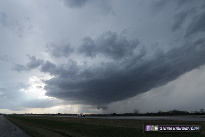
Storms went up by late afternoon at Quincy, as expected. However, other than a small area of cumulus, I saw little sign at this stage of the HRRR's southern storm, which I thought should have been well under way at that point. There wasn't even a radar echo indicating its presence. For that reason, I committed to the original target and moved northeast to position for the Quincy storms as they matured. The lead Quincy cell had a solid rain-free base, but was having outflow undercutting problems:
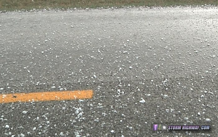
Meanwhile, a storm to the west showed strong circulations and tornado warnings, so I eventually bailed west through the core of the struggling lead storm to intercept the western cell. I encountered hail up to 2 inches in diameter as I moved through this core near Basco:
I caught up to this storm at Carthage, IL, but it was suffering from cold northerly outflow undercutting and would clearly need some time to re-cycle. This appeared to be happening just to the northeast of town, and I drove northeast toward Good Hope to stay with the developing meso. However, two problems conspired to keep me from the soon-to-be Good Hope tornado. First, the storm accellerated dramatically at this point as the upper jet streak slammed into it, making it difficult to stay ahead even with paved roads.
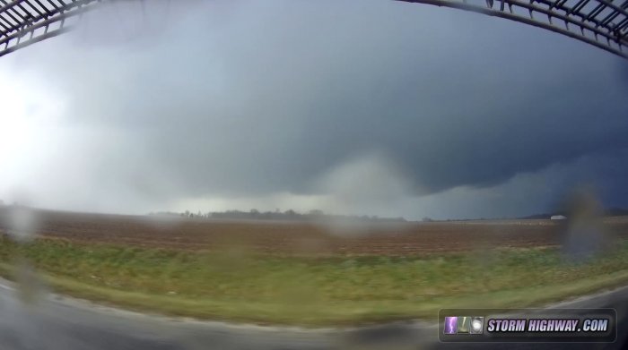
Finally, my road abruptly turned to three-inch-deep gravel, forcing me to slow to 35mph. The RFD precip quickly engulfed me, completely obscuring the updraft base. The storm then just left me in the dust - there was no hope to make it to Good Hope in time, even after finally returning to pavement.
I made a brief attempt to intercept the next cell in the line, but it too was already too far ahead of me. It handily beat me to the road crossing west of Canton, and from there on, I was out of options. The HRRR's southern storm, now mature, was also out of range - already crossing I-55. It was also getting dark and hard to see storm features. I ended the tornado pursuit aspect of the chase and began heading south toward home.
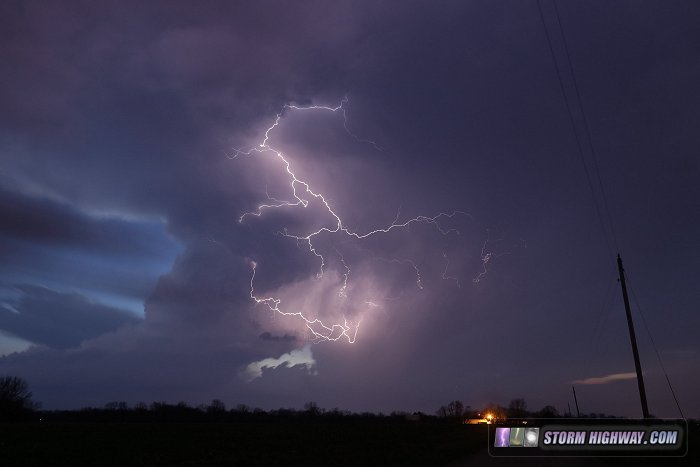
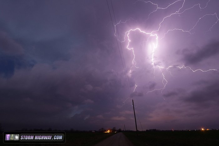
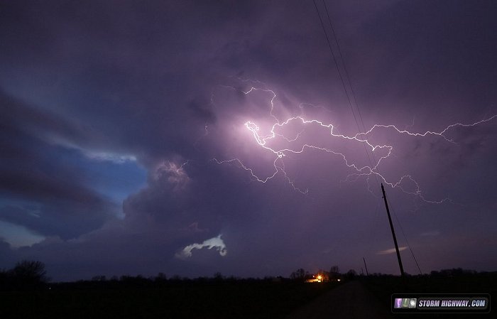
Near Havana, a small updraft behind the cold front was putting on an unexpectedly good lightning show, reminiscent of the incredible display we saw at Bismarck, North Dakota in May of 2006. I stopped and set up both video and still cameras on this scene, and came away with some satisfying material (video is here):
|


