|
Home | Blog Index | Blog Archives | Christianity & Faith Essays | Storm Chasing Essays
Cloud forecast for the 2017 total solar eclipse in the Midwest - Update 2
We are now close enough in time to eclipse day to start getting a feel from models of what type of weather pattern we can expect across the country on August 21. For eclipse viewers in the Midwest (namely Missouri, Illinois, Kentucky and Tennessee), what has been shown so far is reason for concern.
Run after run, models show abundant moisture and numerous areas of precipitation to be present nearly every day east of the Rocky mountains for many days spanning before, during and after the eclipse. Lots of moisture and precip means lots of clouds. Models have been fairly consistent on the main core of the upper-level jet staying to the north across Canada and the northern tier US states. However, there are also numerous minor perturbations in the flow shown farther south across the Midwest. The timing and placement of these smaller impulses are impossible to forecast this far out, but with the moisture shown to be in place area-wide, each of them will likely produce areas of rain and/or complexes of thunderstorms on a daily basis. That's not good news for eclipse day in the Midwest.
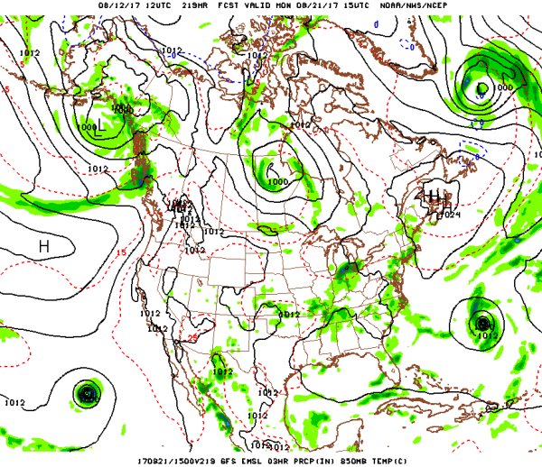
GFS precipitation forecast for August 21
With the exception of a couple of outlier runs, all of the models have not shown any dominant feature taking shape over the central US - neither a trough, closed low, tropical system or surface high pressure. (A just-offshore Atlantic hurricane is shown that could threaten the eastern US states with cloud cover, but it should be too far away from the Midwest to factor in here). Our biggest challenge in the Midwest will likely be those daily "MCS" complexes of thunderstorms and the remnant clouds they produce. As I pointed out in the previous post, the timing and placement of thunderstorms are very difficult if not impossible to nail down with any confidence until a day or two beforehand.
Again, it is still quite early in the forecast cycle to speak about clouds with any level of certainty, as they are smaller-scale features notoriously difficult to pin down even 24 hours out. However, what the models are indicating has me more pessimistic than optimistic that we'll be cloud-free on the 21st in Missouri and Illinois. If I was forced to pick a probability percentage, based on the data right now, I would say 60% for cloudy skies, 40% for clear. The way it looks, I would be making some serious backup plans to relocate west along the eclipse totality path into at least central Nebraska. Of course, we are still far enough away in time from the big day that this could change, possibly significantly. I'll make another update in the next few days, so stay tuned!
GO: Home | Storm Chase Logs | Photography | Extreme Weather Library | Stock Footage | Blog
Featured Weather Library Article:
|


