|
Home | Blog Index | Blog Archives | Christianity & Faith Essays | Storm Chasing Essays
Lightning barrage, hail & tornado from fall supercell - November 5, 2017
4K EXPEDITION VIDEO: Lightning, hail, tornado from St. Louis to Carlyle, IL
A fall (and even winter) severe weather event or two is the norm here in the Midwest, so Sunday's hail and tornado risk was nothing out of the ordinary for the St. Louis region. On the scale of 1 to 10, this event looked like a "3" to me at the beginning of the day. I wasn't expecting much, nor was I feeling very motivated to drive very far. I wouldn't have to, as it turned out.
With the mid and upper levels of the atmosphere within solid supercell parameters, the only question was the low levels - specifically, the speed of a cold front that would both initiate the storms and possibly limit their organization. The faster a cold front moves, the more it can catch up to storms and undercut them in the low levels, eliminating tornado chances. Thus, the chase objective was to be on a storm sufficiently ahead of the front so it could have time to organize. Also of concern was cloud cover early in the day. The more sunlight an area could recieve, the stronger storms would be in that area and the better low-level instability would increase the tornado chances. By midday, a small area of broken clearing was overspreading the St. Louis area and to the east, which gave the low-level environment just enough of a solar boost to make things interesting.
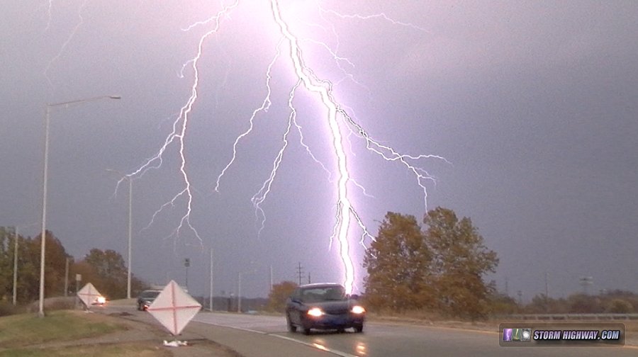
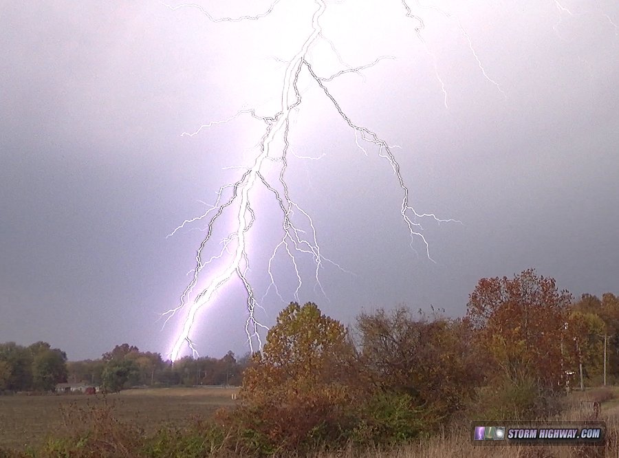
Storms initiated as expected north of St. Louis, but too close to the cold front. I initially headed up to the Highway 4/I-55 interchange to keep within striking distance of these, but quickly decided against it as storms farther southwest began to appear on radar. A dominant storm became established right over the St. Louis metro, and I moved into position at Collinsville to watch it approach. As the base came into view, a broad RFD surge to the south was evident, but no well-defined low-level meso. What was there looked very indercut by either outflow or RFD, everything pushing outward away from the storm's base. The CG lightning in the inflow region of the storm was frequent and intense, and I managed to grab a couple of nice bolts among the fall foliage:
I was prepared to move northeast on I-70 to keep ahead of the storm, but its hard right turn made it clear that Highway 50 or even I-64 might be necessary. I dropped south to I-64, then up to Lebanon to begin tracking the storm east on Highway 50. Initially I was concerned that the storm speed would make it difficult to keep up, but I was pleasantly surprised that I would have plenty of time to take a more leisurely pace east. I even had enough time to drive up to St. Morgan on Highway 160 to sample the hail core, which minutes earlier had produced 3-inch baseballs in Collinsville (just north of where I had been). I found only 3/4" stones at the largest on Highway 160, though I did not go very deep into the core so as to not let the storm get in front of me.
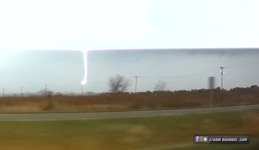
I returned to Highway 50 at Trenton as the storm developed a well-defined hook both visually and on radar. At this point, inflow down at the surface was starting to make it to the storm's base. A barrage of cloud to ground lightning commenced as I arrived in Breese, with one bolt striking a power line near the road. The driver's side dashcam captured this, albeit with rolling shutter cutting the upper part of the bolt off:
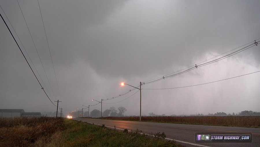
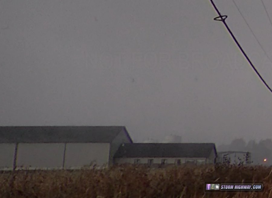
The storm continued to improve as it approached Carlyle. I dropped down to old Highway 50 to get more in line with the center of the meso. Right on the western outskirts of Carlyle, the meso ramped up with the fastest motion I would see all day - a tail cloud/wall cloud moving south with strong RFD racing north. Rain bands with differential motion in these zones was visible, and the feature looked imminently tornadic:
Pieces of sheet metal were lofting in the RFD after something was impacted by either the RFD winds or a tornado (I could not tell which at the time). The video seems to suggest a circulation here:
This feature was short lived. As I arrived in town, I managed to get a look back to see that the RFD precip had cleared out and that the low-level motion had weakened. The storm's radar presentation was also looking less organized. I felt like it was worth keeping with it, however, as the surface inflow corridor looked to be persisting.
East of Carlyle, I made it far enough ahead to get a view of the overall structure:

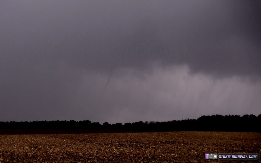
I pulled off at Huey to get another look, at which time a narrow needle funnel appeared in the rain, persisting for about 20 seconds and making it 3/4 of the way to the ground (a likely tornado):
I used the county road grid to stairstep north in line with this circulation for a few miles, but the storm rapidly fell apart, losing all traces of a meso or surface inflow. I dropped south across I-64 to another storm at Addieville, which also briefly appeared to organize but quickly fell apart. With darkness falling and the next storm in line way down at Sparta, I decided to call the chase and head home.
GO: Home | Storm Chase Logs | Photography | Extreme Weather Library | Stock Footage | Blog
Featured Weather Library Article:
|


