
|
||||||||||||||||||||||||||||||||||||||||||||||||||||
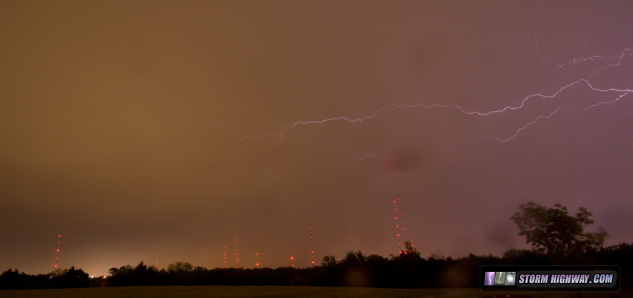
4K VIDEO: Full-day timelapse of this chase, 4-way view I managed to get one day of Great Plains chasing in this year on the first chase of the 2018 season. I had originally intended to leave on Tuesday morning the 1st and cover the triple point in Kansas, but I stayed up too late on Monday night and could not fall asleep in the short window I had left. Facing the dangerous prospect of a 7-hour drive followed by another 7 hours of chasing all on 30+ hours without sleep, I had no choice but to scrub the departure on the 1st. I believe I would have seen the Tescott, Kansas EF3 had I been able to go - meaning this is the first tornado I've missed due to sleep deprivation concerns. I could have easily managed that kind of awake interval when I was younger, but as I get older, it's become a danger that I'm not willing to risk. Finally rested up with an extra day, I departed for Oklahoma at 5AM on Wednesday with a general target from Woodward to Elk City, Oklahoma, to be refined later in the day. I arrived in Oklahoma City after 1PM and made my final forecast. I chose Clinton, Oklahoma, as it appeared that the environment to the south would become the most favorable through late evening. At Clinton, I stocked the hail cooler with dry ice and mounted the hail shields as targetable storms developed to my west and southwest. I went over to look at the storm near Foss Lake, and finding it junk, dropped down to the better-organized storm at Hobart. I lost my Verizon internet data 5 miles south of I-40 and didn't get it back until near the end of the chase at Chickasha, with my old satellite-based standby ThreatNet turning out to be vital once again for radar data. I turned east through the forward flank of the Hobart storm to try and cut ahead of the meso at Mountain View, but it beat me across the road. I ended up in the RFD here, then used Highway 9 and 146 at Fort Cobb Lake to finally get back ahead of the storm - now undercut with a merged RFD and FFD. I went all the way east to Minco and dropped south to the next storm at Pocasset, which slowly began wrapping up as it approached. I tried to jump down to Chickasha to get on the H.E. Bailey Turnpike to stay with it, but the blinding RFD precip beat me into town. I was on the turnpike just southeast of the tornadic circulation at Amber, but never could get out of the rain to see anything. After this, I went to the north OKC tower farm for upward lightning, but there was none due to the lack of a well-developed trailing stratiform region. Only a few anvil crawlers peeked through on the back side of the line:
 That was the only time I used my cameras during this day - a sign of a less-than-stellar chase. I ended the chase here at 10:00PM and headed up to Claremore for the night. I arrived home the following afternoon. NEXT PLAINS CHASE: Day 3: Severe storms from Parsons, KS to Springfield, MO > Storm chasing forecast update #6 Models do not show a favorable pattern worthy of storm chase expeditions for as far out as they can be trusted (10 days or so). A persistent Hudson Bay vortex (eastern Canada) is keeping eastern troughing/central US ridging entrenched through the period, not allowing western troughs to develop and/or eject into the Plains. As a result, prospects for trip #2 are very low for the next 2 weeks. The following table charts the probabilities for a Plains storm chase expedition taking place for the date ranges shown:
GO: Home | Storm Chase Logs | Photography | Extreme Weather Library | Stock Footage | Blog
Featured Weather Library Article:
|
||||||||||||||||||||||||||||||||||||||||||||||||||||


Web Site Design and Internet Marketing by CIS Internet