|
Home | Blog Index | Blog Archives | Christianity & Faith Essays | Storm Chasing Essays
Season forecast update
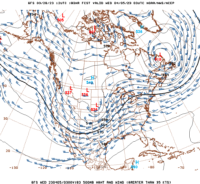
After a cold and mostly-quiet March in the Midwest, things are finally looking to start heating up in the next 2 weeks - both in the temperature and severe storms realms. While medium-to-long range models still show a troubling mass of cold air in Canada that threatens to surge south at a pattern-shift's-notice, the warmth and moisture in the Gulf and southern US is shown to be equally as robust. Demarcating the battle lines between the two is a strong consolidated upper jet, along which several big waves are shown traversing the country. This results in the set up of a classic spring severe weather machine: deep moisture, fast upper-level flow, strong deep-layer shear and cold air aloft. Large areas are shown having multiple significant severe weather and tornado risks from the Great Lakes region all the way to the Gulf Coast, including here in the Midwest. In the near term, Friday and possibly next Tuesday look like big days to watch.

GFS 500mb chart for Tuesday night (April 4)
Stay tuned to the Twitter feed and Youtube channel for the latest updates and new footage. I'll also update the blog with a summary at some point, but those two links will be where I'll post more in real time.
| View 1,609 storm chases: |
| by year: |
|
| by type: |
|
|
|
GO: Home | Storm Chase Logs | Photography | Extreme Weather Library | Stock Footage | Blog
Featured Weather Library Article:
|