| Photo Gallery Categories: | Main Gallery | Storms | St. Louis | Lightning | Tornadoes | Earthquakes | West Virginia | Charleston, WV
2019 Ridgecrest, California Earthquake Surface Rupture - Photo Gallery by Dan Robinson
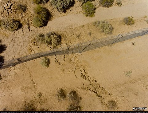
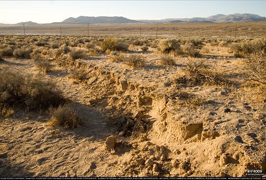
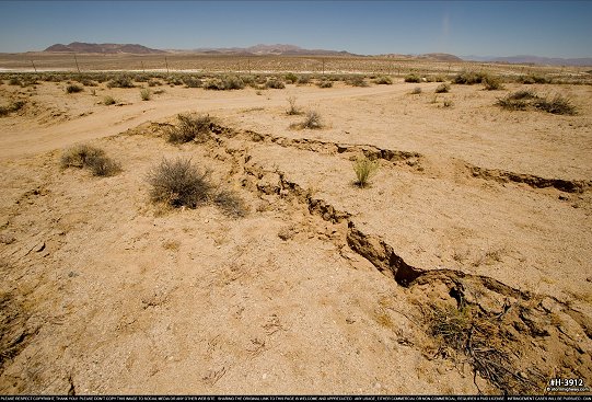
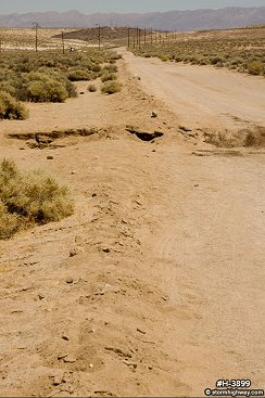
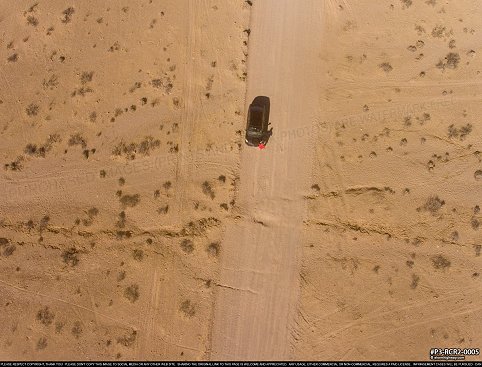
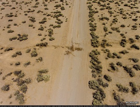
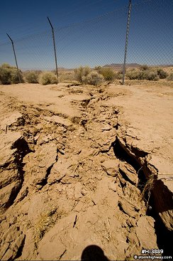
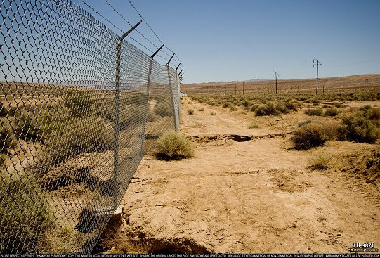
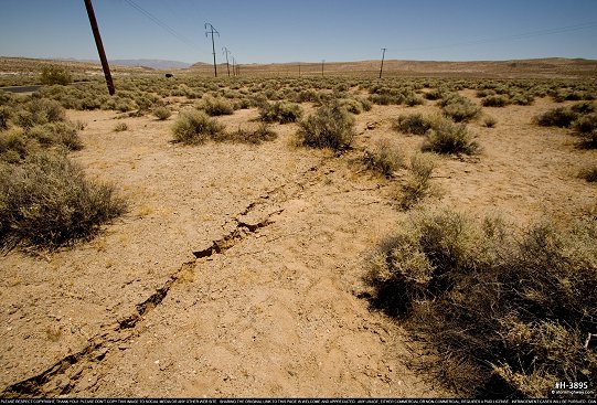
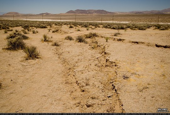
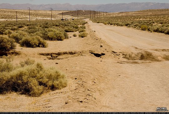
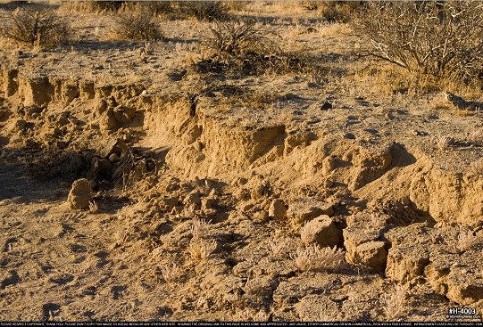
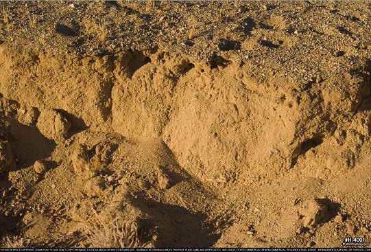
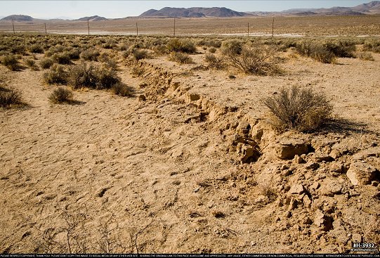
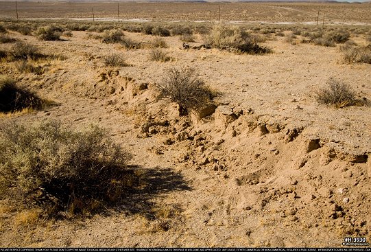
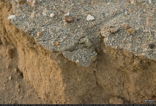
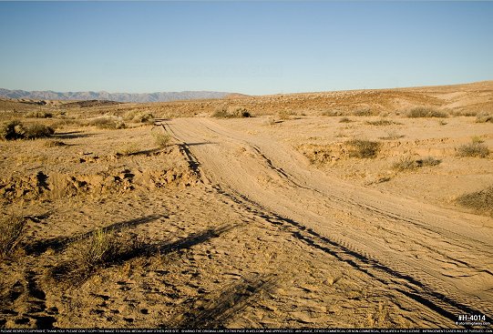
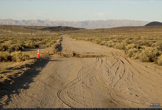
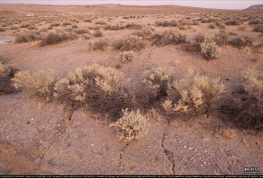
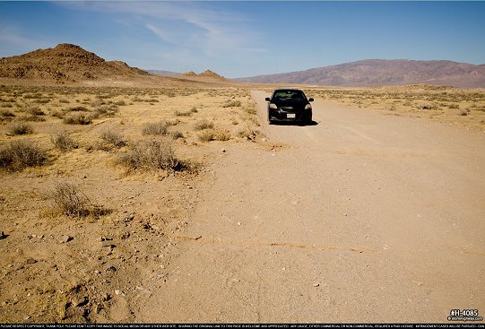
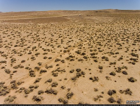
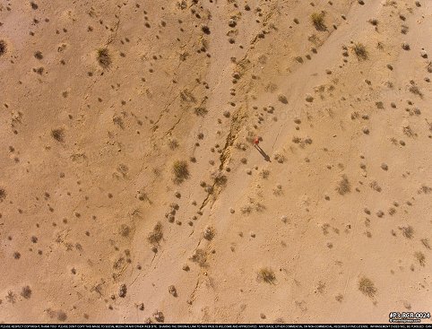
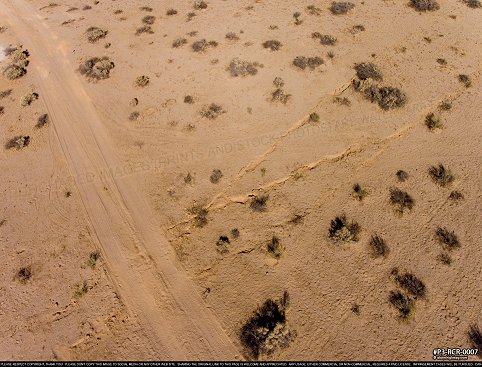
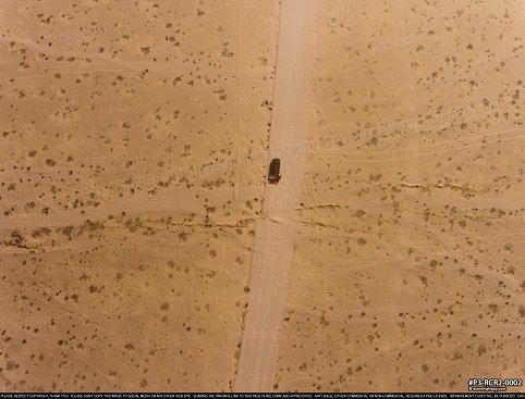
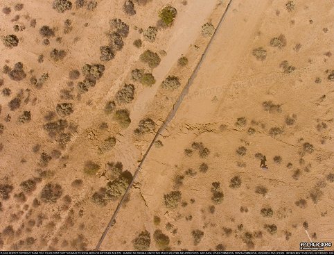
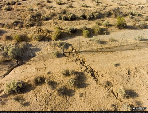
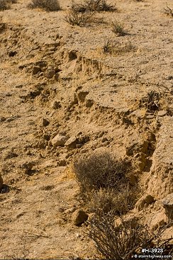
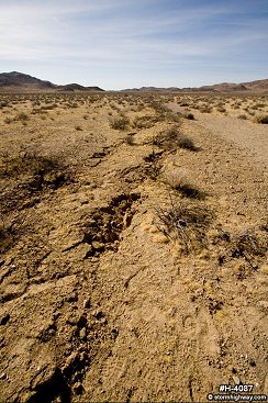
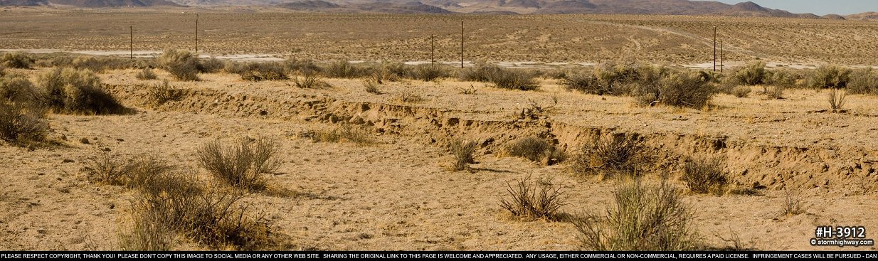
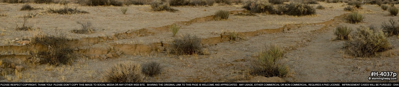
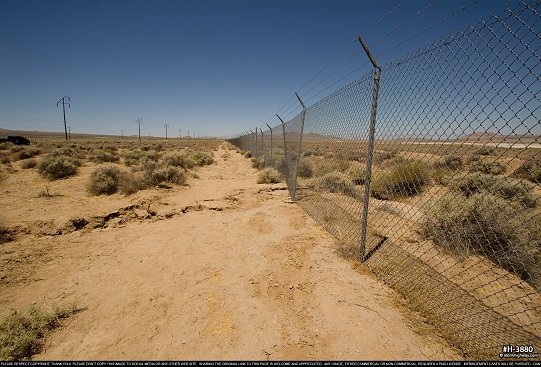
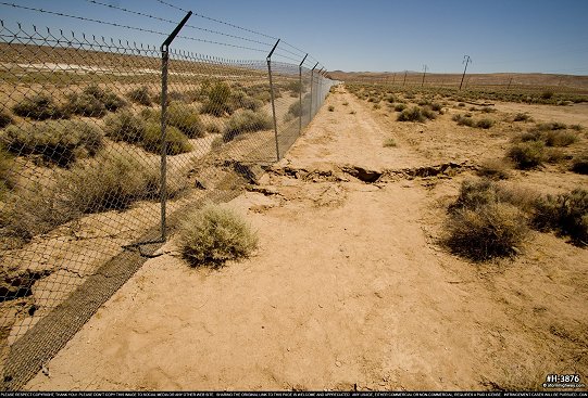
On July 5, 2019 at 8:19pm PDT, a magnitude 7.1 earthquake struck east of Ridgecrest, California, part of a sequence of quakes that included a M 6.4 foreshock the previous day. Both the M 6.4 and M 7.1 events broke the ground surface. The M 6.4 event produced minor left-lateral surface rupture along its trace. The M 7.1 produced spectacular right-lateral surface rupture features along most of its fault trace that slipped. While the greatest offests of over 6 feet occurred within the inaccessible-to-the-public Naval Weapons Station at China Lake, a long stretch of the surface rupture with offsets exceeding 3 feet was within reach across the desert landscape east of Ridgecrest.
EARTHQUAKE GALLERIES: San Andreas Fault | Ridgecrest Earthquake Surface Rupture | Garlock Fault
All photographs © Copyright Dan Robinson - any and all usage requires a paid license. Please don't copy these images to social media. Sharing the link to this page is welcome and appreciated. Feel free to contact Dan for inquiries. |