Lightning barrage: Storms stay below severe limits, but put on a startling light show: July 14, 2006
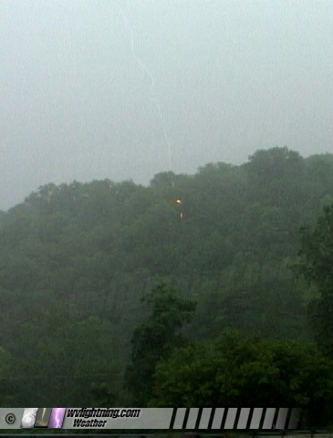
ABOVE: Lightning strikes a tree 700 feet from the camera in Pocatalico on Friday.
EXPEDITION VIDEO 1: Very close lightning strikes in Pocatalico: WMV Clip
EXPEDITION VIDEO 2: Monster gust front and shelf cloud engulfs Charleston: WMV Clip
EXPEDITION VIDEO 3: Lightning over Charleston: WMV Clip
POCATALICO and CHARLESTON, WV - The Charleston, WV metro area saw three rounds of storms between 4PM and midnight. This is a log of the day's chase.
Round 1
For the first intercept, I drove north on I-77 about 15 miles to Pocatalico to meet a potent new cell moving up from the southeast. I wanted to just get inside the core and see some close strikes. I got what I came for. I lost count on how many blasts of thunder that arrived less than one second after strikes. One strike's thunder arrived before the return strokes were finished discharging! I even lowered the video cameras to include more of the ground and trees, because I wanted to be sure I got the whole bolt if something hit less than 100 feet away (the chances were very good). The problem with close lightning is that even with 2 cameras, the lightning is happening literally 360 degrees around you, so it is harder to catch them. I did get three very close hits in the frame, though only one of them had multiple return strokes that looked good on video. The other two were 'one-hit wonders' , one with just a ghost channel visible on one frame and the other a ghost/'real' channel hybrid.
On this clip, I included the strikes that hit out of frame just so you could hear the intense thunder. I included some still frames later on in this report (scroll down to the end if my verboseness is too annoying).
Close lightning strikes along I-77 at Pocatalico, Windows Media
I have to say, even after seeing tornadoes on the Plains, that this is what I love the most about storms. I was under the I-77 highway overpass here, which limited my sky coverage but kept me dry and safe. I almost got the third video camera out, but the first two had the whole view covered.
Round 2
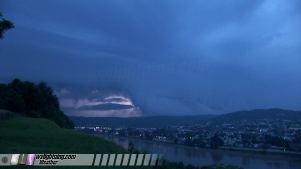
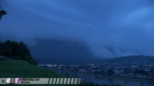
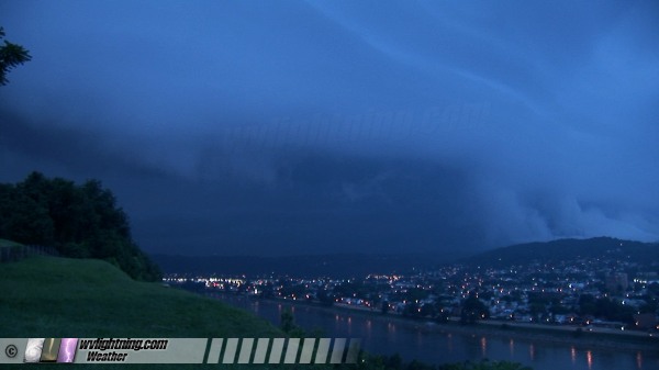
The second line of storms came through at dusk, right on the heels of the first. The most impressive show from this one was the massive, mountain-scraping, stacked-plate shelf cloud that swept over downtown Charleston. I shot a timelapse of this from the overlook at Fort Hill. With temps at 82F and dewpoints at 75F, it didn't take much cool outflow to saturate the hilltop air. As a result, the shelf cloud's base was very low, and it dragged across the tops of the ridges as it turned the evening twilight to near darkness over the city. What a sight!
Here is the timelapse:
Shelf cloud engulfs Charleston, Windows Media
The lightning from round 2 was not as impressive, though I did get some more 'lightning bugs with lightning' video after the shelf cloud moved over:
Lightning bugs with lightning, Windows Media
Round 3
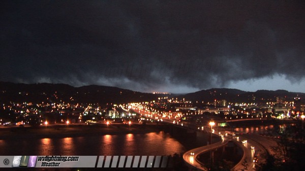
The third and final line of storms rolled in just after midnight. Lightning was not too impressive, but the storm did give me a couple of anvil crawler/CG discharges over the downtown skyline:
Lightning over downtown Charleston, Windows Media
As you can hear in the video, I was shooting these by 'reaction' on 35mm with 8 second exposures following. I can't really tell by the shutter clicks if I got enough of the lightning to get the channel exposure right. I was close though - I'll find out when I get the slides back.
Video Frame Grabs
Here are some frame grabs from the video cameras:
This first frame is from camera #2 that caught the tail-end of a lightning strike hitting a tree on the hillside about 700 feet in front of the camera. You can see the fiery orange color where the lightning channel travels down the tree, partially hidden by other trees in front of it. The lightning discharge consisted of only one quick return stroke, unfortunately meaning that there weren't additional strokes for the camera to get a better image.

This second image is a ghost channel from this strike.
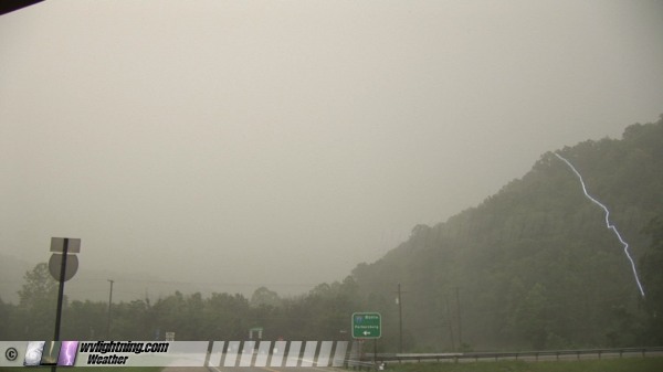
Since a video 'ghost' lightning channel is merely an image of the lightning shifted downward on the screen, the 'real' position of the 'ghost' channel can usually be obtained by shifting it up so that the top of the ghost channel is at the top of the video frame. Here is a quick cut-and-paste of this:

As you can see, the ghost lightning channel is longer than the portion of the sky in view directly above it, showing that this bolt hit on the camera-facing side of the hill. Not as close as it first appears, but still very close. The quick thunder supports this also.
This next image is of a channel that is partly a ghost and partly real. If you look closely at the top of the image, you can see the vertical displacement between the main channel and the matching channel from the stepped leader. The displacement is noticeable, but not extreme as ghost channels go (most ghosts have vertical displacements halfway down the frame or more). Therefore you can see that this bolt struck in front of the treeline in the background, but behind the treeline in the foreground (not in front of the first treeline as the ghosting would suggest).
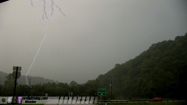
Here are a few more frames from the first storm in Pocatalico:
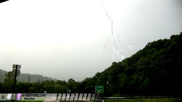
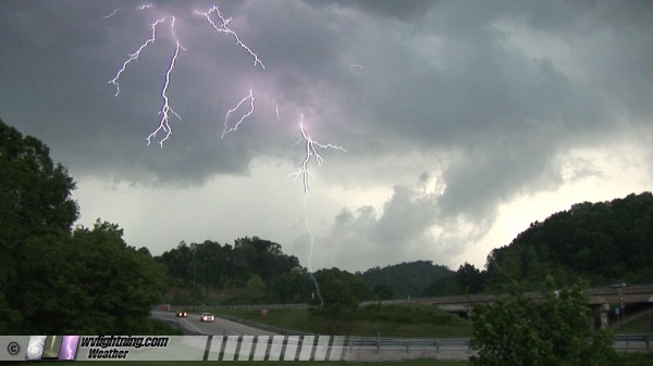
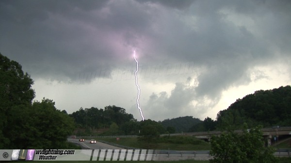
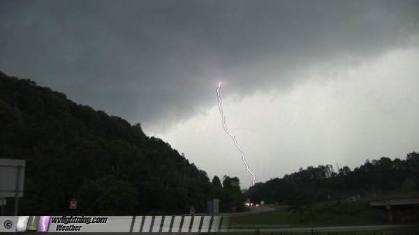
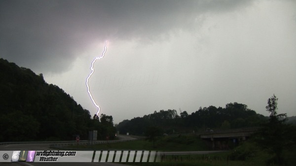
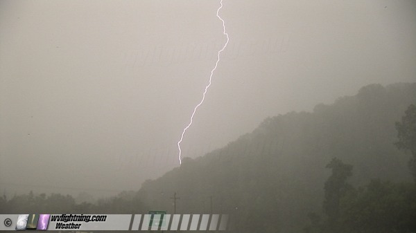
Some frame grabs from storm #3 in Charleston:
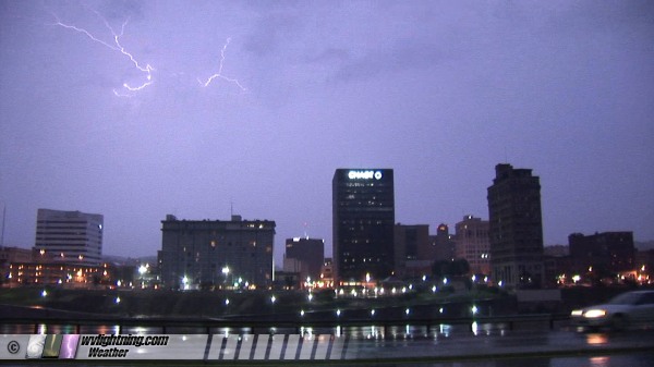
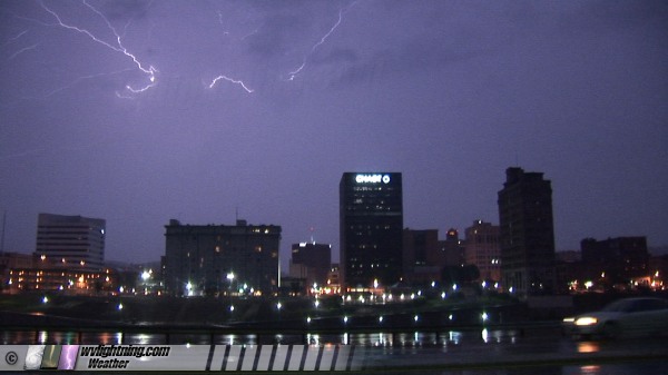
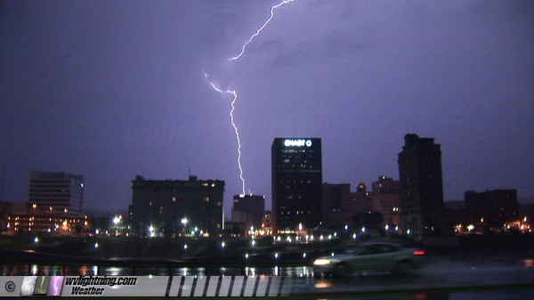
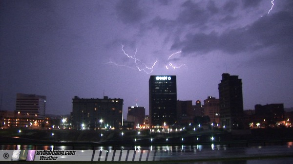
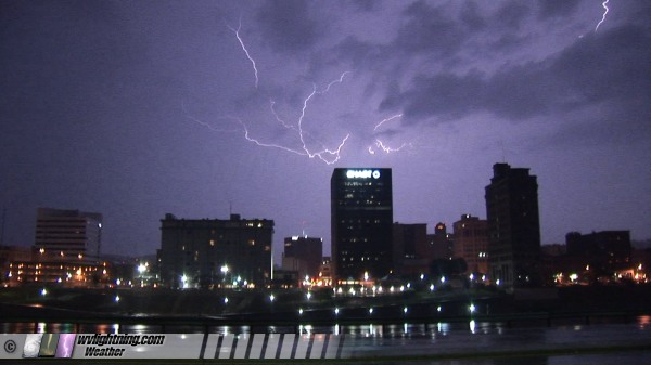
Finally, a few frames from the shelf cloud timelapse from storm #2 in Charleston:
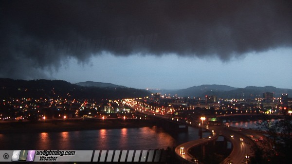
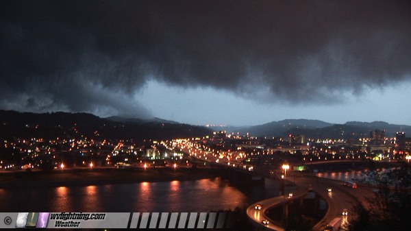
|