 Supercell spares central Missouri: Storm threatens with funnels, hail; stops short of tornadoes: June 13, 2005 Supercell spares central Missouri: Storm threatens with funnels, hail; stops short of tornadoes: June 13, 2005
ROLLA, MO - A supercell thunderstorm developed along Interstate 44 near the town of Rolla in central Missouri on Monday, June 13, growing into an impressive cell but not producing any significant severe weather of note. The following is a log of the day's chase. Photos may be enlarged by clicking on the thumbnail image.
I started the day in Wichita Falls, Texas on Monday morning and began the long trek home to West Virginia. I had a 10AM meeting in Charleston the next day which I had to make, which left me with no spare time to sightsee on the long drive, let alone chase. Any stops or delays today would just end up cutting into my already small window of time for a night's sleep on the way, which I had scheduled for on a short stopover in Louisville, Kentucky. So, I just grit my teeth and started heading north on I-44.
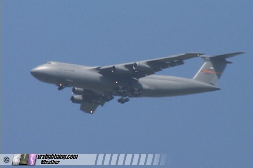
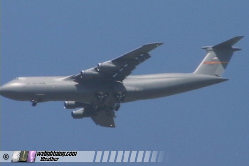
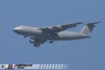
One sight of note was near Lawton, Oklahoma where a massive military cargo jet landing at a nearby base passed directly overhead. I stopped for a minute to get a couple shots of this impressive sight:
Video captures:
There was a significant tornado risk up in central Illinois and northeastern Missouri which I would not be able to make in time, but a smaller risk area extended down into Oklahoma and southern and central Missouri, where I would be traveling through. Again, I didn't have any time to really chase anything unless something popped up right on the interstate on the way. It turned out I was blessed with exactly that, a supercell that developed right beside me and tracked along the interstate in the direction I was already headed. So, the resulting 'chase' didn't cost me much travel time at all.
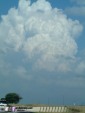
I encountered the first storms firing on the front between Tulsa and Joplin, mainly heavy rain and not much else. Since convection was starting, I fired up the WxWorx radar to keep an eye on things during the drive. I stopped for a quick data check at the Flying J in Springfield, MO to see that the Moderate Risk had been extended south to encompass my entire travel route through Missouri. East of Springfield, vigorous convection was trying to get established just south of I-44:
Digital photo:
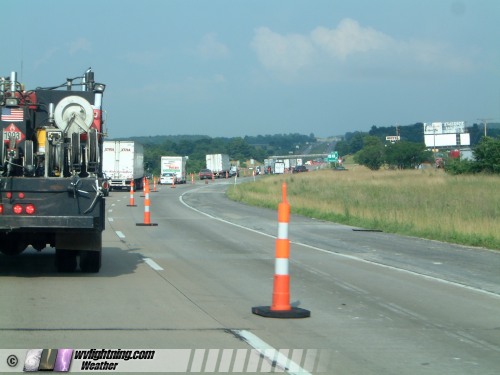
This activity never really could get established, and eventually fizzled. I kept heading east, eventually seeing that the storms behind me near Joplin were now getting quite organized, and eventually tornado-warned. But since I had no time, I couldn't turn around to go after them. There was a line of severe-warned convection a couple of hours ahead of me, and my only hope was to make it to St. Louis in front of them for some lightning shots over the Arch. Furthermore, my prospects for arriving in Charleston on time were being strained by numerous long stretches of construction:
Digital photo:

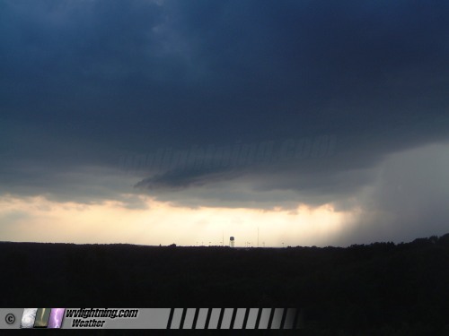
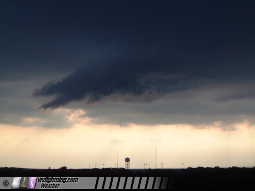
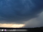
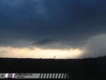
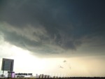
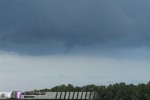
I simply was not going to have time to pay much attention to any storms unless one formed right on top of me. With the exception of activity near Joplin and Springfield, the convection that was occuring was not having much success in maturing anyway. So, I kept pressing on toward home. As I approached Waynesville, I noticed a respectable tower forming a few miles north of I-44. It quickly developed a large rain-free base and heavy precip core. I took the next exit and stopped to snap a few pictures. As I did, a lowering began to rapidly condense and began rotating slowly:
Digital photos:
Video capture:
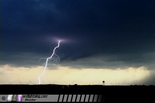
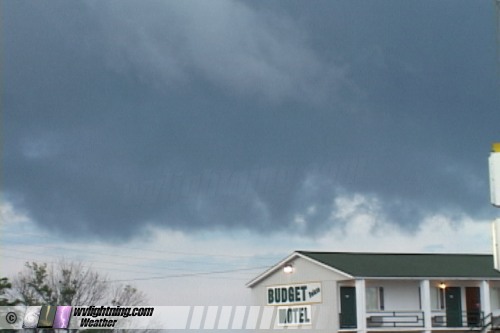
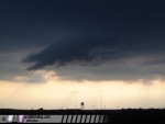
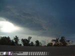
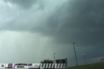
Lightning activity was becoming frequent inside the precip region, and smooth inflow banding begain to take shape to my south and east, curving into the storm's base. I was pretty happy to have this happen at such a convenient time and place. The storm was racing to the east, so I had to get back on I-44 quickly to keep up with it, exiting briefly every so often to keep watching the show. While the lowering/wall cloud feature had trouble maintaining its integrity, distinct clear slots/RFD cuts appeared every so often. The storm was severe-warned at this point. I took these photos along I-44 just west of Rolla:
Digital photos:
Video capture:
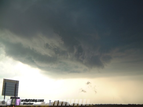
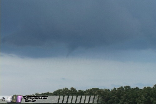
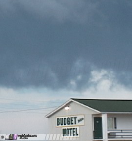
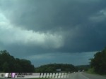
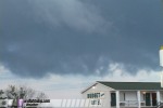
I exited again at Doolittle, just west of Rolla. At this time, the precip core was just north of I-44, encroaching over it several times. The rain-free base extended over and to the south of the Interstate. To my south, a distinct laminar funnel began to descend from the base:
Video capture:
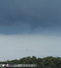
I grabbed the cell phone to report this to 911, but just as I did, a tornado warning was issued for the storm before I could make the call. Apparently the spotter network is alive and well in central Missouri! The funnel persisted for close to two minutes before dissipating. Once again I jumped on I-44 and moved east to stay with the storm. After passing through several rain curtains, another persistent funnel emerged directly over I-44 near downtown Rolla:
Video capture:
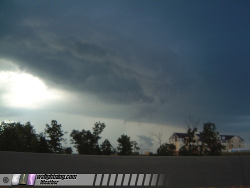
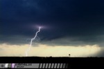
I exited the interstate to hear the sirens going off in Rolla. To the south, an ominous funnel appeared in the midst of a ragged-looking wall cloud:
Video capture:
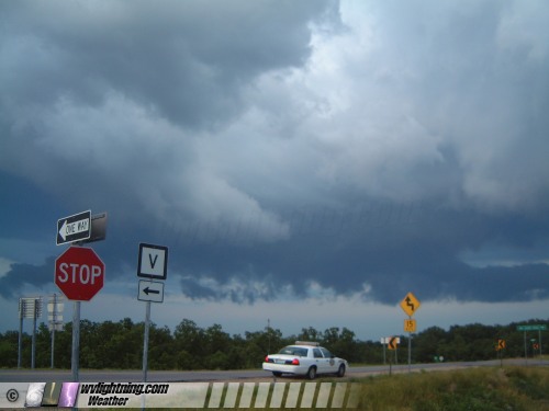
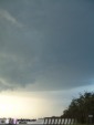
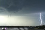
This feature dissipated after about a minute. The base/wall cloud was becoming increasingly disorganized. Rotation was never very strong or even that noticable. I ran into a few police cars and a couple spotters/chasers watching the storm east of Rolla:
Digital photos:

I stopped for too long here - the storm was really starting to get away from me now. I was puzzled at this, since radar showed it being right behind me. I eventually figured out that my radar images coming in were at least 25 minutes old! The storm was visually losing any supercellular features, and its precip core was now well over the Interstate to my east. Due to the delayed radar, futher road construction delays, and low visibility in the rain and hail, I never got back out ahead of the storm until after dark just outside the St. Louis city limits.
New severe convection was firing west of STL and approaching the city, but I had no time left to do any more chasing. My upcoming night's sleep was now reduced to just 3 hours due to all of the road construction and the brief chase in Rolla. I made it to Evansville, Indiana at 2AM, got a hotel room, and set the alarm for 5AM the next morning. This would make for a very short night's sleep, but would get me back to Charleston with only minutes to spare before my 10AM meeting.
I intended to use the next day to recover from this sleep-deprived marathon drive once the meeting was over. But it turned out that this same weather system, the one that gave me the tornadoes in Texas and the funnels in Missouri, would bring one more active storm chase day in West Virginia on Tuesday.
NEXT EVENT: Back in West Virginia for a show of tower lightning
Back to Storm Chasing Expedition 2005 Index
GO: Home | Storm Chase Logs | Photography | Extreme Weather Library | Stock Footage | Blog
Featured Weather Library Article:
|