
|
||||||||||||||
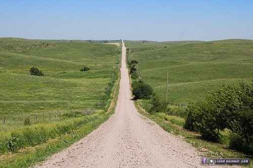
4K EXPEDITION VIDEO: 4-Way Dashcam Timelapse of the chase AURORA, NE - It's not uncommon in storm chasing to have a day that originally was your primary focus turn to junk as the event draws closer. Such was the case on Tuesday, June 13th. Models had been indicating an upper trough ejecting over a robust warm sector from the Dakotas down into Kansas, with the cap breaking virtually everywhere along a dryline in a strongly sheared environment, particularly in the northern section of the event. As the day approached, however, directional shear devolved into a mostly-unidirectional mess except way up in eastern Minnesota - much too far to reach after chasing Monday in far western Nebraska. GPS LOG: Click to view the GPS track for this chase I started the day in Sidney, and began the search for dry ice to replenish the hail cooler. The Safeway in town was completely out of it, and several other stores on the way eastbound also either were out of it or didn't carry it. The two blocks of dry ice I had picked up in Cheyenne looked like they still had several hours left, so I forgot about it for most of the day. Short-term models indicated a few supercells initiating near North Platte and moving northeastward. Accordingly, I chose to target central and southeastern Nebraska, a region that was basically on my way home from Monday's chase - instead of driving 2+ more hours farther north into South Dakota where parameters were slightly better for tornadoes. The storms essentially played out as the short-term models showed they would. I drove up to near Brewster to watch one of these storms approach, encountering this classic Nebraska scene on a gravel road on the way:
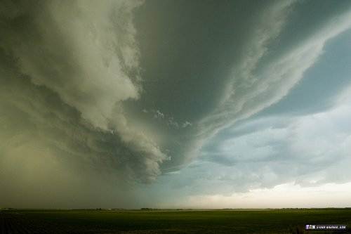
 Structure with the Brewster storm was interesting, but it was overwhelmingly undercut by its own outflow.
 Not seeing much of a reason to follow this storm north farther away from home, I dropped south to an area of towering cumulus near Grand Island. Models had shown storms firing in this area as well, though with even less favorable supercell parameters than farther north. The Grand Island area storms developed as I made my approach from the north. As expected, they were not much to look at when I arrived on them at Central City, aside from a tiered shelf cloud as the storms lined out.
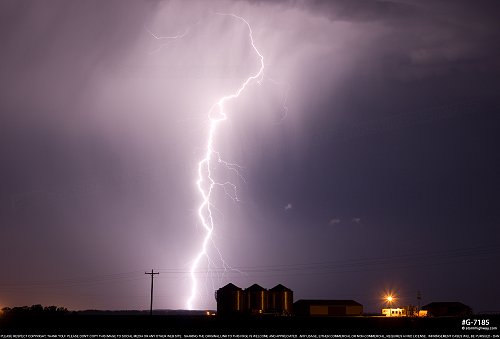
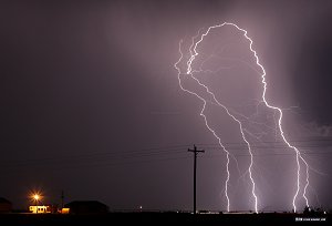
 Suddenly I remembered the hail in the cooler. I stopped to check it, and found that the dry ice was completely gone, and the hail was beginning to melt! So, my primary focus now was to find dry ice to save the hailstones. I called ahead to grocery stores in every town along the way - Aurora, York, Seward - no luck. I called all of the major chains in Lincoln - they too, didn't carry it. Finally, the last store I called - Hy-Vee in Lincoln - had some in stock. I was able to get two more blocks of dry ice, and ensure I'd be able to bring the hail home for photography later. Only two of the stones lost some mass from melting, the others thankfully survived the brief period without dry ice. After dark, new thunderstorms were firing just west of the Missouri River south of Lincoln. I stopped at Rock Port, Missouri and spent an hour or so trying for some lightning shots:
 Unfortunately due to the hail preservation crisis and the lightning photo session, I forgot to archive my dashcam video until I arrived at my hotel in St. Joseph, MO at 3AM. This meant that the first half or so of the daytime chase was lost, but thankfully there was nothing of real interest that happened during that period.
|
||||||||||||||


Web Site Design and Internet Marketing by CIS Internet