July 28, 2000
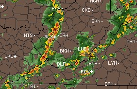
 Four strong lines of storms moved through southern West Virginia today, the first at 12:30am, then 11:00am, 3:00pm and 4:00pm. Four strong lines of storms moved through southern West Virginia today, the first at 12:30am, then 11:00am, 3:00pm and 4:00pm.
Cloud-to-ground lightning was close and frequent during these storms. Storm #1 occurred in the post-midnight hours, but fizzled out before I could begin taking photos. During storms #2, #3, #4 I was at work in Teays Valley, and I opted to use the video camera and bypass taking still shots due to the bright daylight conditions.
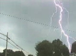
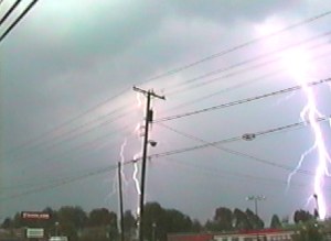
I missed all but one of the closest strikes. This one (at right) was a loud, single-stroke blast about 1/4 mile away, looking to the west during storm #3 (click photo for mpeg video, 95KB).
 Lightning in storm #4 (radar at left) became highly active after it passed to the east, of which I managed about 5 video catches. This multiple stroke flash (MPEG, 269KB) occurred in the eastern sky about 2 miles away, as well as this spectacular triple CG flash (MPEG, 312KB) to the southeast about a mile away (see frame capture below). Lightning in storm #4 (radar at left) became highly active after it passed to the east, of which I managed about 5 video catches. This multiple stroke flash (MPEG, 269KB) occurred in the eastern sky about 2 miles away, as well as this spectacular triple CG flash (MPEG, 312KB) to the southeast about a mile away (see frame capture below).

< Back
| View 1,609 storm chases: |
| by year: |
|
| by type: |
|
|
|
GO: Home | Storm Chase Logs | Photography | Extreme Weather Library | Stock Footage | Blog
Featured Weather Library Article:
|