
|
||||||||||||||||||||||||||||||||||||
[ 35mm slides from this storm ]
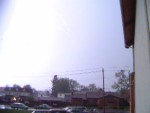
The Mountain State's summer-in-spring weather pattern continued Wednesday evening with a round of spectacular thunderstorms that developed around the Charleston and surrounding areas just before sunset. The storms hardly moved, and stayed very active well after dark, providing an abundance of photo opportunities for several hours - all with no chasing mileage required. The activity began around 7:00PM with several cells firing up in southern West Virginia from the Kentucky border all the way to Kanawha County. A cell drifted over Dunbar at 7:45PM, beginning with a heavy downpour that brought me outside during church to close the windows that I had left open in my truck. Seconds later, frequent cloud-to-ground lightning began to spark out of the cells. I grabbed the digital camera and took a few video clips for a couple of minutes before heading back inside. Below: Two clips of fairly close cloud-to-ground strikes in Dunbar, WV at about 7:45PM (RealVideo format - click photo to view):
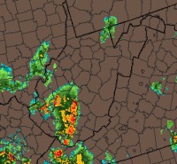
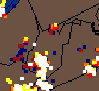
  (NOTE: The lightning in the above clips saturated the camera's exposure, making the flashes seem much brighter than they were in reality.) After church, bright flashes were still surrounding Charleston, and I spent the next 2 hours at home shooting the fireworks. Providing the slides come out, photos will appear on this site soon. Below: Doppler radar (left) and lightning strike data (right) at 8:00PM on Wednesday evening:
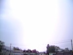
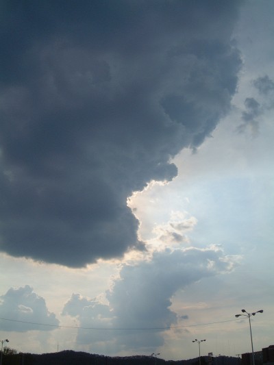
  Below: Rapidly developing Cumulus Congestus clouds begin to reach for the stratosphere above Dunbar at 6:00PM earlier in the afternoon:
GO: Home | Storm Chase Logs | Photography | Extreme Weather Library | Stock Footage | Blog
Featured Weather Library Article:
|
||||||||||||||||||||||||||||||||||||


 At Right: Cloud-to-ground lightning in Dunbar, WV on Wednesday evening.


Web Site Design and Internet Marketing by CIS Internet