March 29, 2002
|
My work is, at this very moment you are reading this, generating the most income it ever has in my career. Yet, I was forced to shut down the professional side of my successul operation, against my will, due to one cause alone: 95% of that revenue is being stolen by piracy and copyright infringement. I've lost more than $1 million to copyright infringement in the last 15 years, and it's finally brought an end to my professional storm chasing operation. Do not be misled by the lies of infringers, anti-copyright activists and organized piracy cartels. This page is a detailed, evidenced account of my battle I had to undertake to just barely stay in business, and eventually could not overcome. It's a problem faced by all of my colleagues and most other creators in the field. |
The unusually active pre-season continued with a cold front/low pressure combination that brought storms to the western half of the state.
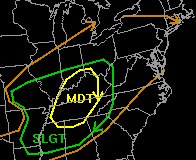
 The Storm Prediction Center's convective (severe thunderstorm) outlook (at right) for the evening was promising, with a significant moderate risk (yellow) zone just west of the Mountain State and a good chunk of West Virginia inside the slight risk (green) zone. A slight risk simply means that storms are almost definate for that area, with a 'slight' chance of encountering a severe storm (Moderate and High risk zones can be interpreted the same way, but are more serious). The Storm Prediction Center's convective (severe thunderstorm) outlook (at right) for the evening was promising, with a significant moderate risk (yellow) zone just west of the Mountain State and a good chunk of West Virginia inside the slight risk (green) zone. A slight risk simply means that storms are almost definate for that area, with a 'slight' chance of encountering a severe storm (Moderate and High risk zones can be interpreted the same way, but are more serious).
105-mile coalfield chase
At 6:30pm, radar showed two very intense thunderstorms in eastern Kentucky headed toward Mingo and Logan counties in West Virginia. I began the long drive south on Rt. 119 only to meet up with the remnants of the once-powerful storms at around 8:00pm at the Logan-Mingo county border just south of Logan.
The skies appeared quiet in the southern coalfields, but a radar-spotting call to fellow chaser Bill Coyle in Virginia Beach, VA brought news that a second line of storms to the west had intensified and was about to cross the border into western West Virginia.
Back to Kanawha County
Cloud-to-ground lightning began to peek out from behind the clouds as I passed the NWS NEXRAD radar dome at Southridge at about 9:00pm, and I decided to head over to Fort Hill overlooking Charleston to catch the line as it moved in.
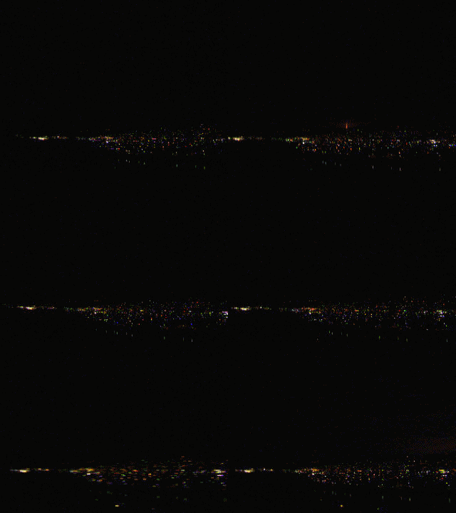
 Lightning was frequent in the distance as I set up the cameras on Fort Hill (see GIF movie at right), but cells to the southwest were approaching faster. I abandoned the north-facing view on Fort Hill for Spring Hill Cemetery's south-facing view just behind my house. Lightning was frequent in the distance as I set up the cameras on Fort Hill (see GIF movie at right), but cells to the southwest were approaching faster. I abandoned the north-facing view on Fort Hill for Spring Hill Cemetery's south-facing view just behind my house.
At right: Video of distant cloud-to-ground lightning in the northwest sky over West Charleston at about 9:15pm on March 29, taken from Fort Hill. (To conserve file size, this is a compilation of several clips- making the lightning seem more frequent than it actually was)
Too close for comfort
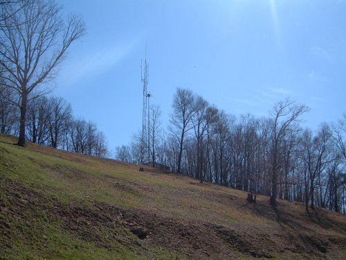
I huffed up the steep mountainside to the knob overlooking the city at the highest point on the ridge (conveniently about 500 feet from my back door). A small radio tower used by the airport (slightly taller than a large HAM radio tower) is perched atop the knob, and a clearing on the mountain's south face allows for a breathtaking view of the city below.
A small cell producing sporadic intracloud lightning flashes was directly overhead of me, but a stronger cell to the southwest was still firing off cloud-to-ground strikes every few minutes. Slowly catching my breath from the hike up the mountain, I set up the camera and aimed for a nice ground strike over the city.
But the cell overhead decided to change my plans. Just as a bright intracloud flash shot overhead, the tower next to me emitted a loud hissing buzz from its antenna, similar to the sound we heard from power lines in Oklahoma last year as anvil crawlers exploded overhead. Thankfully the tower didn't take a hit that time, but I wasn't going to wait around for the next one. That was the first time I'd experienced that phenomenon in West Virginia- and was about all the prompting I needed to head back to the house!
After that, the cells died quickly - within 20 minutes, the skies around the state were dark and quiet.
Below: The tower on the ridgetop in Spring Hill Cemetery. My setup location this night was about 20 feet or so to the left of the tower.

This location is highlighted in a segment on this site about the myth that 'lightning always strikes the tallest or most conductive object'. A tree just to the right of the tower (visible in the photo above) was struck by lightning several years ago, sustaining fatal injuries due to the resulting bark scars.
< Back
| View 1,599 storm chases: |
| by year: |
|
| by type: |
|
|
|
|
My work is, at this very moment you are reading this, generating the most income it ever has in my career. Yet, I was forced to shut down the professional side of my successul operation, against my will, due to one cause alone: 95% of that revenue is being stolen by piracy and copyright infringement. I've lost more than $1 million to copyright infringement in the last 15 years, and it's finally brought an end to my professional storm chasing operation. Do not be misled by the lies of infringers, anti-copyright activists and organized piracy cartels. This page is a detailed, evidenced account of my battle I had to undertake to just barely stay in business, and eventually could not overcome. It's a problem faced by all of my colleagues and most other creators in the field. |
GO: Home | Storm Chase Logs | Photography | Extreme Weather Library | Stock Footage | Blog
Featured Weather Library Article:
|