|
Home | Blog Index | Blog Archives | Christianity & Faith Essays | Storm Chasing Essays
Winter storm of Wednesday, February 20 - updates
This is an ongoing blog post about the current storm affecting the Ohio Valley and Appalachian regions. New updates are listed first.
Update: 11:51AM Wednesday: And with that, part 1 of this storm is done. Most of the snow fell north of Charleston, sparing the metro from any major slick road problems. As you can see on the ground camera, we barely ended up with a quarter of an inch here in town. I'm driving to the Pittsburgh area later this afternoon, so I'll be able to see the accumulation gradient heading northbound on I-79 - which judging from radar returns, should peak somwehere between Wallback and Flatwoods. Despite the storm being a non-event, I did pick up a video assignment this morning from it, which made keeping an eye on things since last night worthwhile. Tomorrow's ice/snow event (round 2 of this storm) looks to get going around sunset, peaking during the overnight hours just before temperatures rise quickly above freezing toward dawn.
Update: 6:01AM Wednesday: Light snow has started falling in Charleston. The Ohio traffic site shows that roads are already covered in Cincinnati and much of the southern part of the state.
11:32PM Tuesday: The 00z model runs are in good agreement in bringing the clipper through by sunrise and peaking the snowfall rates by noon. Both the NAM/WRF and the GFS forecast that temperatures will remain at or below freezing for the entire day, which will maximize accumulations. Radar shows that the system's precip shield is in Illinois and Indiana at this time, and starting to nose into northern Kentucky. Very dry air at the low levels will hold off the onset of snow initially, evidenced by the fact that Louisville and Lexington are not yet reporting snow despite radar echoes overhead. Despite the models' timing suggestion that snow will not begin in Charleston until dawn, I wouldn't be surprised to start seeing snow much earlier based on current radar trends. Charleston may very well see as much as 5 inches on the ground by tomorrow evening if the temperatures stay below 32F as the models advertise.
As for the roads, I think that the more dangerous bridges-only icing scenario will be avoided due to the fact that our temps have been near or below freezing for the past 36 hours. That should have given the ground enough time to cool off to the point that snow will likely stick everywhere tomorrow. This will limit the accident potential at bridges due to the element of surprise being removed from the equation, however the roads in general will be a problem throughout the day. At any rate, I expect the morning rush to be a mess with schools closed across the region.
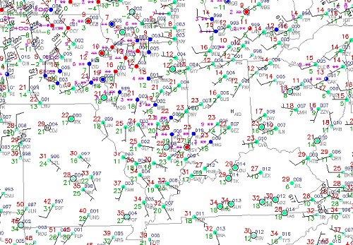
observations at 11:32PM (click for current map)
|


