| Home | Blog Index | Blog Archives | Christianity & Faith Essays | Storm Chasing Essays
Storms over the Coalfields
HD EXPEDITION VIDEO: Lightning over southern Mingo County, WV
Yes, finally some storm photos for a change - at least I think that's what this site was supposed to be about. A fairly mediocre chase this afternoon, but it was good to see some visible lightning again after nearly a month. I would not have normally driven as far as I did today for storms of this caliber - but with the strong upper level trough over us, we had nice lapse rates (thanks to very unseasonably cold air aloft), some good low-level instability and notable deep-layer directional shear profiles - which brought a small tornado / cold air funnel risk to the region.
I saw nothing of that nature today (funnels or even storm structure). The most active area was down in the southern coalfields, around the Logan/Williamson/Paintsville vicinity. So, the chase route was 119 south to the Kentucky state line - all the way to the tiny Appalachian coal town of Nolan (Mingo County), where I finally gave up on the funnels and set up for lightning along the Norfolk Southern (former N&W) mainline. I ran both HD video and reaction-based stills. Two trains passed in the 25 minutes I was there. I was hoping to get a lightning shot with locomotives - which I actually came within about 8 seconds of getting (watch the video), instead catching the anvil crawler over the passing hopper cars just behind the engines (first image below).
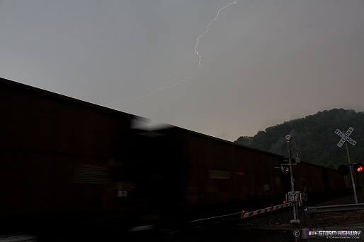
click to enlarge
While most of the discharges I saw were pretty meager, there was one spectacular and complex sky-filler that I missed on the DSLR by a fraction of a second (you can hear the shutter opening too late on the video). I included a slow-motion replay on the video clip that shows the progression of the flash - there is a CG ground connection in the middle of it all. Here are a few grabs from video:
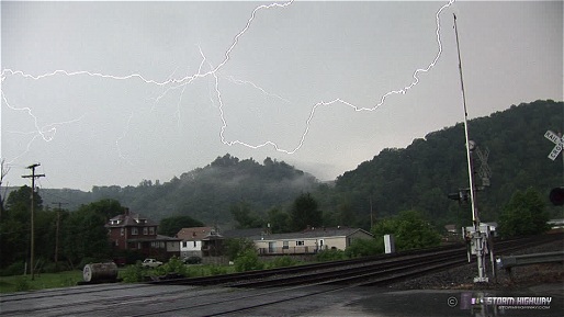
click to enlarge
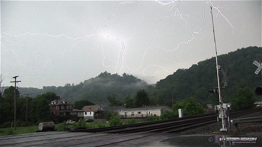
click to enlarge
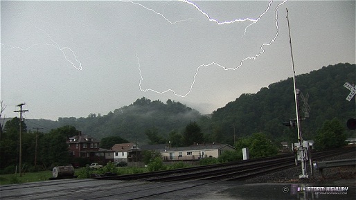
click to enlarge
As this batch of storms faded, another complex of convection fired to the northeast in Nicholas and Fayette counties on what looked like a boundary from earlier activity. They remained fairly stationary through sunset. Since I expected them to die off quickly, I didn't go after them - opting instead to shoot the distant lightning from ridgetops in Boone and Kanawha counties along Route 119 on the way home.
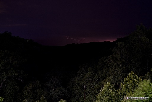
click to enlarge
|


