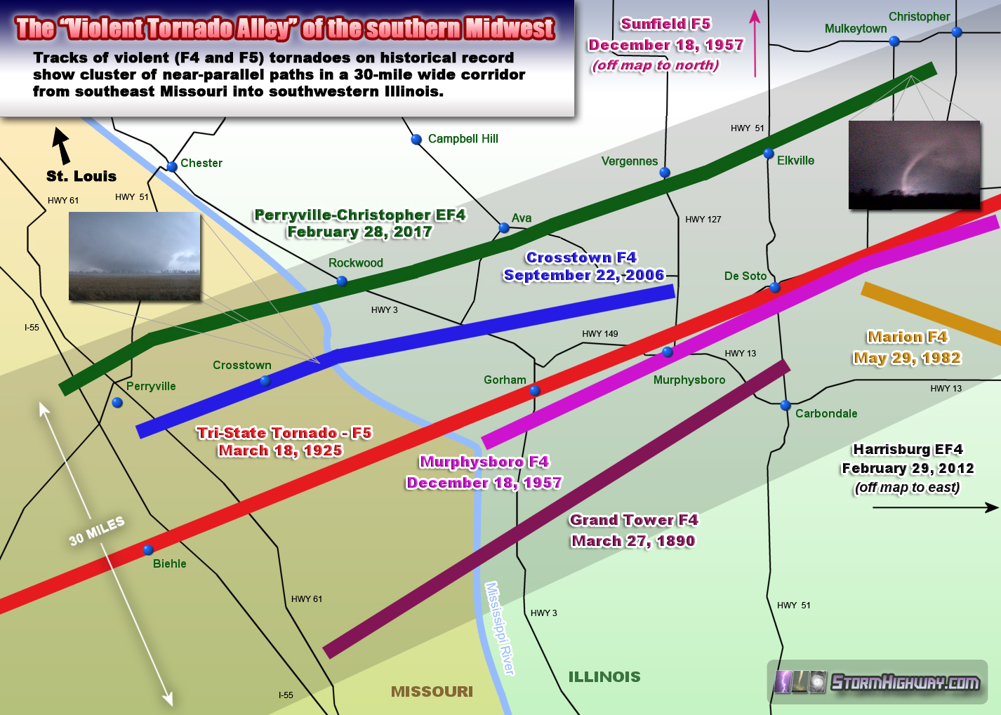
| It's also interesting to note that these tornadoes all occurred in dissimilar synoptic environments, with many happening outside of the peak severe weather season. The Tri-State Tornado, for example, formed from a supercell essentially riding near the center of a surface low tracking across the region, while the 2006 and 2017 events were far removed from the surface low in the southern portions of a larger outbreak. The dates of each of these events reiterates the fact that the Midwest has no tornado "off season" - the threat can materialize at any time of year and at any hour of the day or night.
Notice that the track of the Tri-State Tornado of 1925 is in the center of this corridor. In fact, if I were to a.) extend this map farther to the northeast into southern Indiana, covering the entire length of the Tri-State Tornado track and b.) expand the corridor width to 70-100 miles, I could include many more historical violent tornado tracks including the February 2012 Harrisburg, IL EF4, the December 1957 Sunfield, IL F5/Mount Vernon, IL F4 and the June 1990 Albion, IL F4 - all of which followed similar trajectories to the east-northeast as the tracks shown here!
I witnessed two of the events shown on this map, the Crosstown F4 in 2006 and the Perryville-Christopher EF4 of 2017:
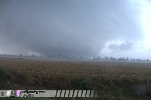
Crosstown, Missouri F4 tornado - September 22, 2006
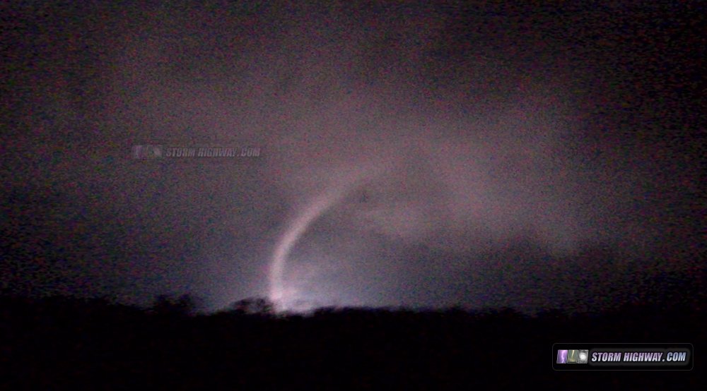
Christopher, Illinois EF4 tornado - February 28, 2017
GO: Home | Storm Chase Logs | Photography | Extreme Weather Library | Stock Footage | Blog
Featured Weather Library Article:
|