|
Home | Blog Index | Blog Archives | Christianity & Faith Essays | Storm Chasing Essays
December 2021 - January 2022 Storms and Weather Roundup
Winter was non-existent in the lower Midwest for November and December 2022, but returned with a volley of events during the first week of 2022. Here's a roundup of trips and events chased during December of 2021 and January of 2022.
 December 1 to ?: Low water levels on the Mississippi River December 1 to ?: Low water levels on the Mississippi River
The prolonged inactive weather in the Midwest through much of the fall resulted in the Mississippi River reaching very low water levels. On December 1, the river was just above the zero-foot stage, about 6 feet from the record of -6.10' set in 1940. I took some photos from the Eads Bridge and assembled this animation comparing the low water levels with the near-record crest of 45.9' during the June 2019 flood:
The low levels have continued into 2022, with the river fluctuating above and below the zero mark into the first week of January. With the upstream watershed solidly in subfreezing temperatures, these levels may continue to drop until spring.
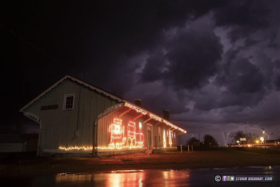
 December 6: Thunderstorms in southern Illinois December 6: Thunderstorms in southern Illinois
A flurry of lightning-active storms developed east of St. Louis. I followed them from home all the way to McLeansboro, Illinois with the primary objective of capturing photos and videos of lightning with Christmas decorations. The best of these was this image of the Dahlgren, Illinois train station, followed by video of lightning and thunder above the holiday displays at McLeansboro:
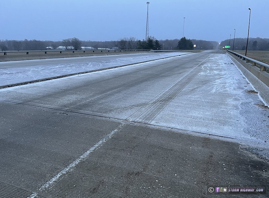
 December 7: Snow in southern Illinois December 7: Snow in southern Illinois
A very light snow event materialized this evening east of St. Louis, creating a few icy bridges along I-64 west of Mount Vernon.
I observed a nighttime EF-3 tornado crossing Highway 40 (I-64) in Chesterfield in the western St. Louis metro area. This event has its own page here.
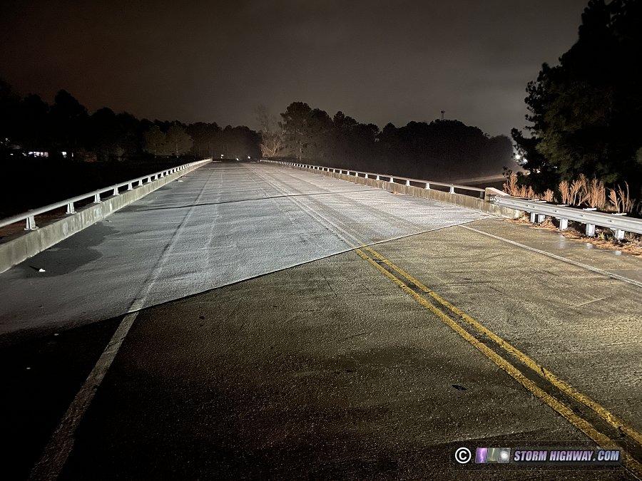
December 20: Freezing (river) fog bridge icing event in St. Louis
The only icy road event of November and December of 2021 in St. Louis came as a complete surprise. I awoke at 4AM to find heavy frost and rime ice on trees, grass and my car. Thinking that bridges might be able to ice, I checked the traffic maps to see that those very impacts were in progress in St. Louis at almost every bridge along the river valleys. I did not make it in time to capture any footage of the many accidents and spinouts that occurred on the highways in these areas. I took a few shots of the rime ice on bridges that caused the problems.
 January 1: Missouri freezing rain and freezing drizzle January 1: Missouri freezing rain and freezing drizzle
After its absence in November and December of 2021, winter finally flipped its switch to the "go" position in the Midwest on the first day of 2022. I spent Christmas with my family in the Pittsburgh area, and I left late on the 30th to get home in time to rest up for the event on January 1. I awoke minutes before 2022's arrival at midnight, heading west to start the new year with a long day covering the winter storm moving across Missouri. I began in Kansas City, staying with the zone of freezing rain eastbound all the way to St. Louis. Road treatment kept this event's impacts to a minimum until the colder air moved in late during a period of freezing drizzle. I captured some footage of vehicles sliding in Columbia from this, then spent a few hours monitoring the St. Louis metro for any problems.
January 2 & 3: Northern Alabama snow
Winter precipitation in the southern states is a must-be-there thing for me, so only 12 hours after ending my January 1 trip, I was back on the road south to cover what models had suddenly started showing as a potent snow event in northern and central Alabama. I encountered the first flakes in Clarksville, Tennessee just after sunset and hit the heaviest band and the resulting road impacts south of Nashville, about 20 miles from the Alabama border.
I exited the heavy snow band south of Cullman and continued to Birmingham, where snow had coated the grass and some of the roads. Temperatures of 35°F in this area quickly melted any snow on the pavement, so I turned around and headed back north to Huntsville where the heavier snow amounts seemed evident.
I spent the rest of the night driving around the Huntsville area monitoring the road conditions. The worst were on the city's elevated highways, but police had shut down Route 231 both north and south, limiting the traffic numbers. The bigger story was the power outages caused by the snow-laden tree branches bending and breaking. The city's night sky was alight with power flashes like you'd see during an ice storm. I captured a few of them on my dashcams:
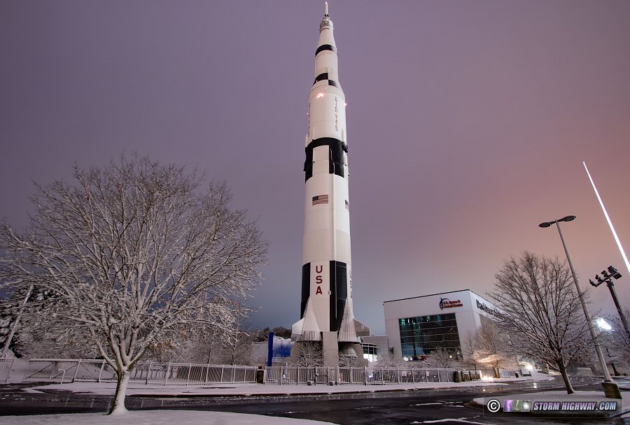
I stopped at the U.S. Space and Rocket Center to grab a few shots of the Saturn V rocket (Apollo moon missions) in the snow:
January 6: Mississippi River valley winter storm
Yet another storm meant my third major winter weather trip in 6 days. I had two potential targets for high road impacts in mind for this system: here at home in St. Louis for a very light snowfall event, and down in the Memphis area for freezing rain. Leading up to the event, models progressively lowered the snowfall amounts in the St. Louis area and kept moving any impacts well south of the metro. When I awoke to leave for the event before midnight, radar showed the mass of snow in western Missouri shifting southeast, seemingly confirming the model trends. At that point, I made the choice to head for Memphis.
I arrived in the Memphis area at 4AM to find icing already in progress along I-40 from rain showers that were rapidly wet-bulbing the air temperature down to the freezing mark. I spent the next few hours monitoring conditions around the metro area on both sides of the river, but Arkansas and Tennessee DOT crews had a good handle on treatment efforts. At the same time, a rogue snow band formed over St. Louis in defiance of model forecasts and began causing impacts in the southern metro area.
Finding no problems of note from the freezing rain in the Memphis area, I decided to head back toward home and investigate the area of heavier snow that was getting started between Terrill, AR and Cape Girardeau, MO. I encountered rapidly deteriorating conditions on I-55 from Blytheville northward into the Missouri bootheel, and started seeing significant impacts from accidents between Portageville and Sikeston. I stopped a few times to shoot "compression zones" where fast-moving traffic was encountering the backups from previous accidents, at Sikeston capturing a 3-semi chain reaction crash and a camper trailer sliding into a semi and then off the road:
I managed to not get stuck in the ensuing closures of the interstate by staying on the parallel county/frontage roads, making it home by late afternoon.
January 8: St. Louis metro freezing rain
St. Louis was mostly spared from what could have been a significant event this day. The forecast freezing rain began developing right over the city at around 9AM, only becoming heavy enough for severe icing problems after crossing the river into Illinois. This confined most of the problems to the northeastern side of the metro area. I monitored this activity from Clayton to Staunton, capturing a few shots of the textbook "black ice" on rural roads north of Livingston:
January 14-15: St. Louis snow
The models were all over the place in the days leading up to this event, so I wasn't sure if I was going to be staying in the St. Louis metro or driving down to the deep south (Mississippi to Georgia) to cover the snow there. Within 24 hours of the event, models finally settled on a solution that featured mostly borderline-freezing temperatures from the Midwest through the South, with the exception being the cold air-damming zone just east of the Appalachians from South Carolina northeastward. Any areas that did make it below freezing would only do so briefly due to dynamic cooling in the precipitation itself, with no cold advection bringing any reinforcing subfreezing temperatures. I felt that this would limit the impacts of the event both in St. Louis and in the South, again with the exception of the Columbia-Charlotte corridor in the Carolinas. The region of impact in the Carolinas is a little more prepared for this type of event, and with the very long drive needed to get there and back, I chose to stay home.
I went out at 6PM Friday night to begin covering the event in the St. Louis metro, staying out all night and making it home mid-morning on Saturday. As expected, the road impacts in the metro were very few thanks to the temperatures remaining above freezing during the entire event. No footage captured. January 16: St. Louis snow
A brief band of snow was shown by models to accompany a shortwave disturbance moving across the Midwest on Sunday evening, with precip amounts right on the edge of what is capable of producing road impacts. I monitored the conditions in the city as the band moved through after 8PM. While isolated, some very slick conditions did occur in spots, causing several major accidents - namely on I-70 to the north of downtown and on I-44 downtown right next to the Arch. No footage captured.
January 19: Perryville/Cape Girardeau, Missouri snow
I departed this Wednesday to head down to either New Orleans or Atlanta to cover the expected winter storm in the South. On the way, I would encounter a snow event in southeastern Missouri, which I spent a few hours chasing between Perryville and Cape Girardeau. The only hazardous road conditions I chased were in Cape Girardeau and directly across the river into Illinois. No footage captured.
January 20-22: North Carolina winter storm trip
As mentioned in the previous entry, this trip began on the 19th. I originally expected to be going to either New Orleans or central Georgia to cover freezing rain that models had been persistent in showing for those areas for Friday the 21st. Within 24 hours of the event, all models had backed off of the precipitation in both areas, instead focusing the entire event in the eastern Carolinas. After finishing with the snow in Missouri on Wednesday afternoon, I was heading southeast toward North Carolina.
I began covering the event in Tarboro, North Carolina on Thursday night, staying with the freezing rain zone southward to Wilmington into the early morning hours. Thanks to diligent road treatment by NCDOT crews, I found no problems. After a brief nap during a lull in the precipitation on Friday morning, I headed north to Raleigh to chase the snow getting started there by late afternoon. I made my way south to Fayetteville, noting a few icy bridges, but finding no significant problems.
With the precipitation shield (snow) now backbuilding westward, I returned to Raleigh for the rest of the event, rolling video at several locations until mid-morning Saturday. I captured no footage. I arrived back home on Sunday afternoon.
January 27: Light snow icy roads in St. Louis
I woke up at 2AM to go out and chase a minor snow event models had been showing for the St. Louis metro area for the morning hours. Amounts were very light, but I felt that it might be enough to cause road issues. Snow did not begin until after 6AM, and most of the region was spared from impacts. The exception was the northeastern metro from Florissant to Alton, where some isolated high-impact icing did occur. I captured this footage on Highway 367 southbound at Florissant:
January 28: St. Louis light snow
Another day with some light snow showers moving through the region. I was in the middle of a long two-day work period with two of my other jobs, so I was not able to do much with this event. I went out for the second round of snow bands moving through the city, but no road problems were encountered. No footage captured.
That covers events through the first month of the year. Stay tuned for more of what 2022 weather has in store!
< September-October 2021 Recap | All Storm Chase Logs | February 2022 Recap >
GO: Home | Storm Chase Logs | Photography | Extreme Weather Library | Stock Footage | Blog
Featured Weather Library Article:
|


