 Lightning show in northwestern Oklahoma: Tornado-producing storms in Texas move north, put on light show: June 11, 2005 Lightning show in northwestern Oklahoma: Tornado-producing storms in Texas move north, put on light show: June 11, 2005
EXPEDITION VIDEO 1: Lightning barrage near Fort Supply
EXPEDITION VIDEO 2: 60mph winds in Woodward topple plants
FORT SUPPLY, OK - Supercells broke out once again on the Plains, continuing the active string of severe weather days during the second week of June. The following is a log of the day's chase. Photos may be enlarged by clicking on the thumbnail image.
Kurt Hulst and Nick Grillo had been riding in my car with me during the past week of chasing to share fuel and hotel expenses. We had left Kurt's car safely parked at Pete McConnell's house in Hastings, Nebraska earlier in the week. Now that the main storm season appeared to be wrapping up in the next few days, we decided to make the trip north to get Kurt's car, as I'd need to start heading back to West Virginia by Sunday night. Saturday the 11th and Sunday the 12th both looked like good storm chase days, so we'd have to miss one of them to go to Nebraska. We picked Saturday as the day to miss, and on Friday night began the long trek to Hastings, stopping overnight in Russell, Kansas.
We started the day driving north out of Russell, and after several hours made it to Hastings. I got an oil change in town while Kurt and Nick loaded up their vehicle, and we started back south to position ourselves for the setup taking shape in Texas on Sunday. On the way, we passed through damage swaths from the June 9 storms, chasing extensive straight-line wind damage in Red Cloud, Nebraska as well as damage in Stockton, Kansas from the tornadoes we'd seen just two days earlier:
Digital photos:
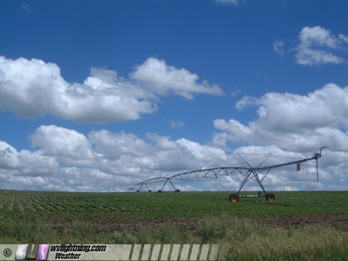
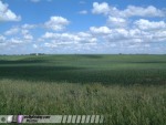
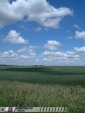
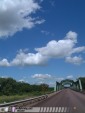
In Nebraska and northern Kansas, we were north of a frontal boundary, with crisp blue skies, puffy cumulus and crystal-clear visibility making for some great scenic photo opportunities:
Digital photos:
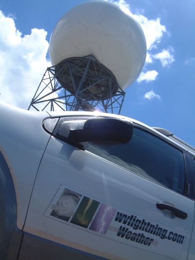
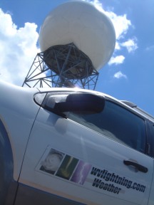
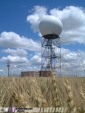
We also stopped for some shots of a NEXRAD radar dome in the wheat fields south of Hastings.
Digital photos:
As we traveled southbound through Kansas during the late afternoon, we could see tornadic supercells in progress near Amarillo, Texas on the WxWorx display. We initially regretted choosing this day to retrieve Kurt's car as we watched the storms go crazy in the Texas panhandle. I say initially, because later I was glad we didn't choose the 12th to go to Nebraska, or we would have missed the even more spectacular tornadofest in north Texas on Sunday.
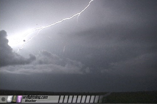
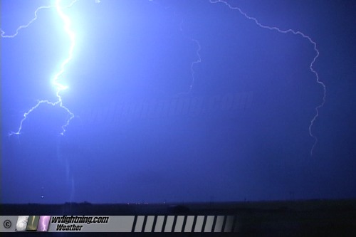
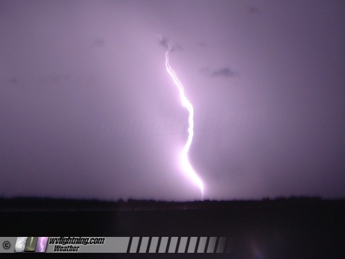
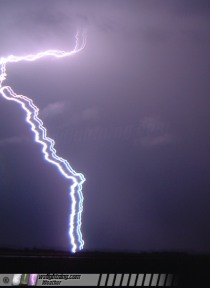
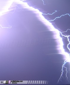
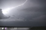
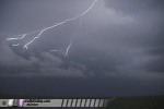
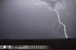
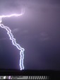
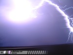
At a data stop in Dodge City, we discovered the potential for the Texas storms to rapidly build northeastward along the boundary into northwestern Oklahoma. So, we decided to keep pushing south to hopefully bag some lightning shots after dark. Near Laverne, OK, we met the developing line of storms and stopped for some lightning photography:
Video captures:
While we stood outside taking pictures, we could hear a mysterious high-pitched hissing-squealing sound coming from somewhere. We tried to identify it, thinking it was a mouse or some creature in the weeds, but never could find the source of the sound.
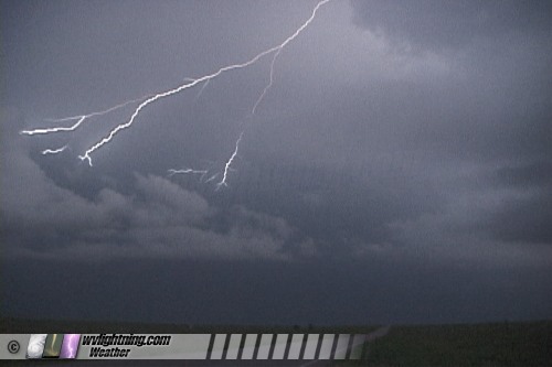
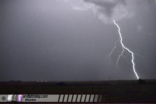
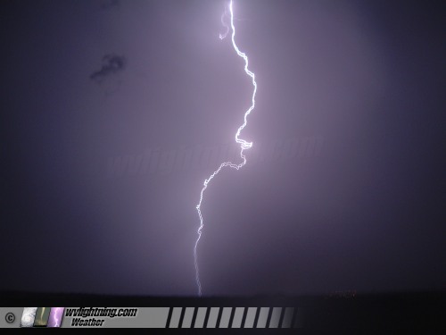
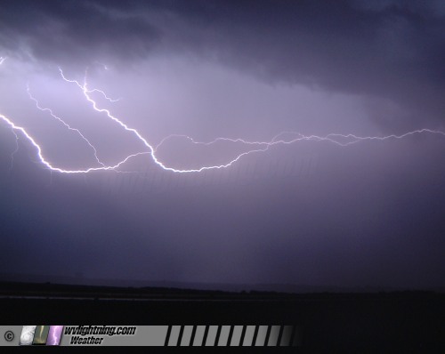
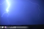
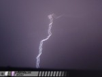
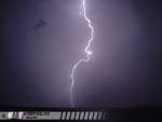
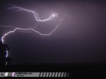
Once the rain started to pick up, we decided to head to Woodward to get a hotel room. As we drove, lightning activity picked up significantly, and I couldn't resist the opportunity. Kurt and Nick drove on to Woodward, and I stopped just outside of Fort Supply to set up all of my cameras to record the great lightning show. I had four cameras running - two video cameras covering two different areas of sky, a 35mm SLR taking long slide exposures, and my digital point-and-shoot which I tried a unique method of lightning photography (explained below). My slides will eventually be developed and posted here in the near future.
Video captures:
 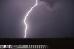 
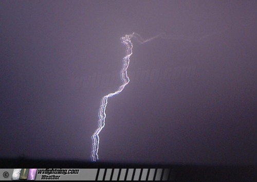
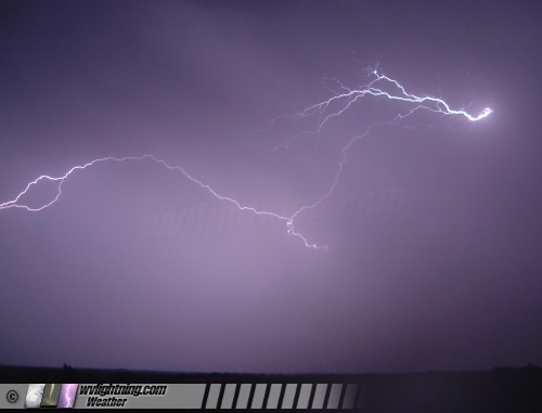
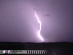
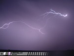
With the handheld digital camera, I decided to experiment with 'streak photography' of the lightning strokes. Streak photography involves moving the camera horizontally in a quick, sweeping motion while taking the picture. This results in the numerous return strokes of the lightning flashes being exposed side-by-side, so the time-resolution of the individual strokes can be recorded on the image. My digital camera unfortunately did not offer long-exposure capability, so I had to react to the bolts by hitting the shutter when I saw the flashes. This would be quite tedious with a normal storm, but the lightning was so frequent and plentiful this night that it was pretty easy to grab a few shots this way:
Digital photos:
Around 11:30PM, I ran out of slide film and digital memory, and the lightning was cycling down temporarily. Besides, I'd literally been driving for two straight days, and I needed some rest before our chase in Texas tomorrow. So, I pulled out on the highway to head to the hotel in Woodward. Immediately, I found out what that mysterious hissing sound was that we'd heard earlier. Now the sound I was hearding was the dreaded 'thumpity-thumpity-thumpity'. The right rear tire had gone flat while I photographed the storms.
I was between thunderstorm cells when I started changing the tire. I heard thunder to the south getting closer, so I figured I had some time before I got drenched. I got the first three lug nuts on the spare when very close cloud-to-ground strikes suddenly started exploding around me. It was crazy, so much so I had to take shelter in the car for 10 minutes. Eventually I got out and quickly pre-tightened the lug nuts, then drove slowly down the road until I was under high-tension power lines. Using the power lines as my lightning protection, I finished tightening the lugs and limped on to Woodward.
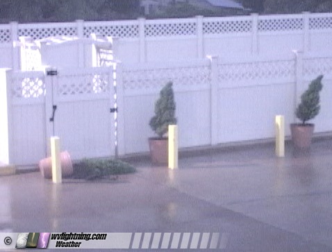
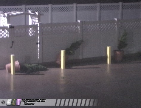
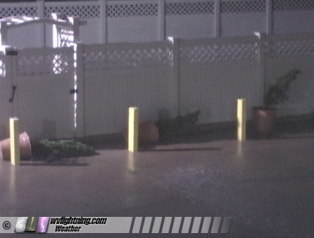
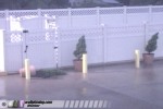
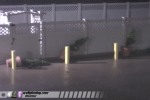
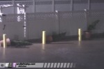
Back at the hotel, I got some hurricane-like video of the now-severe storms crashing through town, with potted plants blowing over in the +60 mph winds:
Video captures:
I was worried about finding a place to fix my tire on a Sunday in a small Oklahoma town, on the day of a big chase. But I'd have to worry about that in the morning, for now I needed to get some rest. Sunday looked to be a potentially great storm chase day.
NEXT EVENT: Tornadofest in Kent County, Texas
Back to Storm Chasing Expedition 2005 Index
GO: Home | Storm Chase Logs | Photography | Extreme Weather Library | Stock Footage | Blog
Featured Weather Library Article:
|