| Home | Blog Index | Blog Archives | Christianity & Faith Essays | Storm Chasing Essays
High-resolution radar of Midwestern supercell events
Having recently discovered the ability to download and view archived high resolution Dual-Pol Level II radar on the NOAA NCDC web site, I have been compiling data on some recent Midwestern supercell and tornado events. I put these together in 'infographic' format so that the imagery of the tornadoes accompanies the radar data (both base reflectivity and radial velocity).
Click on any of these to open in full size. These are very large images that when viewed at 100%, you will need to scroll right, left, up and down to view their entire content. I elected to do it this way to preserve the detail in the radar imagery while keeping everything in one image. If your browser automatically sizes these down to fit your window, you might have to click the image again to get it to go to 100%.
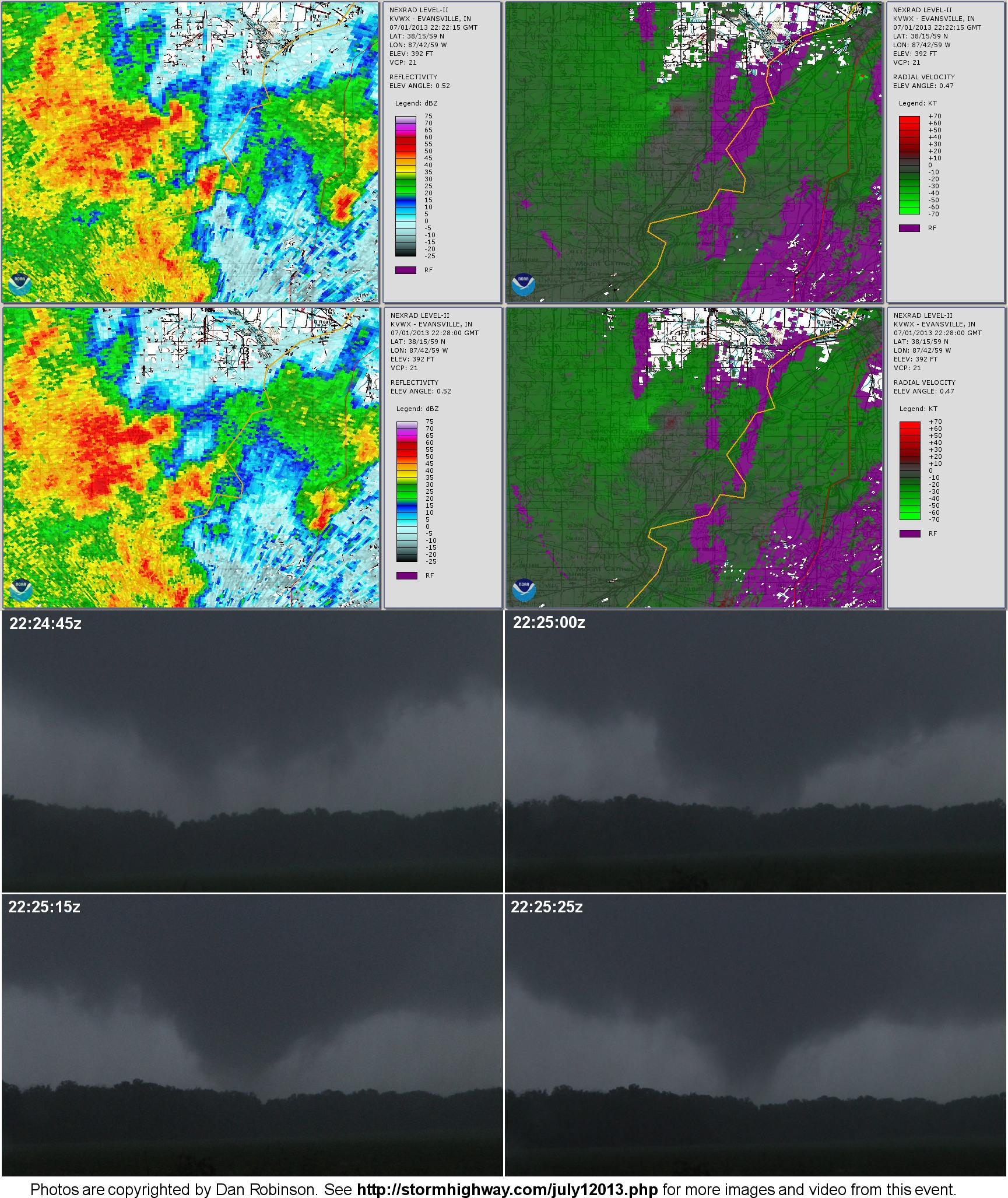
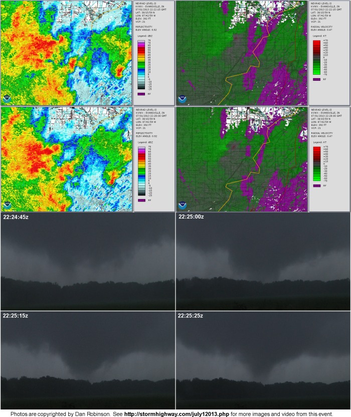
July 1, 2013 Saint Francisville, Illinois tornado
This is the most unusual supercell I've ever witnessed. It was flipped 180 degrees from 'normal', and was moving west inside the core of an well-defined MCV. Surface inflow was from the north, and the 'hook' of the storm was on the north side. I also viewed the tornado from the north side of the storm, looking south. [ Read the chase log from this day ]
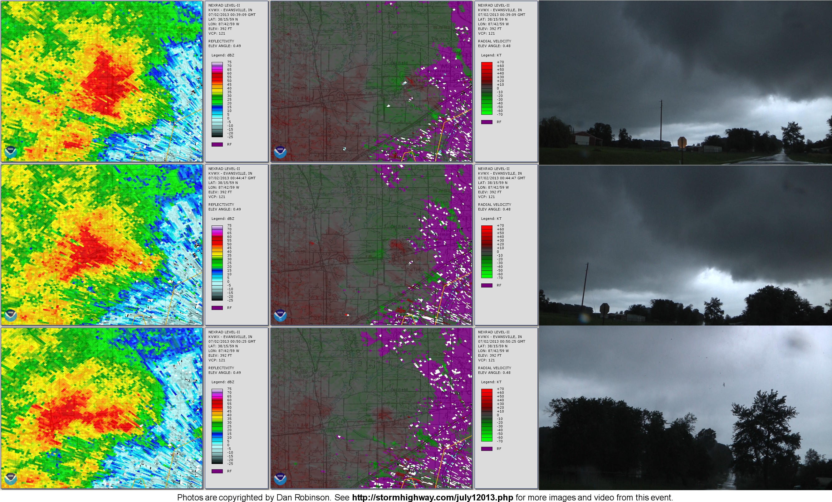
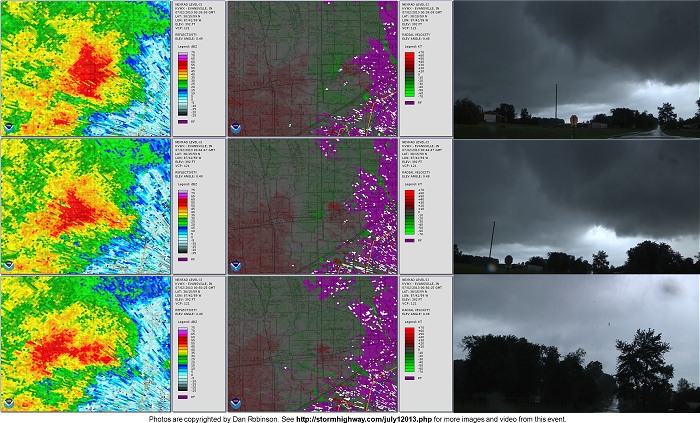
July 1, 2013 Bellmont, Illinois tornado
This is the third of the three tornadoes I saw on July 1. This supercell's inflow was more northeasterly, but the structure was still flipped almost 180 degrees from normal, with the tornado on the northeast side of the storm. Like the first storm and tornado, everything was moving westward. [ Read the chase log from this day ]
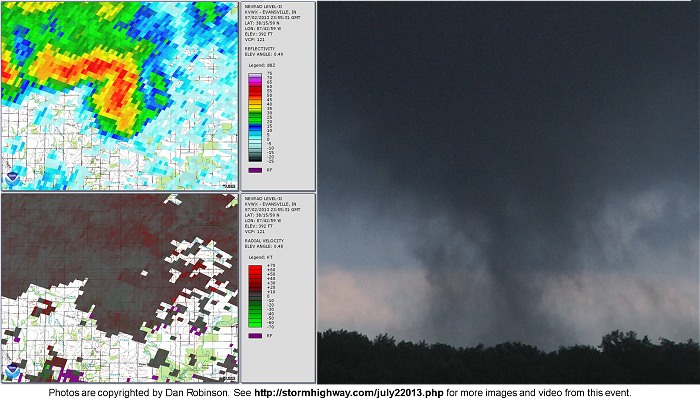
July 2, 2013 Geff, Illinois tornado
The same MCV that produced the July 1 tornadoes remained almost stationary, and presented a very similar setup on July 2 as the previous day - although with much weaker instability. This storm that produced the very weak Geff tornado was moving north, with southwesterly inflow and the tornado on the southwest side of the storm (a more normal orientation). [ Read the chase log from this day ]
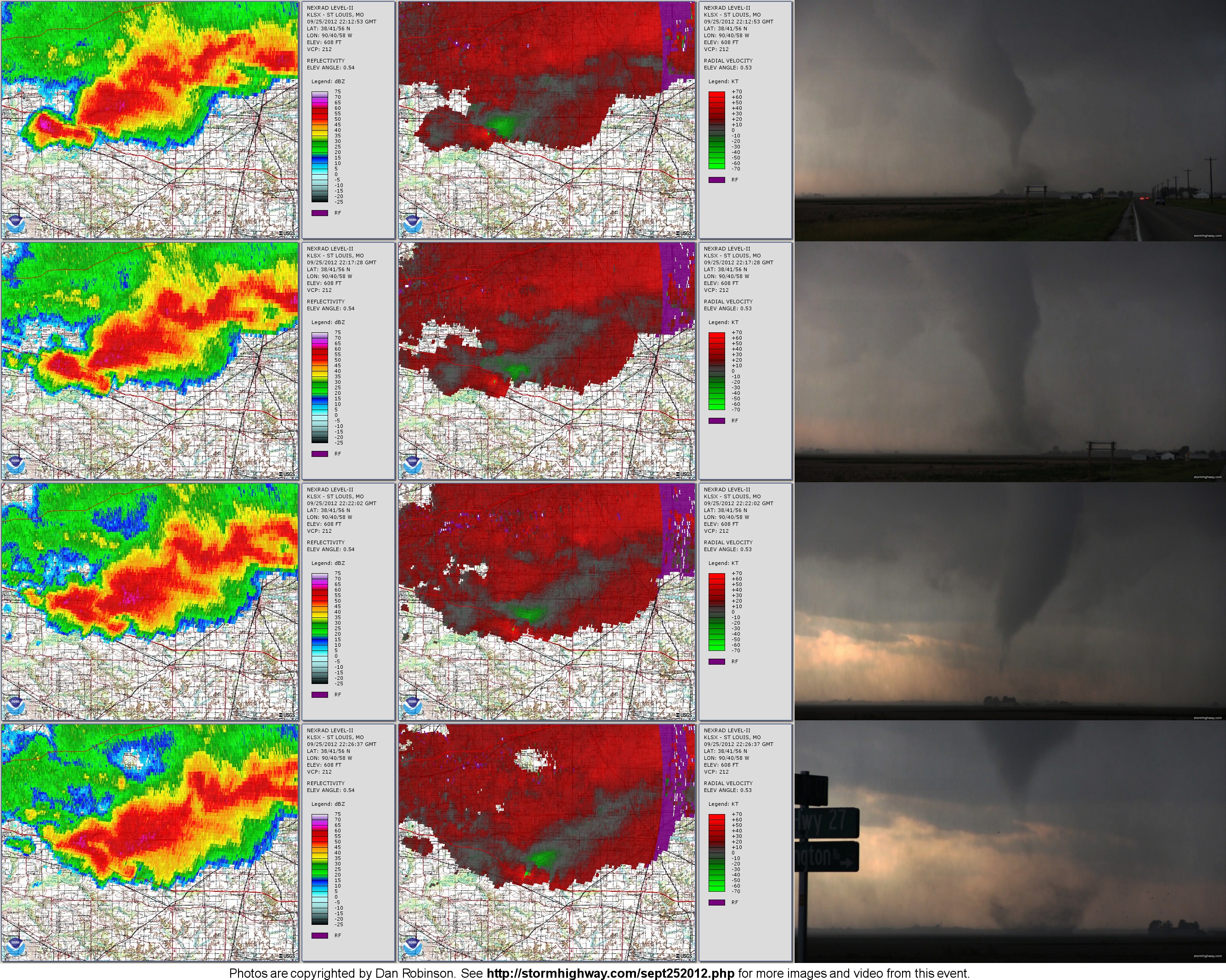
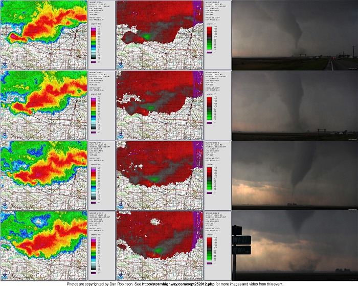
September 25, 2012 Okawville, Illinois tornado
This HP supercell produced a briefly strong tornado as it interacted with a quasi outflow boundary/warm front feature. The tornado crossed Interstate 64 twice and was rated EF-1. [ Read the chase log from this day ]
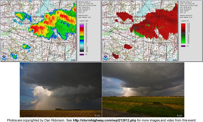
September 21, 2012 Okawville-New Minden, Illinois supercell
Four days before the September 25 tornado, another small supercell tracked along a nearly identical path. The storm displayed a hook on radar along with a very well defined rear-flank downdraft clear slot and rotating lowering. Several needle funnels were chased. [ Read the chase log from this day ]
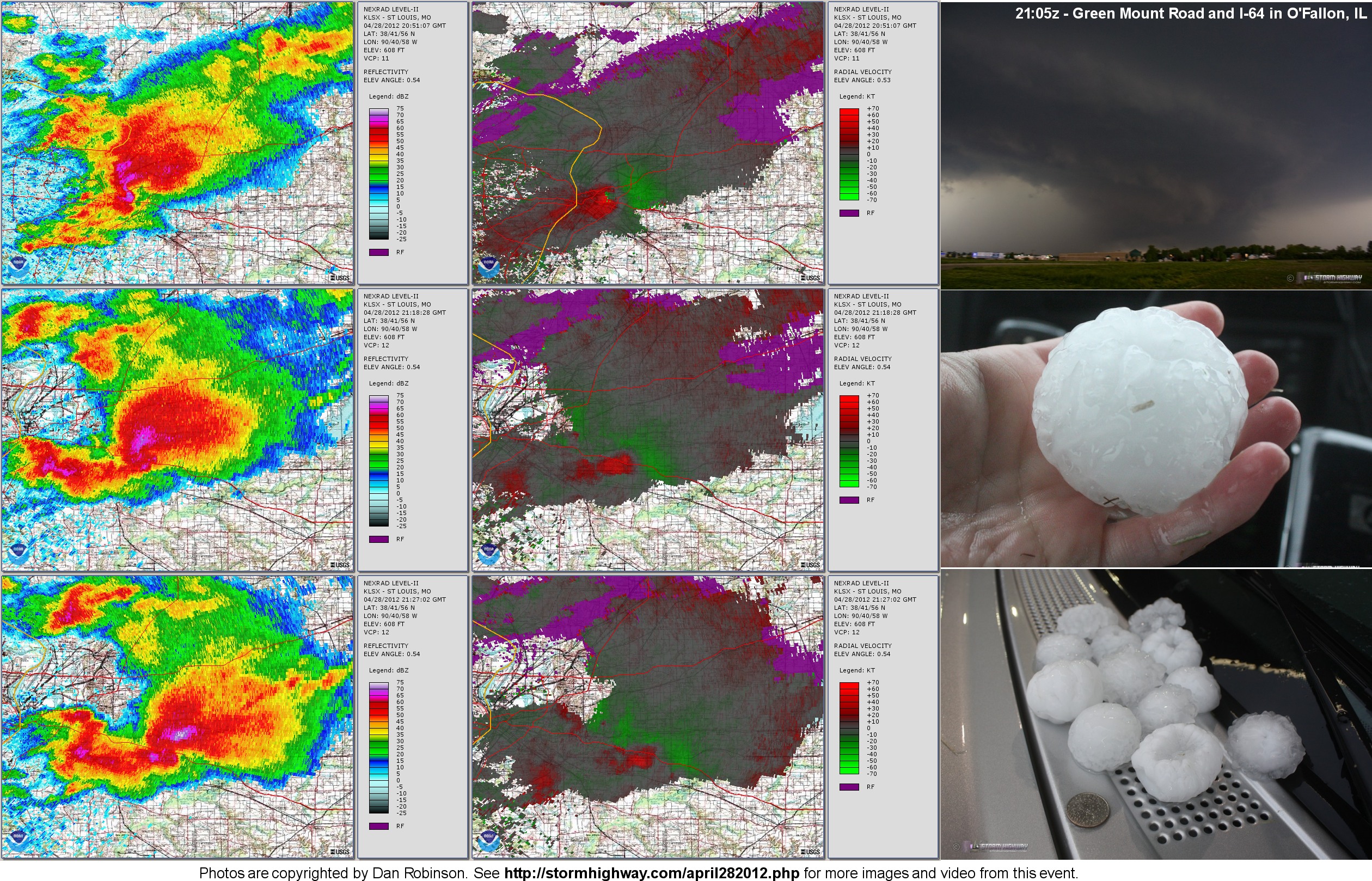
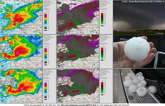
April 28, 2012 St. Louis major hail-producing supercell
This supercell formed near the center of a surface low and tracked east along a warm front, plowing directly through the heart of the St. Louis metro area. Though the storm thankfully never tornadoed, it produced large amounts of baseball and softball hail, creating the second-worst hailstorm in St. Louis history. Losses totaled $1.6 billion in the St. Louis metro area alone. [ Read the chase log from this day ]
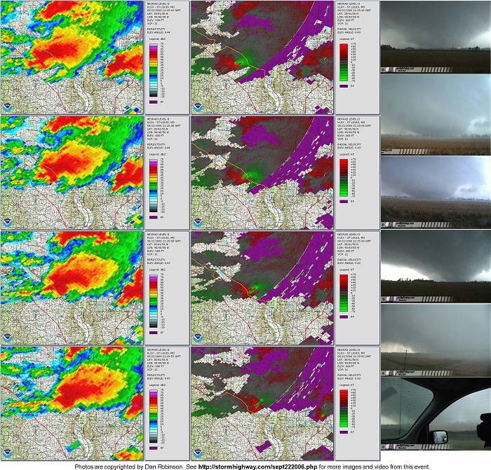
September 22, 2006 Crosstown-Gorham-Murphysboro F4 tornado
Though this event was before the era of Dual-Pol, the Level II radar is still interesting to look at. This supercell produced the strongest tornado, an F4, of the September 22 outbreak as it tracked from Missouri across the Mississippi into Illinois. [ Read the chase log from this day ]
|