|
Home | Blog Index | Blog Archives | Christianity & Faith Essays | Storm Chasing Essays
August 2021 storm chasing roundup
August 2021 was about average in terms of storm activity in the lower Midwest. While Iowa and extreme northern Illinois had several notable tornado events during this time, they were all far outside of my normal summer travel range for storms (5+ hours or more distant). Here's a summary of the events centered around the St. Louis metro area.
 August 8: Multiple rounds of storms in the St. Louis metro August 8: Multiple rounds of storms in the St. Louis metro
On Sunday afternoon, I initially headed up to Hazelwood to shoot lightning with a newly-developed cluster of cells ahead of the main squall line. I set up my 3-month old professional 4K camera up on the tripod. The storm's gust front promptly knocked it over, smashing it into the rip-rap along the road and severing the camera's LCD screen. Cost of the damage was $600. I managed to capture one bolt on high speed here, but otherwise this storm left me with little else than a damaged brand-new camera.
Later that night, multiple rounds of storms fired as the low-level jet kicked in. I initially was headed west on I-44 to meet the incoming line, but new storms fired directly overhead of me after midnight in Kirkwood, heading for downtown. I turned around and took handheld exposures out of the windshield as I raced the storm on I-44 back to downtown:
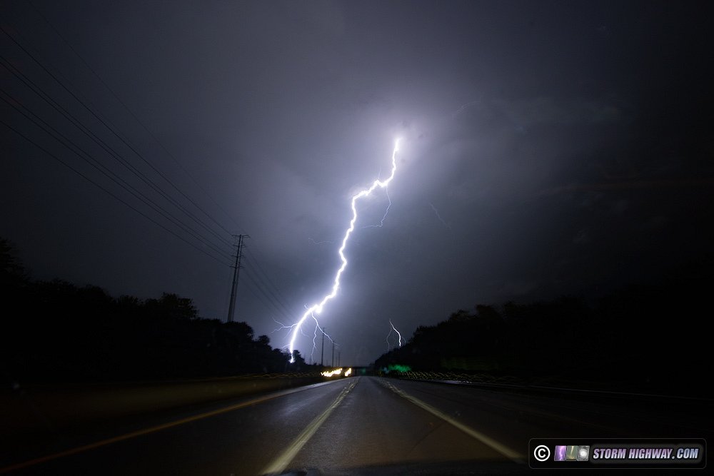
I beat the storm into the city, but most of the lightning activity coalesced into the storm's southern flank, which stayed south of downtown. The overflow from the heavy rain blew off a storm sewer cap on Pine Street, sending geysers of water high into the air:
I headed back west on I-64 to Brentwood to shoot a second round of storms moving into the northern metro area. While awaiting these storms, a new cell fired directly to the southwest and started firing off occasional bolts within a mile to my immediate south.
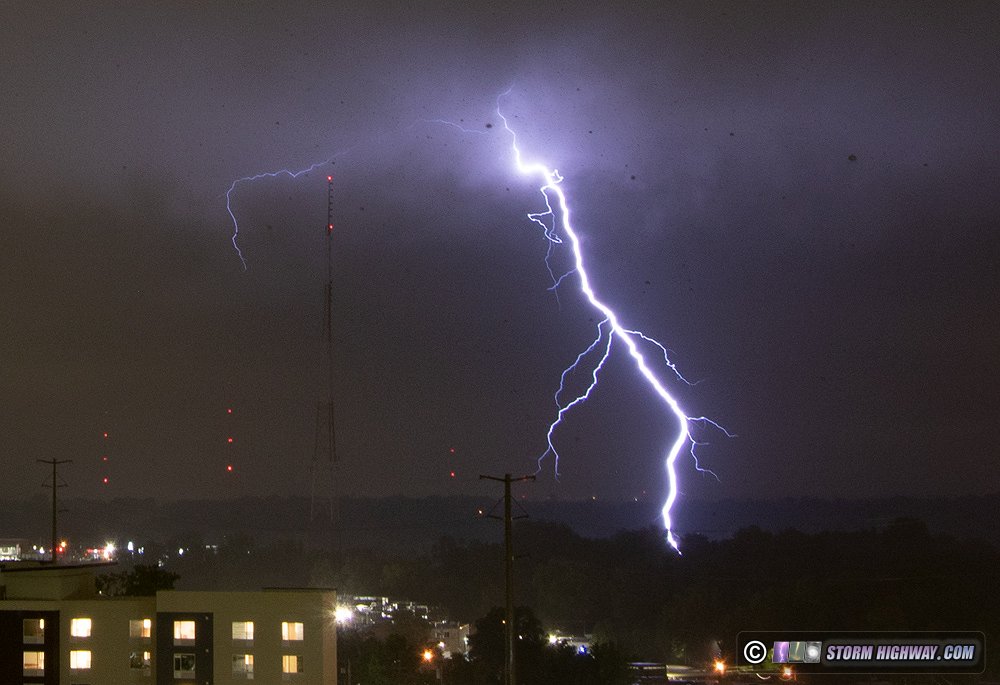
This flash consisted of two ground connections, one to the broadcast tower at Hanley and Manchester and another near the Hanley Wal-Mart. The video posted above shows the dashcam view of this event:
August 9: Missed brief supercell in Belleville, IL
I had chosen to not travel to nothern Illinois for this day's event, instead opting for a marginal storm setup here at home. Storms formed in the southern metro area by 4PM, but they were mostly short-lived and lightning was unimpressive from my vantage point near Mascoutah. I drove west to Caseyville to get a look at any updraft bases, but saw nothing of interest. I later saw a post on social media of a rather impressive-looking supercell structure on one of the storms' updrafts near Belleville. It just didn't last long enough for me to see it.
August 10: Midday St. Louis storms
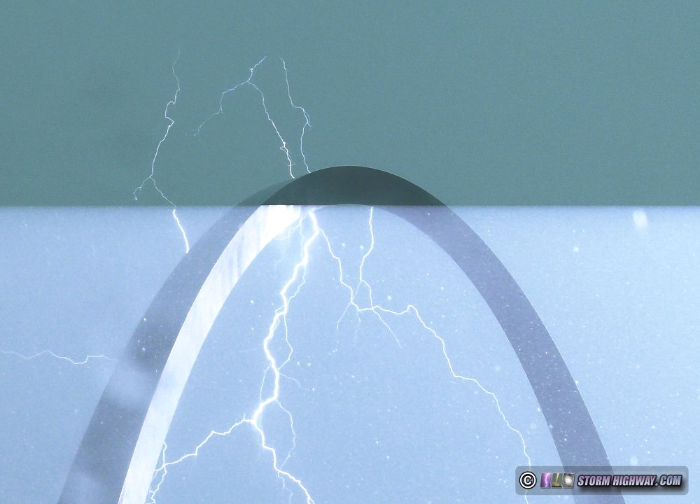
Models had originally been showing a strong storm complex moving through the St. Louis metro at sunset this day at peak instability time. Instead, storms formed on a remnant outflow in mid-Missouri early in the morning and moved through the city just after noon. Storms this early are typically not very impressive since the sun has not had the full day to destabilize things. So, at first, I decided that these weren't worth going out for. However as the storms approached the city, they rapidly intensified with the lightning strike data going crazy north and south of the city. Figuring this activity would fill in potentially right over downtown, I headed down to one of my usual Arch vantage points to shoot video. As expected, the convection filled in just to the east of downtown with a barrage of bolts about a mile to the southeast. One hit the high tension power lines over the river next to the Poplar Street Bridge. I was zoomed in close on the Arch on my main camera, but the front dashcam caught it:
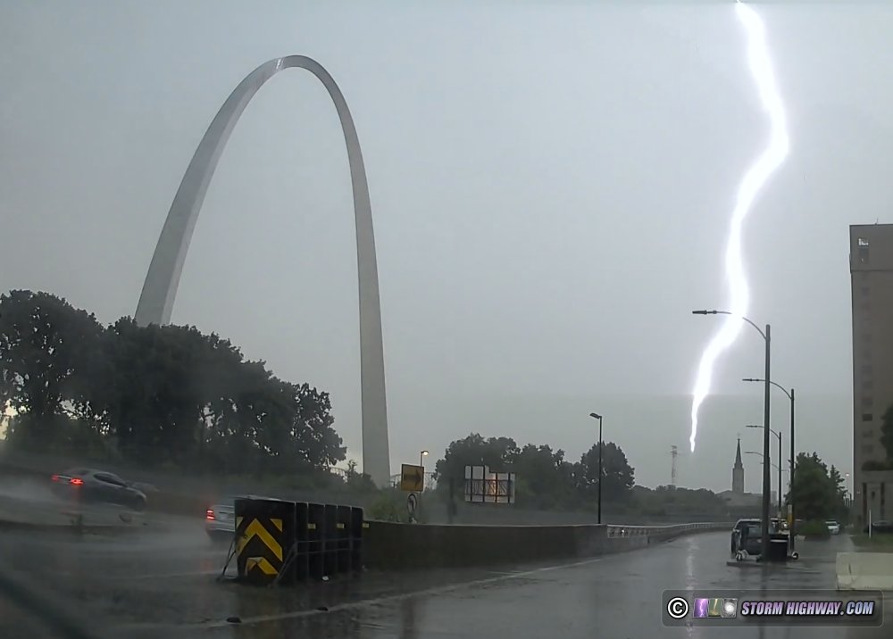
On my main camera, the branches from this strike were nicely positioned behind the Arch - but CMOS rolling shutter ruined the frame:
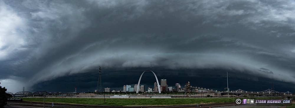
The line was moving rather slowly to the east, so I jumped back on I-64 toward home. The segment of the line over the highway was bowing out, racing to the east. I just barely beat the precipitation core to New Baden, but the outflow was still way ahead of me with an impressive "whale's mouth" structure on the back side of the gust front:
I tried for some more high-speed lightning shots in the trailing stratiform region, but all but one were uncooperative. I was on standby for additional storms after dark, but these could not become established thanks to the early-day complex stabilizing things.
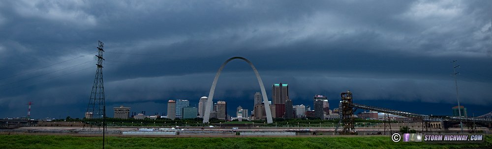
 August 12: Severe storms in the St. Louis metro August 12: Severe storms in the St. Louis metro
I worked overnight on Wednesday the 11th, then had a meeting to attend Thursday evening. Before I went to bed Wednesday night, models had mostly removed the chance of any northern Illinois storms making it this far south. As a result, I didn't set my alarm. I awoke at mid-afternoon suprised to see storms bearing down on the city from both the west and the north. I made it downtown in plenty of time.
The dominant storms were to the west, but a strong outflow from the storm complex to the north swept over the city about an hour ahead of the western activity. This put the western storms' longevity in question, but they maintained their strength all the way through the metro and into Illinois with widespread severe wind gusts, tree damage and power outages. Lightning was disappointing with these, but the shelf cloud was decent - about a 5 out of 10 on the dramatic-ness scale.
I stayed downtown to see if there was any worthwhile lightning in the cores, and saw none. The stratiform region lightning data didn't look good enough to miss my evening meeting, so I headed back from downtown just behind the main cores.
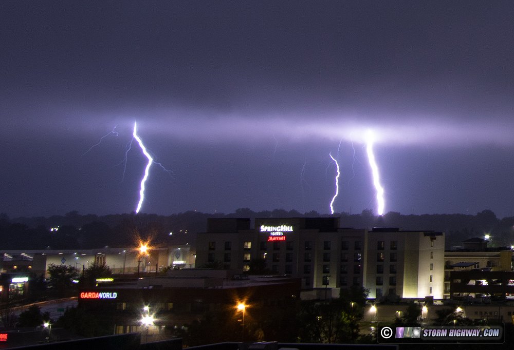
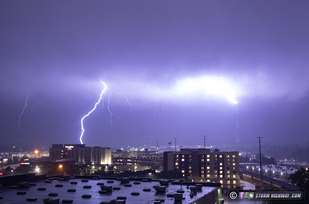
August 23: St. Louis metro lightning barrage
All models completely failed this day, with forecasts ranging from nothing at all to a few small showers around 5pm south of the metro area. Instead, strong storms developed west of the metro, and towering cumulus bubbled up areawide. Expecting eventual storms over downtown, I went to my usual spot and waited. Eventually, a new storm went up in South County, with ominous updraft bases materializing right over the city. Those eventually exploded into a large storm just north of downtown. A CG lightning barrage took shape about 2 miles north, so I moved over to the I-70 Packers interchange to shoot these over the Musial Bridge. I caught several nice bolts on the high speed camera at 6,000 FPS:
 August 24: Chicago lightning trip August 24: Chicago lightning trip
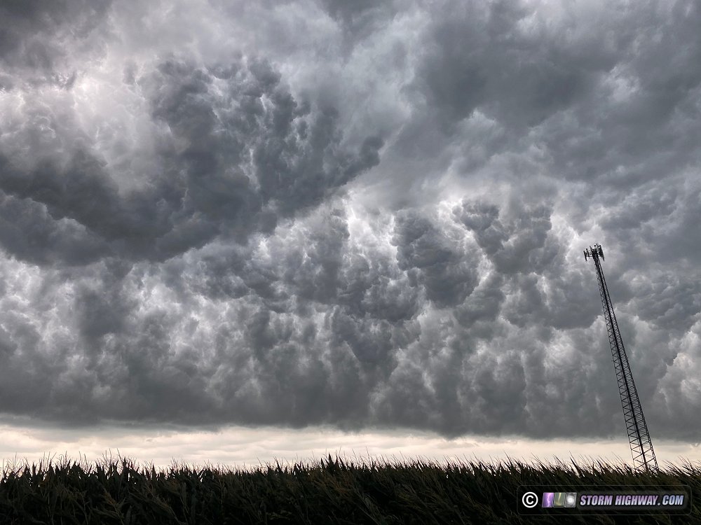
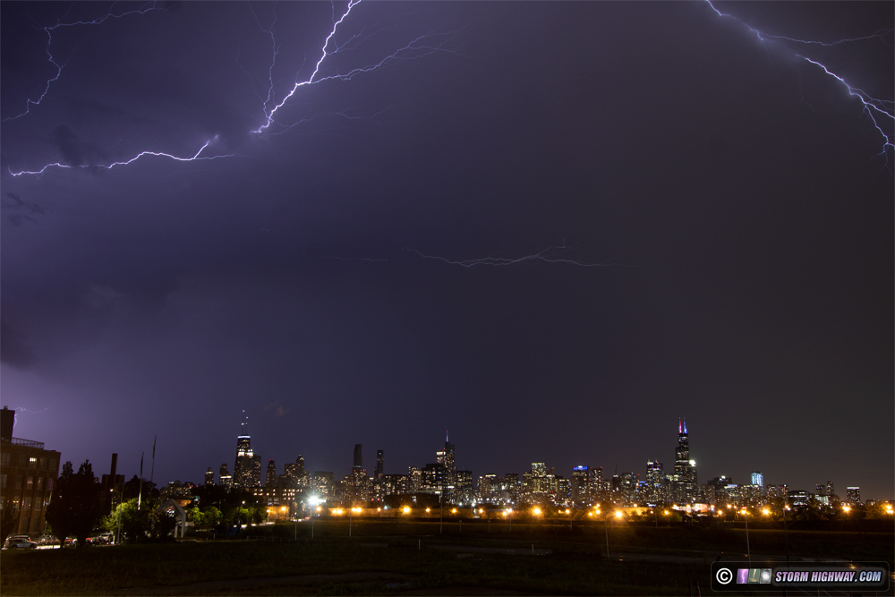
Models showed very little activity in Iowa and northern Illinois, but radar trends and mesoanalysis painted a different picture. A strong cluster of storms in northeastern Iowa was persisting at midday, with 4,000 MLCAPE, abundant sunshine and at least 25 knots of bulk shear ahead of it all the way to Lake Michigan. It was clear the models were once again completely useless for the day's events, so I began the trip north for another lightning trip to Chicago, my first of 2021 and 21st lifetime. The storms maintained through the city, but did not offer much photogenic lightning nor any upward discharges to the buildings. I missed the lone visible CG that occurred over the skyline, coming away with a couple of marginal "anvil crawlers".
August 30: Midday St. Louis metro storms
I missed most of this storm event in the city thanks to following Union Pacific "Big Boy" steam locomotive #4014 to just outside of Jefferson City. Storms fired in St. Louis along the cold front fairly early in the day, and were mostly done by the time I got back into town in the mid afternoon. Lightning data showed above-average cloud-to-ground strike activity downtown while I was still 90 minutes away, with the data indicating a possible Arch strike (a common theme for me, the one day I chose to focus on something else over storms this year). I couldn't find any evidence that an Arch strike had occured (no bystander videos or photos), and if it had, it was likely during the low-visibility very heavy rain core that caused flash flooding throughout the city.
New storms repeatedly went up west of existing activity in the advancing outflows, with that pattern repeating a couple of times. I encountered the storms on my way back at Pacific, seeing a nice cloud-to-ground lightning burst for about 10 minutes as I approached. It didn't last, and I saw nothing else worth shooting through the evening - choosing instead to prioritize editing and publishing the #4014 video I'd captured during the previous 36 hours.  August 31: Weak storms in the metro area August 31: Weak storms in the metro area
The cold front finally swept through this evening, with mostly frontal-forced convection (with very little instability). The result was a few heavy rain cores passing through the metro around 8:30PM. I went out for about 30 minutes, but didn't see any lightning.
< July 15-31, 2021 Recap | All Storm Chase Logs | September-October 2021 Recap >
GO: Home | Storm Chase Logs | Photography | Extreme Weather Library | Stock Footage | Blog
Featured Weather Library Article:
|


