San Andreas Fault, Part 3: Frazier Park, Tejon Pass, Gorman
GALLERY: All San Andreas Fault photos in gallery format
As we descend off of the high ridges into the valley on Hudson Ranch road, the fault zone finally becomes accessible again, crossing and/or running along with the road several times. It is here that two major features are encountered: the intersection with the Garlock fault, and the San Andreas' prominent turn to a more easterly direction. This "Big Bend" region of the San Andreas creates a broad zone of complex faults for miles around that shape the surrounding landscape. Again, the trace of the fault lies mostly invisible and dormant underneath these locations, but will one day rip the surface in two during the next major earthquake.
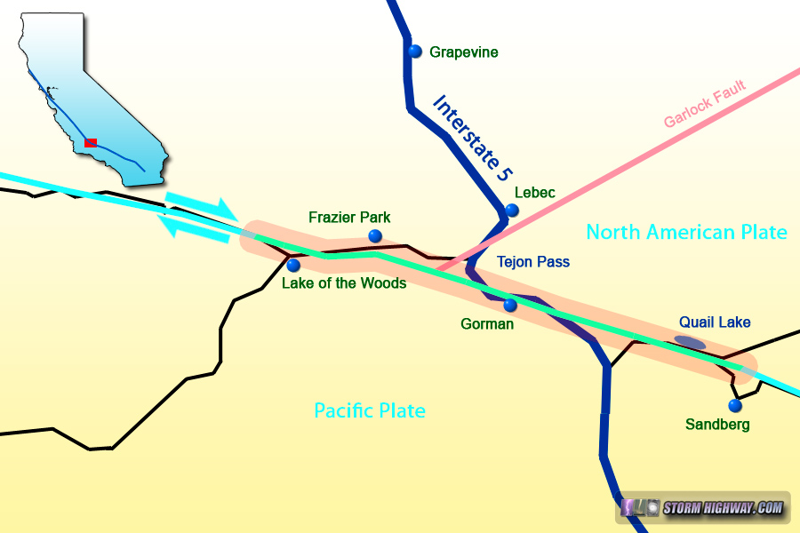
Map of this segment of the tour
Frazier Park, California
This is the view of the Cuddy Valley Road crossing of the fault zone at Lake of the Woods:
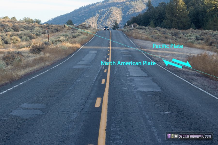
San Andreas Fault crossing Cuddy Valley Road
This playground/skate park lies directly atop the fault:
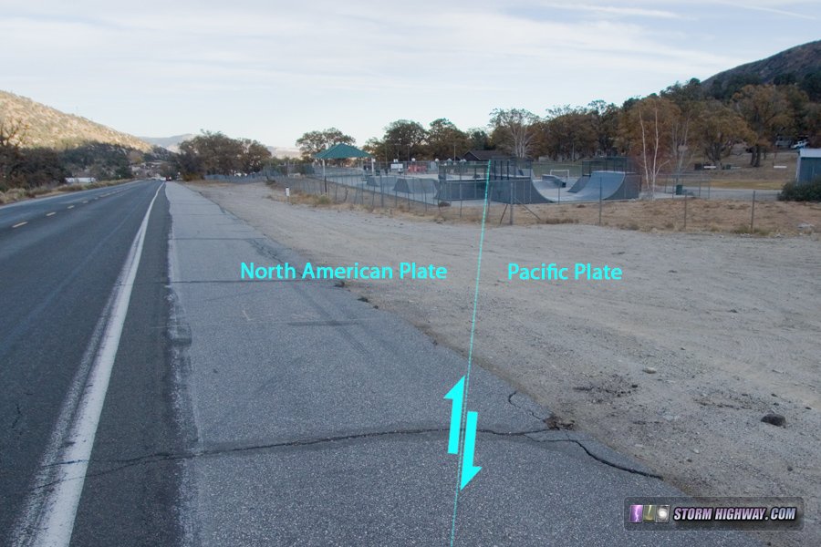
San Andreas Fault location at Frazier Park
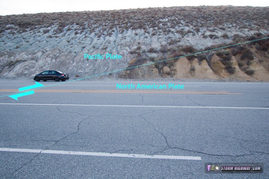
Gorman, California (Tejon Pass)
As we arrive at Interstate 5 and turn southeast on the frontage road at Gorman, one of the most detailed visible expressions of the San Andreas can be seen in the road cut as it makes its first of three crossings of I-5. The fault divides two different types of rocks/soil on either side:
click for larger version
The second fault crossing of I-5 is near the highway's overpass at Gorman School Road - again, invisible for the time being due to all of the current infrastructure being constructed atop the fault zone more than a century after the last earthquake:
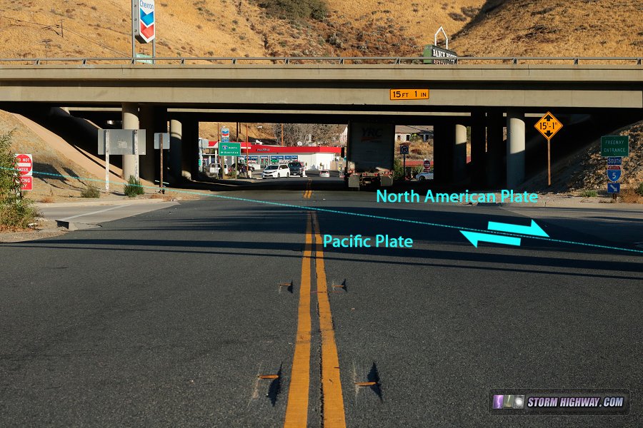
San Andreas Fault crossing location of I-5 at Gorman, CA
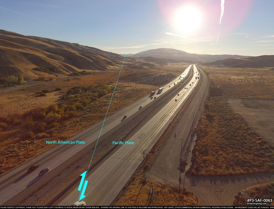
The third and final place the fault crosses I-5 is just south of Gorman. This view looks east:
click for larger version
And the view west here:
click for larger version
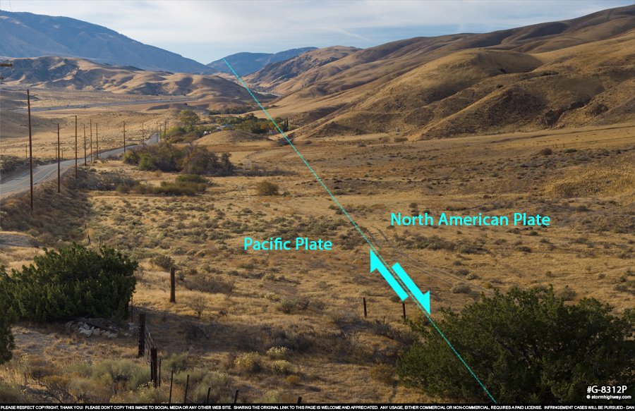
The San Andreas generally follows the valley on the south side of Tejon Pass. The surface trace is not visible in most places, with the 1857 earthquake surface rupture long erased by 160 years of erosion and road construction. Nonetheless, several sag ponds are apparent, along with the relatively straight "linear valley" created by the fault. This view is looking northwest, with I-5 visible in the background:
click for larger version
This panorama is centered looking northeast:
click for larger version
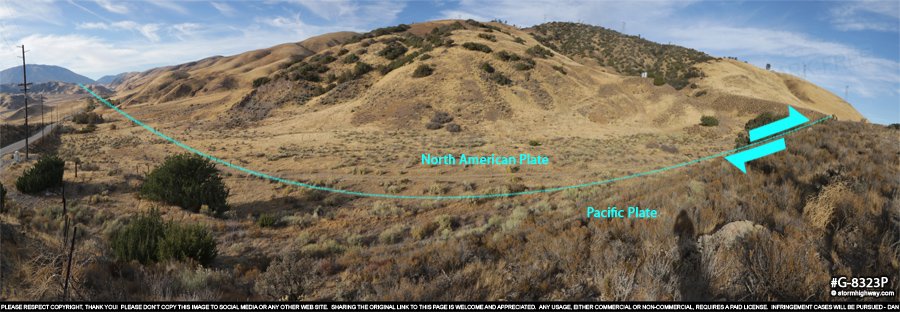
As we continue moving east along the fault past Gorman, looking north from Old Ridge Route Road we get a scenic panorama of the valley and a distinct view of the Tehachapi Mountains associated with the Garlock fault. The San Andreas cuts through the foreground of this scene, across Highway 138 and under the small roadside ranch. The fault also passes under Quail Lake, visible on the left. |