San Andreas Fault, Part 2: Carrizo Plain, Soda Lake & Bitter Creek
GALLERY: All San Andreas Fault photos in gallery format
We'll need to start with a full tank of gas and some reserves of food and water (in case of emergency) as we follow the San Andreas Fault on rough dirt roads into the arid and remote Carrizo Plain National Monument.
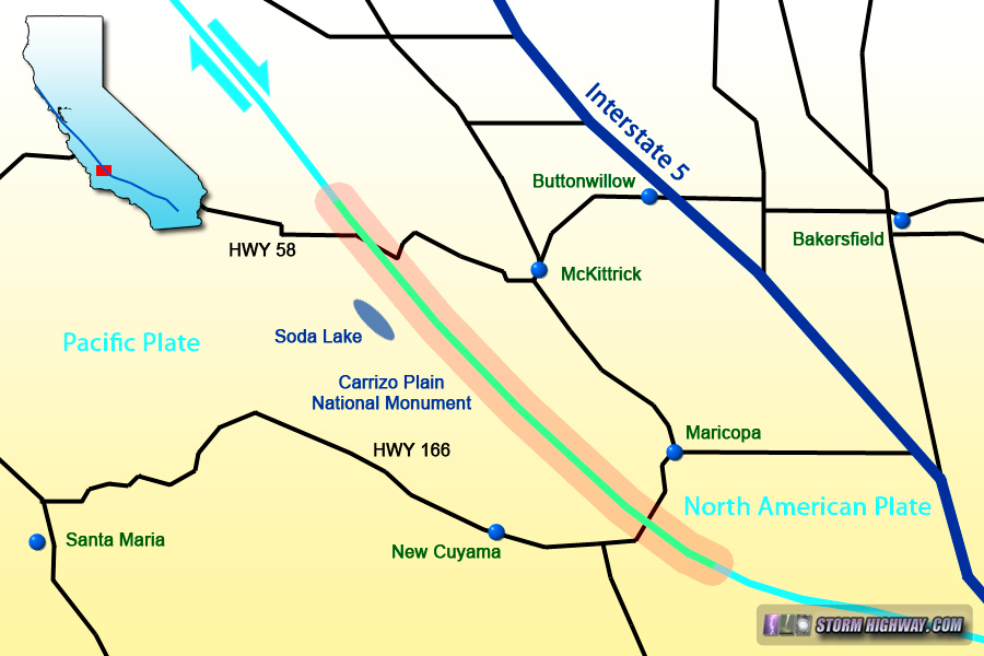
Map of this segment of the tour
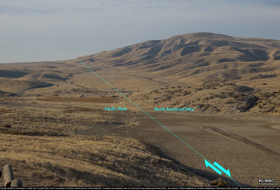
Entering the Carrizo Plain from the northwest alongside the Temblor Range on Blue Star Memorial Highway (58), the road drops down suddenly on a prominent fault scarp among several solar power plants. This view is looking northwest across the fault:
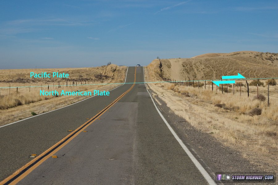
click for larger version
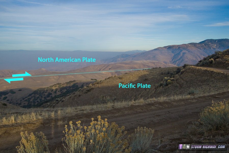
Turning onto 7 mile road, the fault zone can be seen in several scarps and vegetation rows:
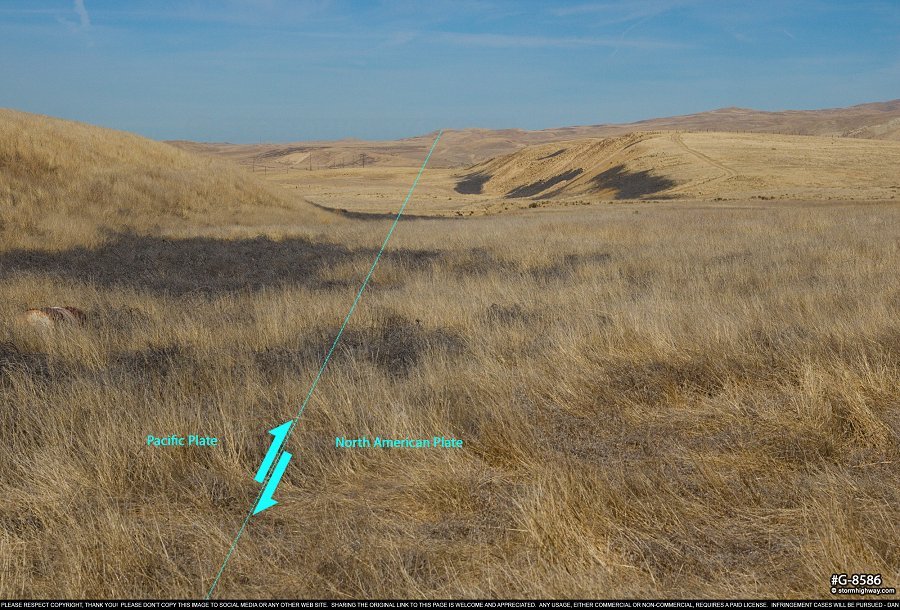
click for larger version
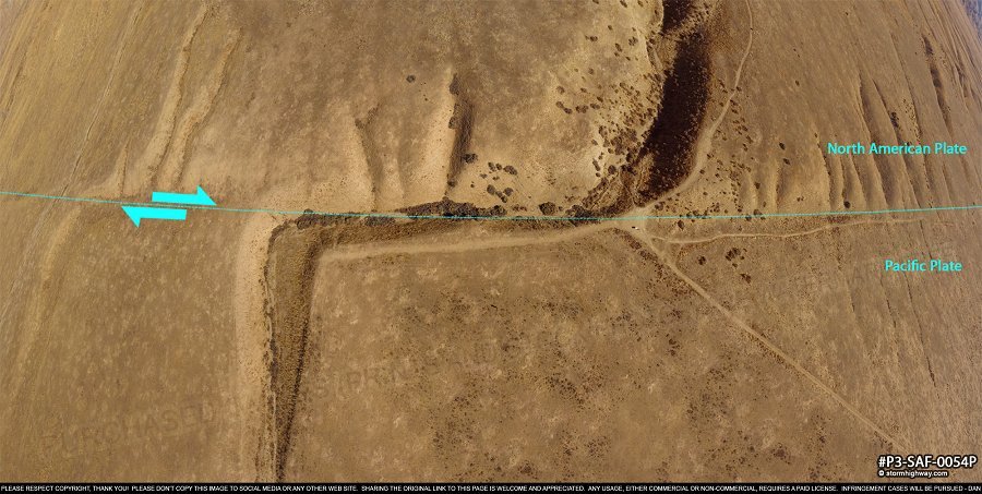
Entering the Carrizo Plain National Monument, the fault trace is clearly visible in many places in the form of a low scarp:
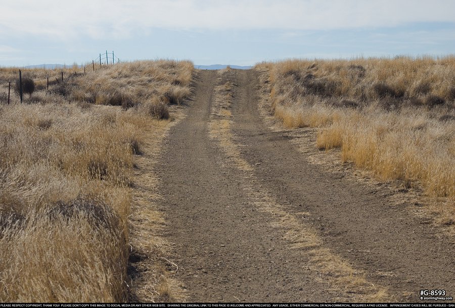
click for larger version
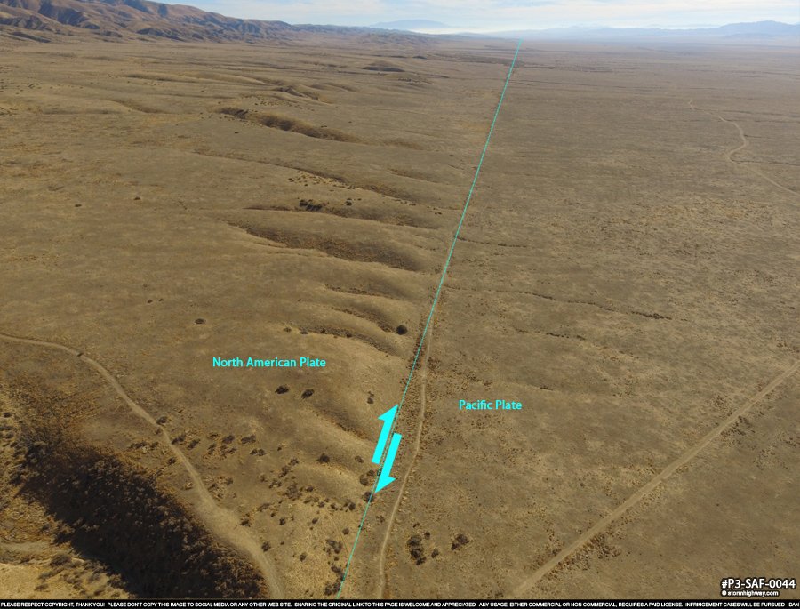
As we move farther southeast along the fault with Soda Lake visible to our right, it is not long until we arrive at one of the more famous landmarks on the San Andreas: Wallace Creek. We have already seen some examples of stream channels offset by fault movement, and Wallace Creek is the best-known and possibly the most visually striking example of one. Over the past 3800 years, the fault has repeatedly broken the creek bed during earthquakes and forced it to erode an ever-lengthening dogleg that sits right on the fault trace. Significant earthquakes every 100 years on average extend the offset by 15 to 30 feet each time. It has been 160 years since an earthquake last stretched the offset further, which sits at around 420 feet today.
This aerial panorama shows the Wallace Creek offset as well as several "orphaned" stream channels on the North American side of the fault, which terminate right on the very visible fault trace here. There are few other places on the San Andreas where the fault and its movement over time are so clearly on display.
click for larger version
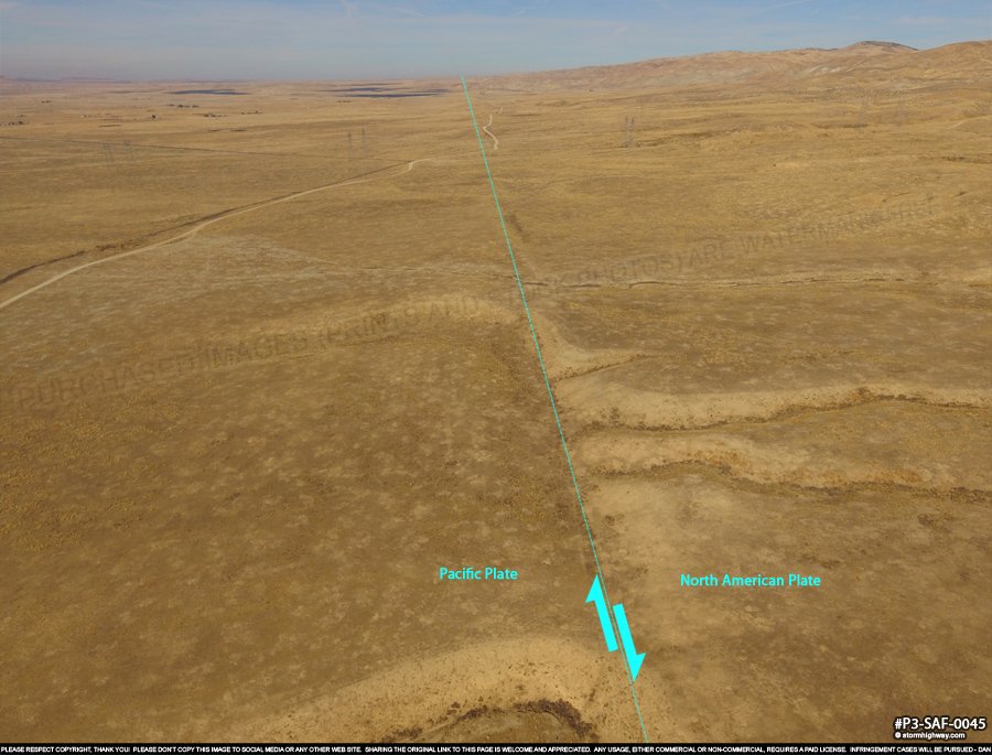
At this location, we can look southeast down the clearly-visible fault trace extending to the horizon:
click for larger version
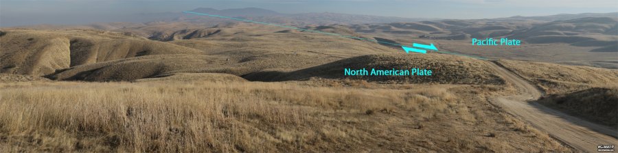
As well as looking northwest in the direction we arrived from:
click for larger version
Not far after Wallace Creek, gates mark the spot where public road access to the fault ends. From here to Bitter Creek, no public roads are available for easy access to the fault trace - one must either hike or fly to get an up-close or overhead view of the famous Elkhorn Scarp.
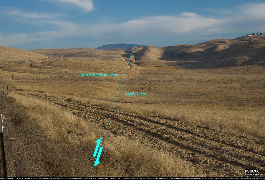
Taking the long and heavily-washboarded dirt roads to the north of Elkhorn Scarp, we finally regain a visual on the fault trace again just north of Soda Lake Road:
click for larger version
Soda Lake Road (which runs far to the south of Elkhorn scarp) takes us past the eastern entrance to the Carrizo Plain National Monument. Here, we can see a clear view of the fault trace looking northwest, as well as a large sag pond marking the fault zone:
click for larger version
Another mile to the east is Highway 33, which crosses the fault through a small cut. Here the two different types of rock/soil on either side clearly reveal the fault trace:
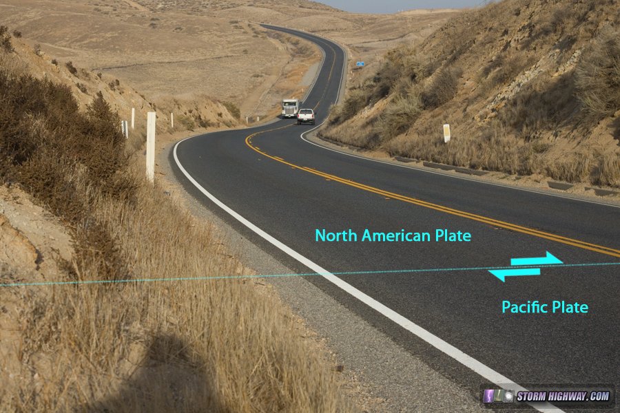
click for larger version
click for larger version
Continuing east on Hudson Ranch Road into the Bitter Creek National Wildlife Refuge, we will only get a couple more views of the fault zone before the road turns away from it for an extended distance. This view is about a mile east of Highway 33:
click for larger version
After this point, the fault enters generally inaccessible terrain in the Los Padres National Forest. The fault zone can still be viewed at a distance from a few places on Hudson Ranch Road, which runs along the ridgetops high above.
San Andreas Fault zone at a distance from Hudson Ranch Road
Without 4WD to view the fault on forest roads in this area, we will continue east through the Los Padres National Forest to the Frazier Park area. Continue to Part 3 >
< San Andreas Fault - Home
 About the Author: Dan Robinson has been a storm chaser, photographer and cameraman for 34 years. His career has involved traveling around the country covering the most extreme weather on the planet including tornadoes, hurricanes, lightning, floods and winter storms. Dan has been extensively published in newspapers, magazines, web articles and more, and has both supplied footage for and appeared in numerous television productions and newscasts. He has also been involved in the research community, providing material for published scientific journal papers on tornadoes and lightning. |
GO: Home | Storm Chase Logs | Photography | Extreme Weather Library | Stock Footage | Blog
Featured Weather Library Article:
|


