San Andreas Fault, Part 4: Palmdale, Littlerock
GALLERY: All San Andreas Fault photos in gallery format
After turning off of Highway 183 at Quail Lake, we temporarily leave the San Andreas fault zone to climb in elevation on Old Ridge Route Road. After about four miles, we're just past Sandberg and back along the fault zone.
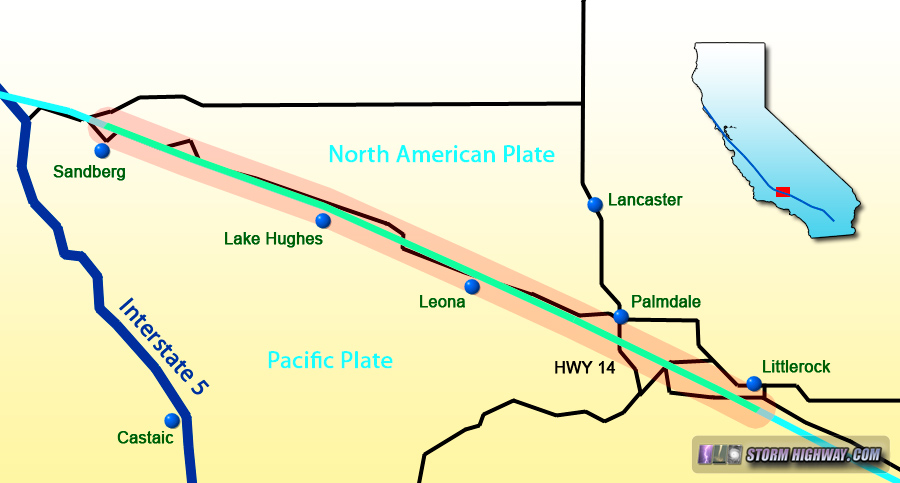
Map of this segment of the tour
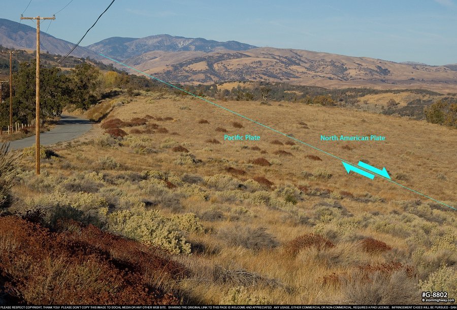
Sandberg, California
The fault zone lies in the field on the north side of Pine Canyon Road. As before, the time since the last earthquake means that the visible surface rupture has long been erased by erosion and vegetation. That of course will change when this segment of the fault ruptures again.
click for larger version
Lake Hughes, California
After passing Three Points, the fault zone generally runs directly underneath the road all the way to Palmdale. There are no obvious signs of the fault trace to be seen in these locations, although it is apparent that surface rupture from a future earthquake will do significant damage to this stretch of the road.
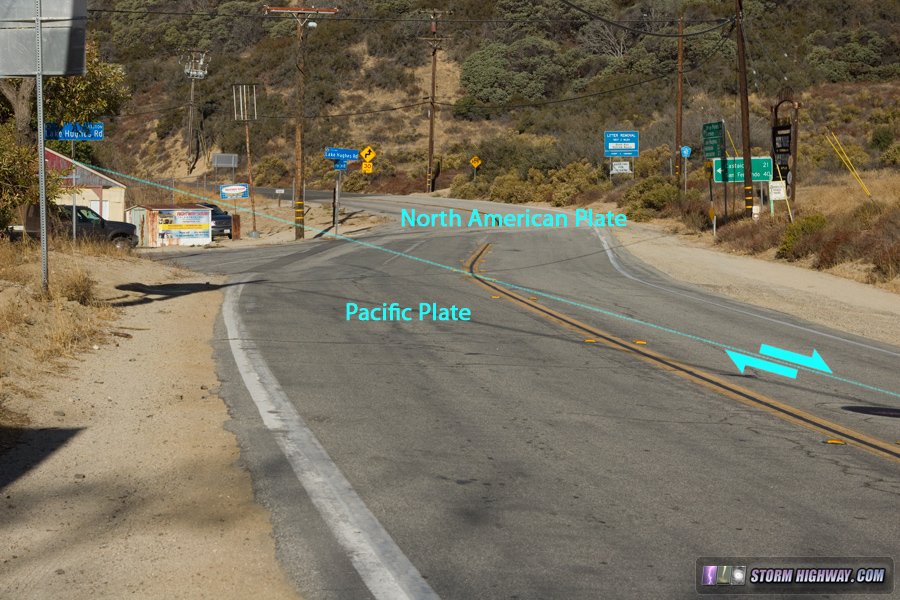
San Andreas Fault zone at Lake Hughes, CA
Palmdale, California
As we head into the Palmdale area, the lanes of Ranch Center Road cross the fault zone on a hill:
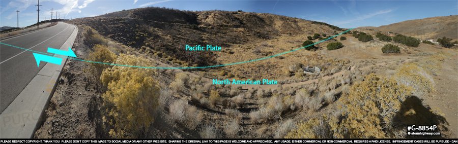
click for larger version
In most locations, the San Andreas is not just a single fault. A complex network of mostly parallel faults often run on either side for some distance. Sometimes, these parallel faults will rupture in an earthquake instead of the main strand. Palmdale is one such location, famous in seismological circles for the Highway 14 road cut that exposes a fascinatingly detailed view of the folding and deformation of rocks along the numerous parallel faults in the area.
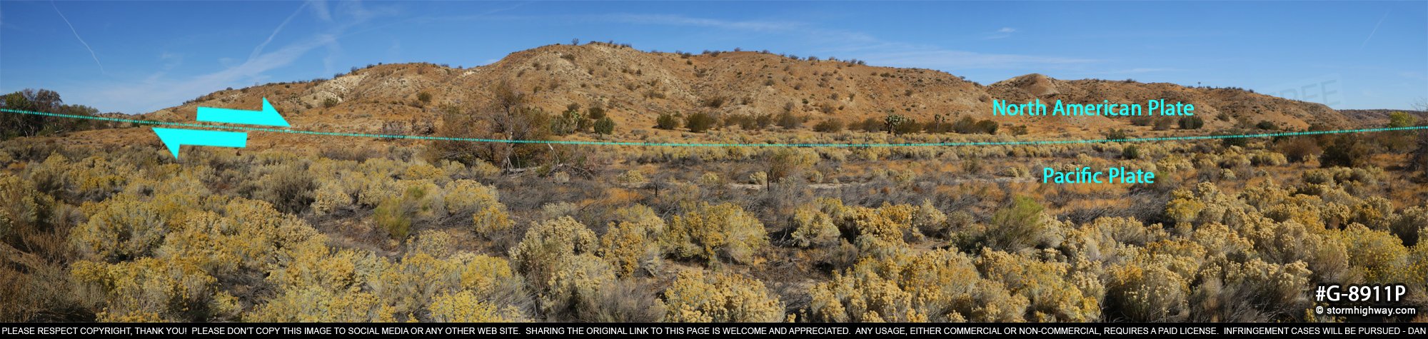
The main San Andreas Fault zone is most visible in this scene near Highway 14 by noting the distict difference in the color of the dirt and the types of vegetation on either side of the fault trace. This view looks west:
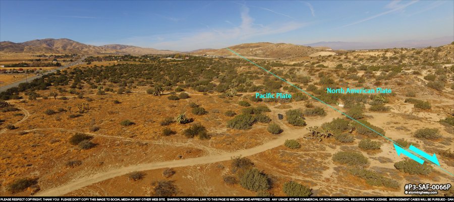
click for larger version
And the view looking east over Highway 14:
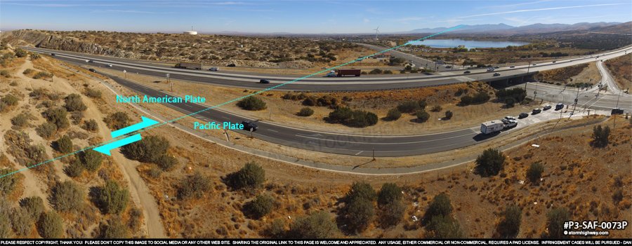
click for larger version
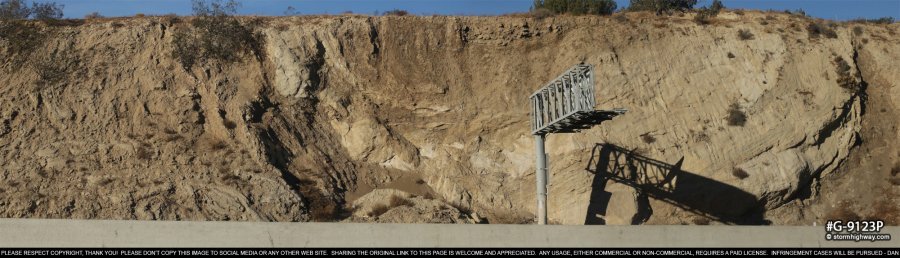
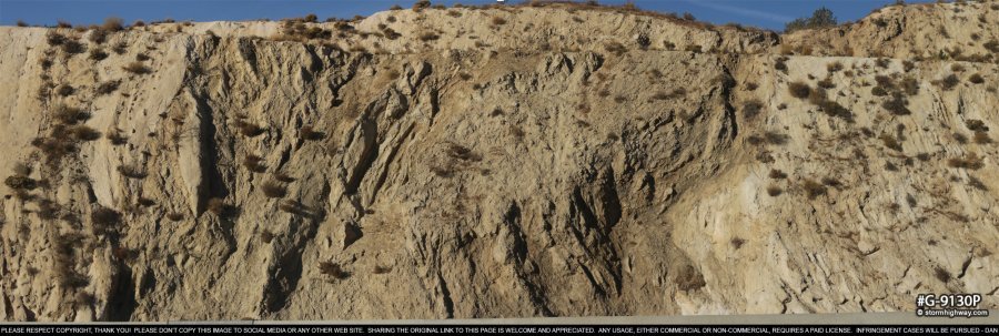
While the Highway 14 cut does not bisect the main San Andreas Fault strand, it shows a rare detailed view of what goes on just under the surface in a complex and active fault zone. These are close-up views of the cut just north of the East Avenue South interchange:
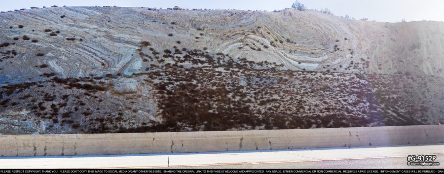
click for larger version
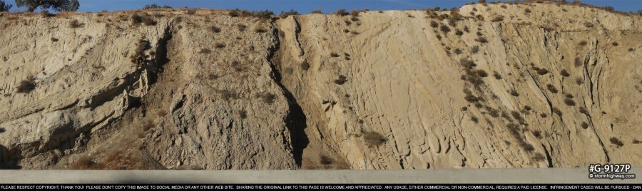
click for larger version
click for larger version
click for larger version
From Palmdale onward, the fault trace is generally easy to pick out as differing soil/rock colors and vegetation types are present on either side. On the outskirts of Palmdale, several sag ponds (some dry, some still filled) and scarps are apparent, as in this scene along Barrel Springs Road:
click for larger version
Littlerock, California
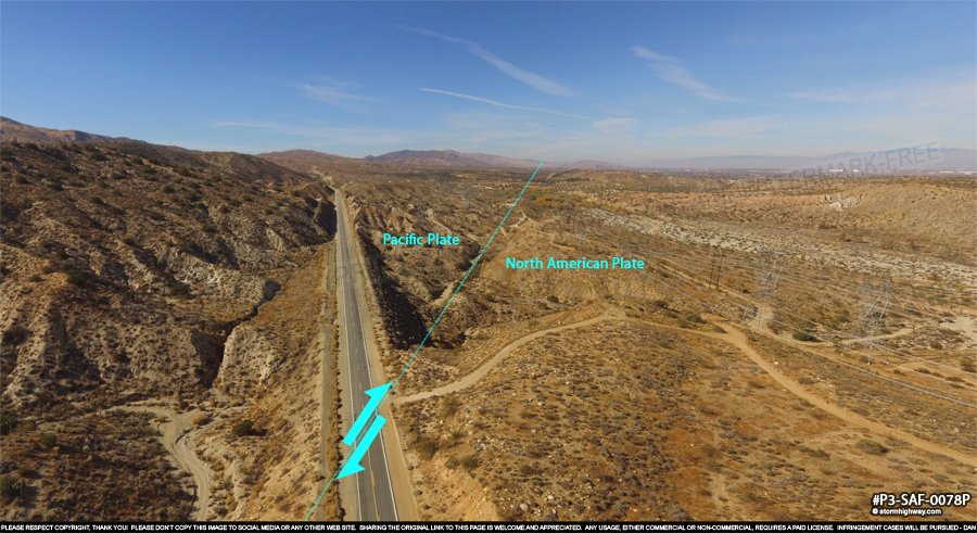
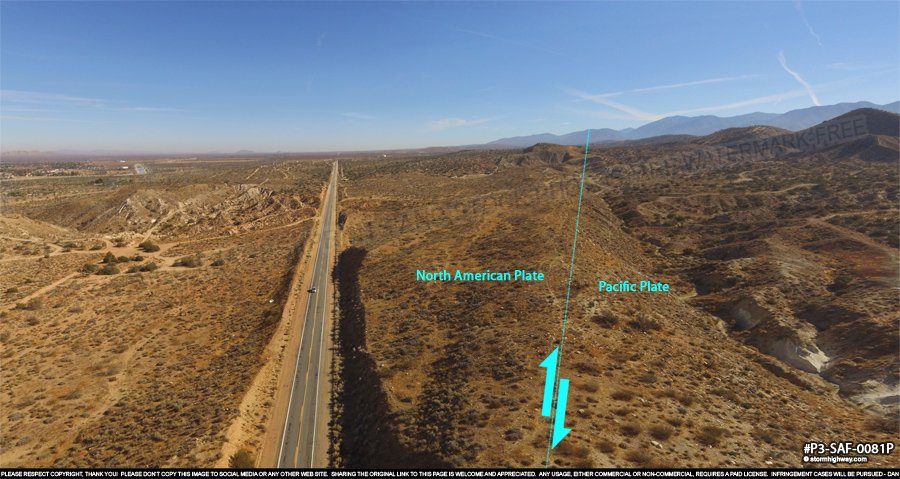
One will have no problem finding the San Andreas southeast of Palmdale, especially looking from above. The soil and rocks on either side of the fault are starkly different colors, and the flora on each side is noticeably dissimilar. These views show the fault crossing Mt. Emma Road near Littlerock, first looking west:
click for larger version
Then looking east:
click for larger version
We'll be leaving the Antelope Valley shortly as we follow the fault into the San Gabriel Mountains. NEXT: Part 5: Wrightwood, Cajon Pass >
< San Andreas Fault - Home
 About the Author: Dan Robinson has been a storm chaser, photographer and cameraman for 34 years. His career has involved traveling around the country covering the most extreme weather on the planet including tornadoes, hurricanes, lightning, floods and winter storms. Dan has been extensively published in newspapers, magazines, web articles and more, and has both supplied footage for and appeared in numerous television productions and newscasts. He has also been involved in the research community, providing material for published scientific journal papers on tornadoes and lightning. |
GO: Home | Storm Chase Logs | Photography | Extreme Weather Library | Stock Footage | Blog
Featured Weather Library Article:
|


