 |
San Andreas Fault, Part 1: Parkfield, Cholame & Annette, California
GALLERY: All San Andreas Fault photos in gallery format
We begin our tour of the southern San Andreas Fault at the remote town of Parkfield, a world-famous place in the realm of seismology. The town marks a transition zone where the fault goes from creeping (the two sides continuously sliding freely without major earthquakes) to locked (both sides stuck together, allowing strain to build which is then released suddenly in large earthquakes). In this 7-part series, we will be following the locked segment of the fault southward to near where it ends at the Salton Sea.
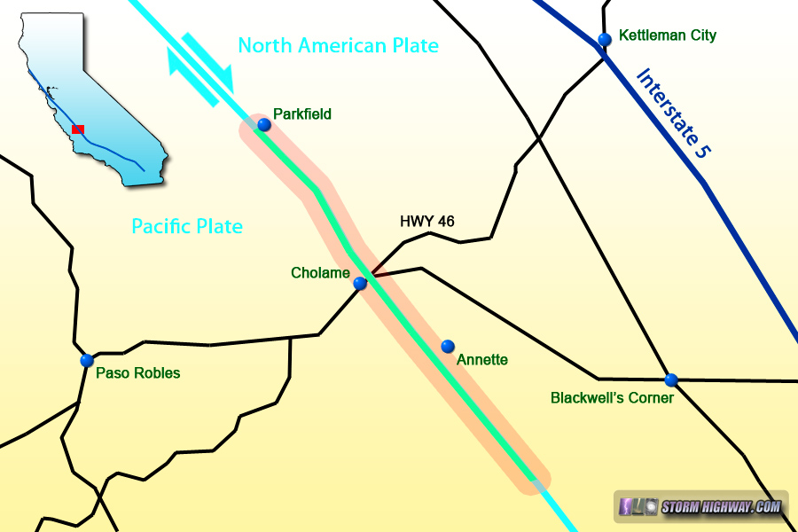
Map of this segment of the tour
Parkfield, California
Seismologists recognized that the San Andreas was producing nearly identical magnitude 6.0 earthquakes at Parkfield with surprising regularity, roughly every 22 years. After the event in 1966, it was predicted that the next M6.0 earthquake in the sequence would happen sometime in the late 1980s or early 1990s (1). Accordingly, the fault zone at Parkfield was heavily instrumented in anticipation of the event. 1990 and then 2000 passed, but no earthquake occurred in the forecasted time window. Finally, in 2004, the M6.0 event did occur, and a wealth of data was obtained.
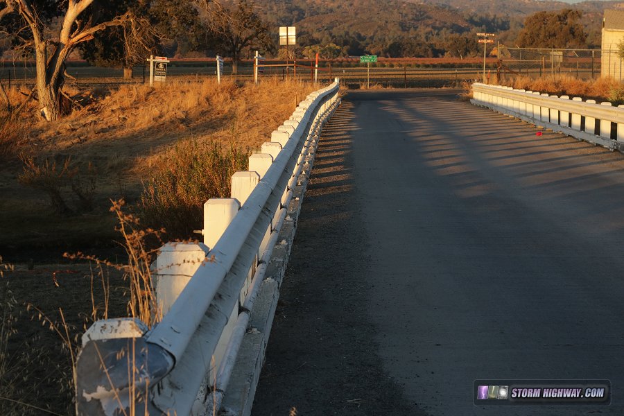
The big landmark at Parkfield is the bridge over Little Cholame Creek that carries Parkfield-Coalinga Road across the fault. Perfectly straight when built in 1936, the bridge has been slowly bent over the decades as the right-lateral fault motion continues. In this photo, you can see the more than 5 feet of total offset in the bridge's concrete piers that were originally aligned:
click for larger version
Looking directly across the bridge, the offset is clearly visible in the guardrails:
click for larger version
The expansion joint separating the two concrete deck sections has been filled with wedge-shaped shims as the fault continues to pull one side of the bridge apart:
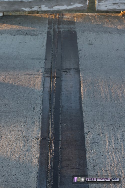
click for larger version
Cholame, California
South of Parkfield, Cholame Road parallels and crosses the fault several times, which itself continues southeast in roughly a straight line. The surface trace of the fault is not visible in most places, with the 1857 earthquake surface rupture long erased by 160 years of erosion and road construction.
San Andreas Fault crossing Cholame Road
Moving southeast toward highway 50, the fault crosses over to the south side of the valley and road, running through fields at the base of the hills. |

click for larger version
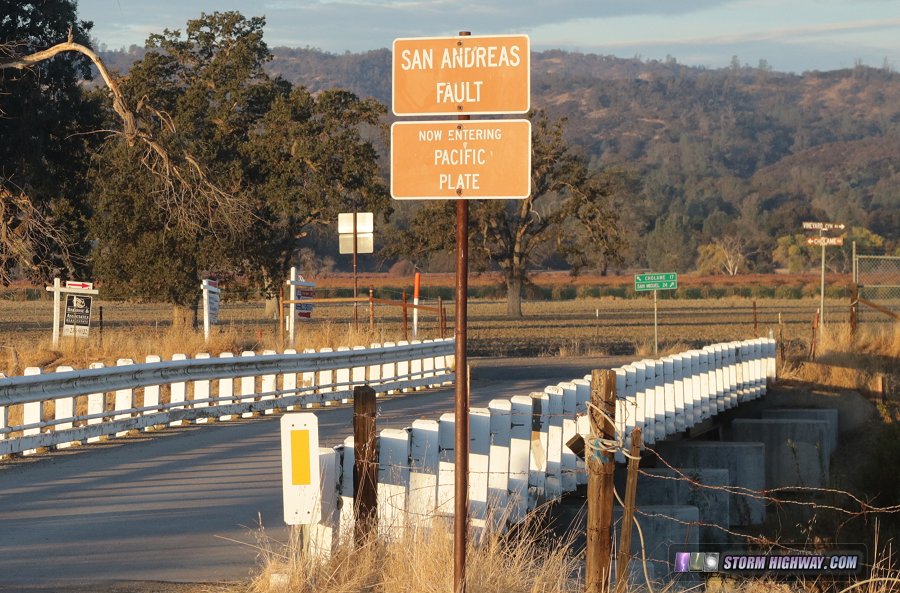
| The fault crosses Highway 46 at Cholame. This location is famous for another reason: it is where actor James Dean was killed in a car crash in 1955. A memorial to Dean is out of view at the bottom of this image.
click for larger version
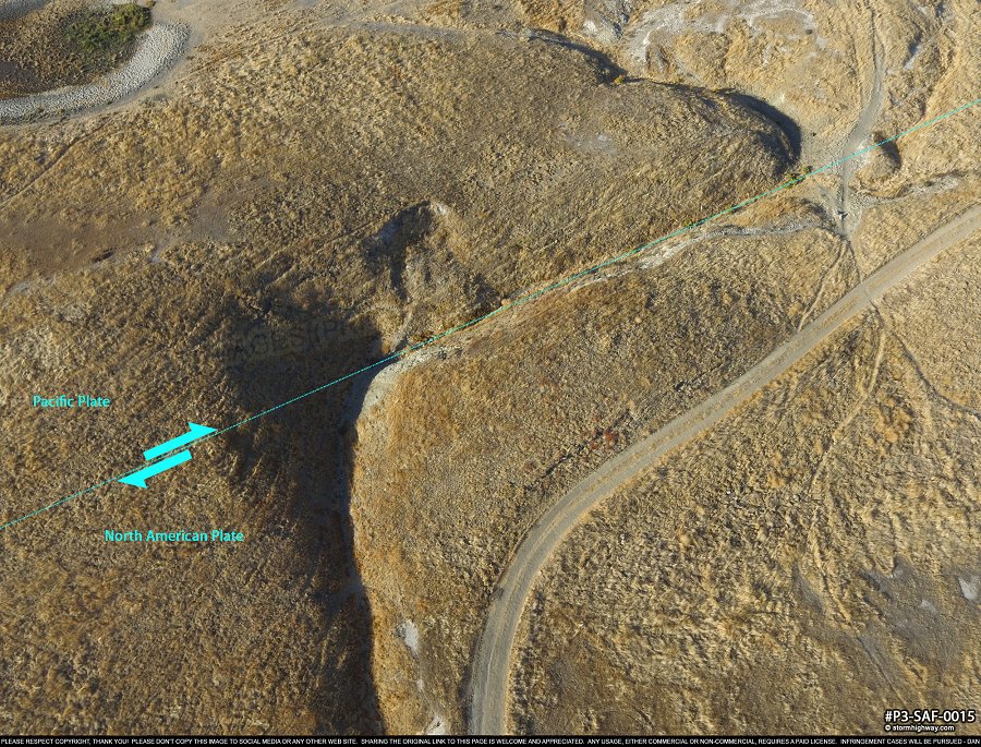
South of Highway 46, one of the numerous characteristic offset dry stream channels across the fault can be seen. Each time the fault ruptures in an earthquake, the ground along the fault shifts to the right (relative to the other side) as much as 20 or 30 feet in a few seconds. This is called "surface rupture", and anything crossing the fault where this occurs - be it a road, a stream, a pipeline or a fence - will be broken and offset in dramatic fashion. This can clearly be seen here. The top right and lower left sections of the creek bed were once aligned. With each earthquake, the creek bed is broken and shifted laterally, "stretching" the section between the two sides of the fault. As rainfall episodes fill the creek, the creek bed erodes the "dogleg" section right along the fault, creating the charateristic "z" shape of the creek bed.
click for larger version
If rainfall is sparse in between earthquakes, no new channels are eroded, and the upper and lower sections are permanently separated as the fault shifts. There will be many examples of offset stream channels on the San Andreas as we move southeast.
Annette, California
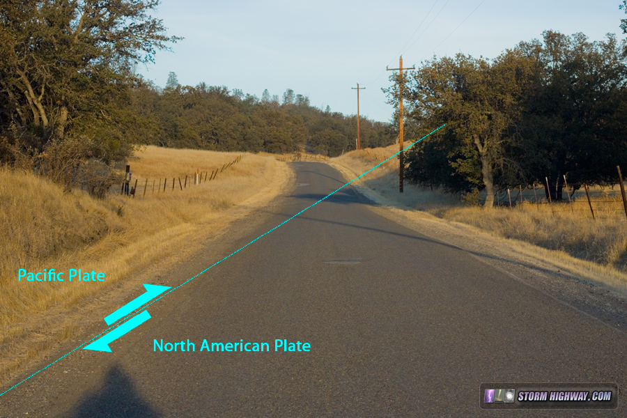
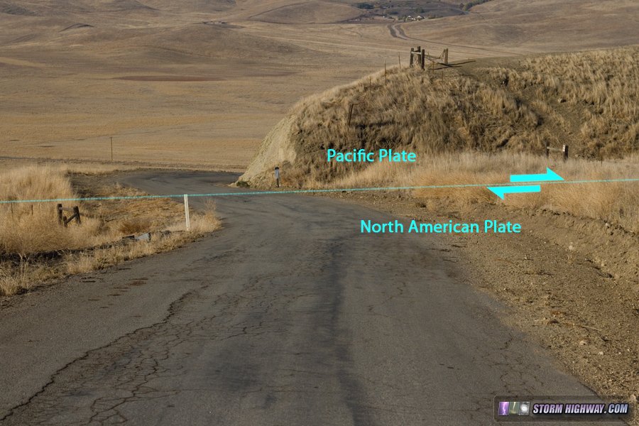
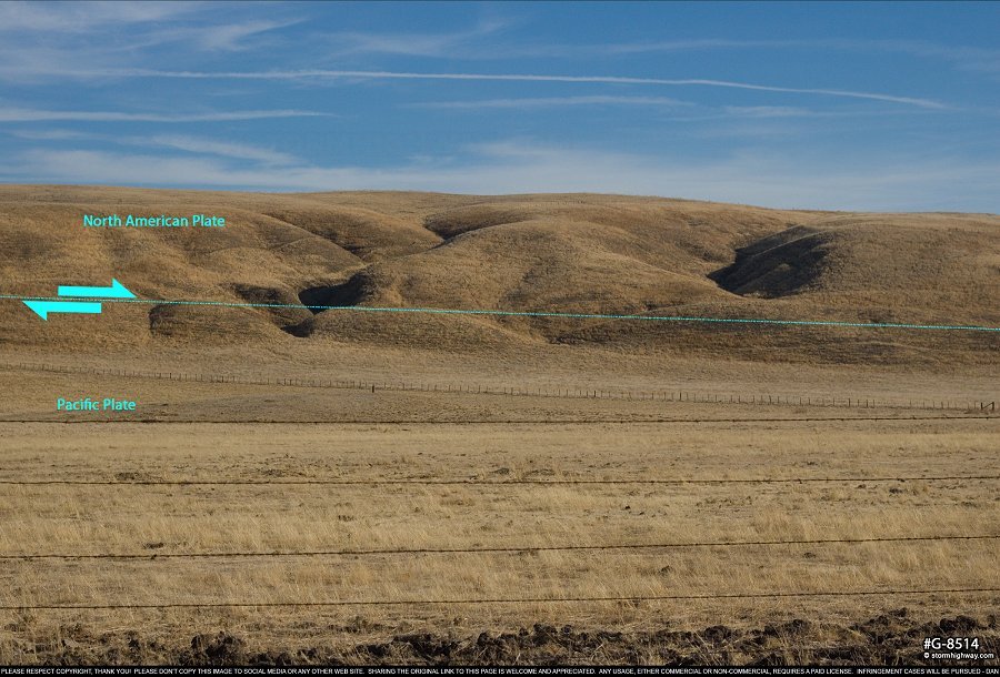
The next stop is the fault's crossing of Annette Road south of Annette. The fault trace is visible here as a linear depression/scarp that bisects the hills on the north side of the valley. In this image, the fault runs just in front of the small rise in the foreground, about where the metal road marker is on the right side of the pavement:
Fault crossing Annette Road
Standing atop the fault, looking northwest straight down the fault trace, a sag pond called Still Lake is visible to the north of the road. Sag ponds form when a depression develops in a fault zone and later fills with water. Many of the sag ponds on the San Andreas are completely dried out due to the sparse rainfall in these regions.
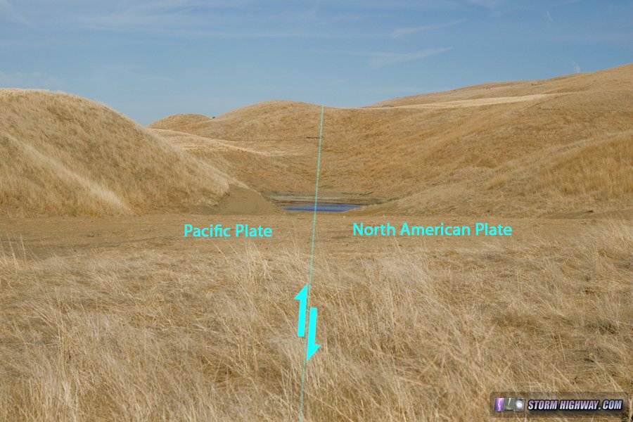
Still Lake sag pond, Annette
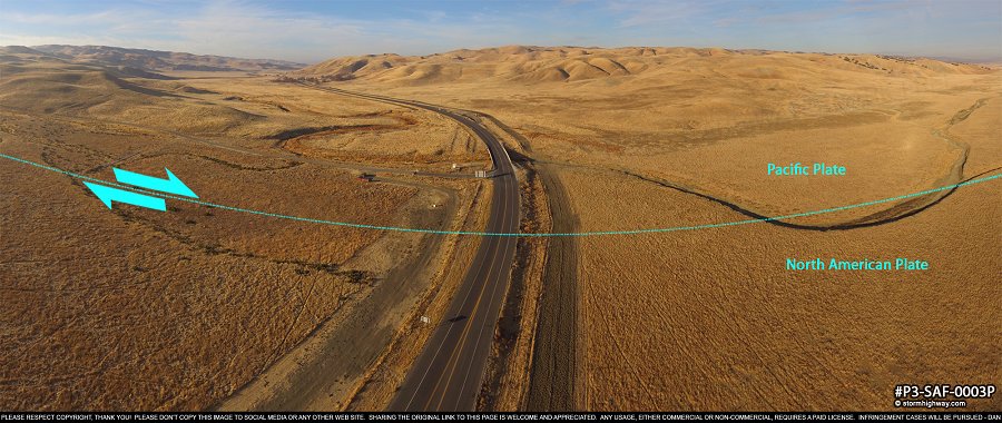
Moving to the northeast a short distance, we have a nice panoramic view of the fault zone with the valley in the background: |

click for larger version
| Moving back into the valley and looking north along the hills from Bitterwater Road, the fault trace is easy to pick out as the linear feature running the length of the valley-facing (southern) side of the hills, as if someone took a butter knife and dragged it through the lower 1/4 of the slopes. Look closely at this panoramic image taken here and see if you can locate the offset stream channels similar to the one I showed up-close earlier at Cholame (click the image for a large full-screen pannable version): |

click for larger version
| Here is a closer look at some of the stream offsets. The one on the left is a shorter, younger offset, possibly only one or two earthquakes wide. The offset on the right is much older, probably forming over the course of 4 or 5 major earthquakes to give it its longer distance.
click for larger version
Continuing southeast along Bitterwater Road, the fault trace becomes less noticable for some distance, but some subtle visual clues can barely be made out. This view looks northwest along the fault trace:
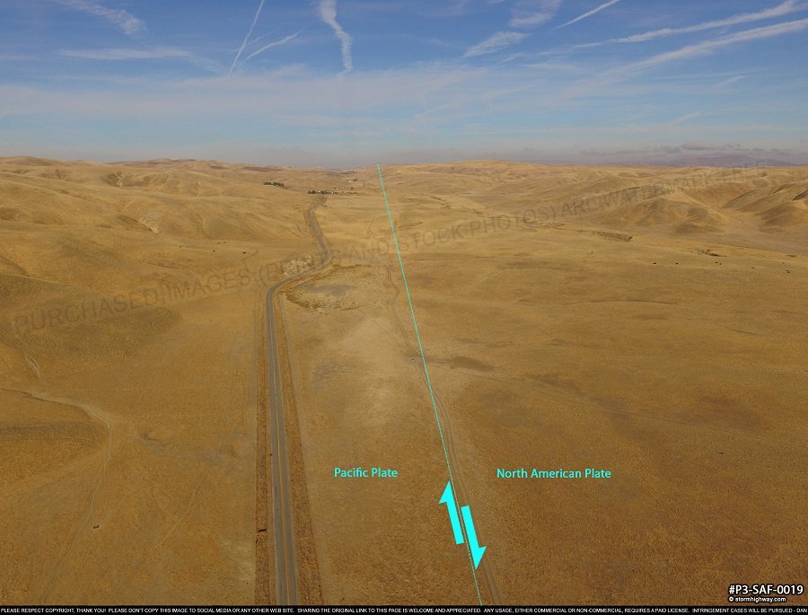
click for larger version
And this view to the southeast:
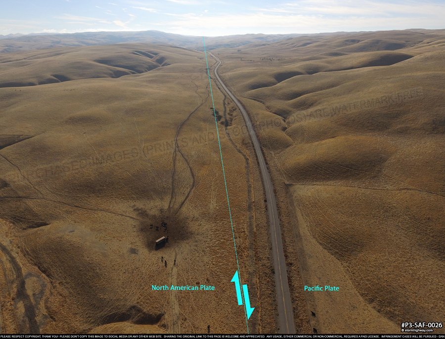
click for larger version
After this point, the San Andreas enters the Carrizo Plain, where some of its most interesting features can be found. Continue to Part 2 >
< San Andreas Fault - Home
 About the Author: Dan Robinson has been a storm chaser, photographer and cameraman for 34 years. His career has involved traveling around the country covering the most extreme weather on the planet including tornadoes, hurricanes, lightning, floods and winter storms. Dan has been extensively published in newspapers, magazines, web articles and more, and has both supplied footage for and appeared in numerous television productions and newscasts. He has also been involved in the research community, providing material for published scientific journal papers on tornadoes and lightning. |
GO: Home | Storm Chase Logs | Photography | Extreme Weather Library | Stock Footage | Blog
Featured Weather Library Article:
|
|


