San Andreas Fault, Part 5: Wrightwood, Cajon Pass
|
In September of 2025, my work is generating the most income it ever has in my career. Yet, I'm being forced to shut down my successul operation, against my will, due to one cause alone: 95% of that revenue is being stolen by piracy and copyright infringement. I've lost more than $1 million to copyright infringement in the last 15 years, and it's finally brought an end to my professional storm chasing operation. Do not be misled by the lies of infringers, anti-copyright activists and organized piracy cartels. This page is a detailed, evidenced account of my battle I had to undertake to just barely stay in business, and eventually could not overcome. It's a problem faced by all of my colleagues and most other creators in the field. |
GALLERY: All San Andreas Fault photos in gallery format
East of the Palmdale area, the fault trace leaves the Antelope Valley and begins crossing the San Gabriel Mountains.
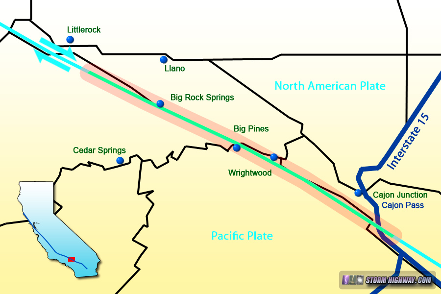
Map of this segment of the tour
Big Rock Springs, California
After Valyermo, Big Pines Road runs more or less directly atop of the fault, crossing it numerous times during the climb toward the summit:

click for larger version
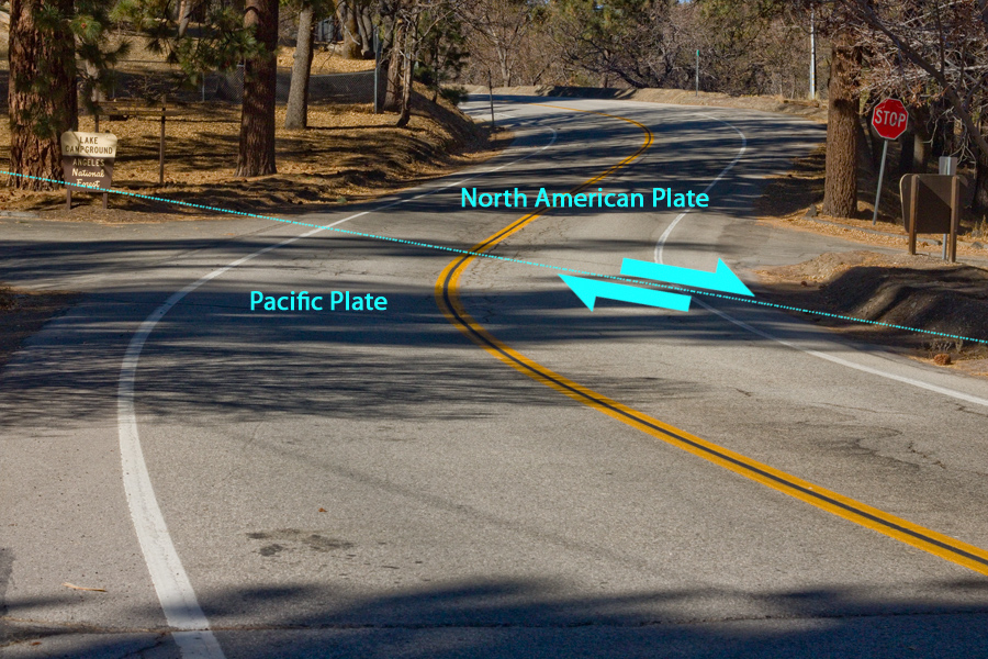
San Andreas Fault zone near Jackson Lake, CA
At Big Pines, the fault zone runs under the five-way intersection at the Angeles Crest Highway:

San Andreas Fault zone at Big Pines, CA
Wrightwood, California
The fault parallels Lone Pine Canyon Road on the east side of Wrightwood, crossing the wash in Sheep Canyon just south of the road:
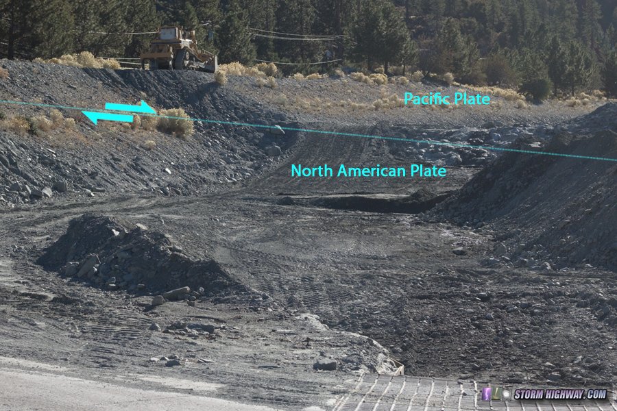
San Andreas Fault zone at Wrightwood, CA
Lone Pine Canyon runs down the linear valley from Wrightwood to Cajon Pass, generally paralleling the fault and crossing it several times in an area burned in the Blue Cut wildfire in August 2016:
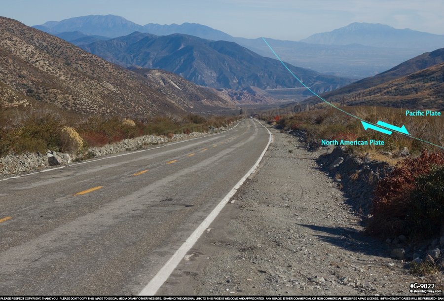
San Andreas Fault zone near Wrightwood, CA
As we approach Cajon Pass on Swarthout Canyon Road, the linear valley associated with the fault is the prominent feature. As before, look for the differing colors in the rock and soil on either side. This view looks west:

click for larger version
And looking east, with I-15 visible in the distance.
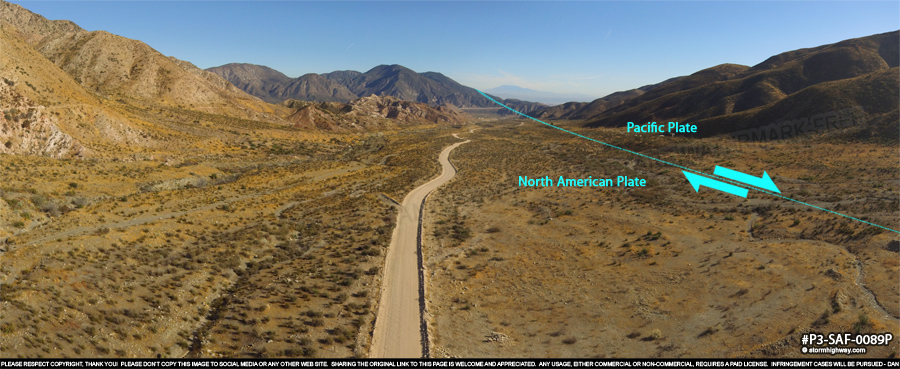
click for larger version
Cajon Pass
At Cajon Pass, the fault crosses several major infrastructures - 9 lanes of Interstate 15, US Route 66, two major railroad mainlines (Union Pacific and BNSF) as well as power, gas and water lines.
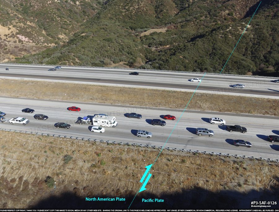
click for larger version
Looking west on the ridge above I-15, we have a great view of the fault zone and can look back west along its trace nearly to Wrightwood:
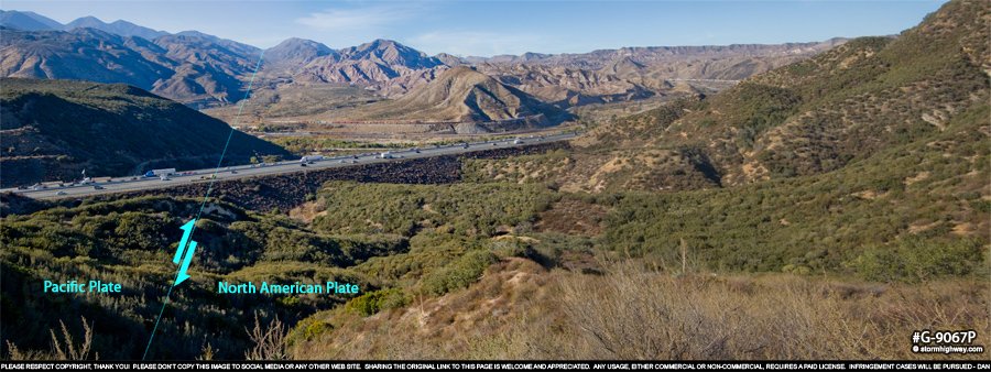
click for larger version
East of I-15, the fault enters rugged terrain before descending into the San Bernardino Valley:
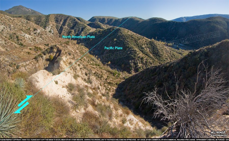
click for larger version
At this point, we'll jump on I-15 here to re-join the fault zone down in the valley. Continue to Part 6 >
< San Andreas Fault - Home
 About the Author: Dan Robinson has been a storm chaser, photographer and cameraman for 34 years. His career has involved traveling around the country covering the most extreme weather on the planet including tornadoes, hurricanes, lightning, floods and winter storms. Dan has been extensively published in newspapers, magazines, web articles and more, and has both supplied footage for and appeared in numerous television productions and newscasts. He has also been involved in the research community, providing material for published scientific journal papers on tornadoes and lightning. |
GO: Home | Storm Chase Logs | Photography | Extreme Weather Library | Stock Footage | Blog
Featured Weather Library Article:
|